Moorhead in Clay County, Minnesota — The American Midwest (Upper Plains)
Local History
Steamboats on the Red River
Photographed by Cosmos Mariner, June 27, 2024
1. Local History Marker
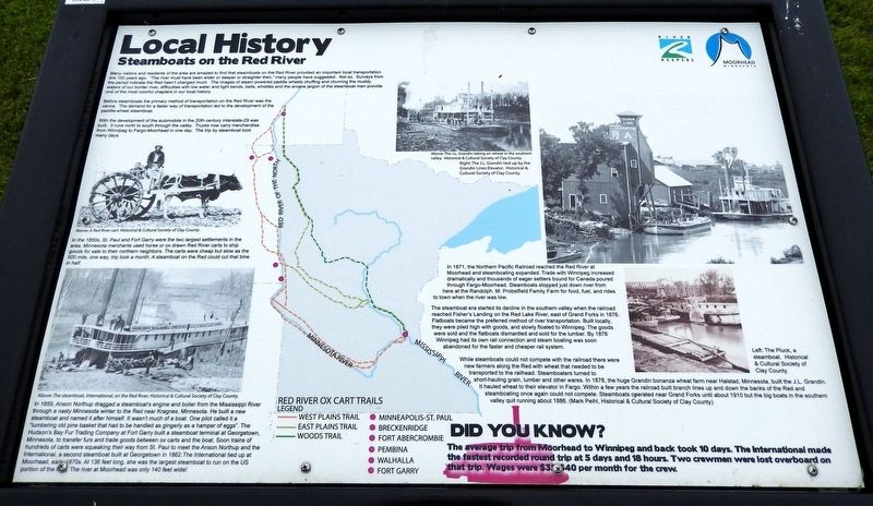
Many visitors and residents of the area are amazed to find that steamboats on the Red River provided an important local transportation link 150 years ago. "The river must have been wider or deeper or straighter then," many people have suggested. Not so. Surveys from the period indicate the Red hasn't changed much. The images of steam powered paddle wheels chuffing and churning the muddy waters of our border river, difficulties with low water and tight bends, bells, whistles and the arcane jargon of the steamboat men provide one of the most colorful chapters in our local history.
Before steamboats the primary method of transportation on the Red River was the canoe. The demand for a faster way of transportation led to the development of the paddlewheel steamboat.
With the development of the automobile in the 20th century Interstate-29 was built. It runs north to south through the valley. Trucks now carry merchandise from Winnipeg to Fargo-Moorhead in one day. The trip by steamboat took many days.
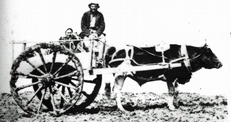
In the 1850s, St. Paul and Fort Garry were the two largest settlements in the area. Minnesota merchants used horse or ox drawn
this page online
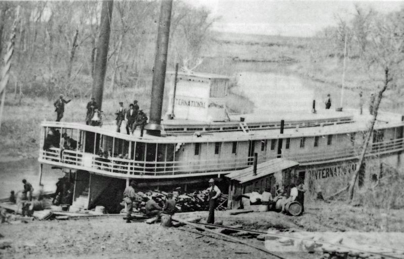
In 1859, Anson Northup dragged a steamboat's engine and boiler from the Mississippi River through a nasty Minnesota winter to the Red near Kragnes, Minnesota. He built a new steamboat and named it after himself. It wasn't much of a boat. One pilot called it a "lumbering old pine basket that had to be handled as gingerly as a hamper of eggs". The Hudson's Bay Fur Trading Company at Fort Garry built a steamboat terminal at Georgetown, Minnesota, to transfer furs and trade goods between ox carts and the boat. Soon trains of hundreds of carts were squeaking their way from St. Paul to meet the Anson Northup and the International, a second steamboat built at Georgetown in 1862. The International tied up at Moorhead, early 1870s. At 136 feet long, she was the largest steamboat to run on the US portion of the Red. The river at Moorhead was only 140 feet wide!
In 1871, the Northern Pacific Railroad reached the Red River at Moorhead and steamboating expanded.
Historical & Cultural Society of Clay County
2. Marker detail: A Red River Cart
The steamboat era started its decline in the southern valley when the railroad reached Fisher's Landing on the Red Lake River, east of Grand Forks in 1876. Flatboats became the preferred method of river transportation. Built locally, they were piled high with goods, and slowly floated to Winnipeg. The goods were sold and the flatboats dismantled and sold for the lumber. By 1878 Winnipeg had its own rail connection and steam boating was soon abandoned for the faster and cheaper rail system.
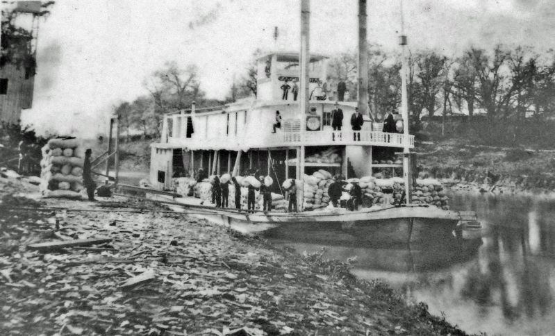
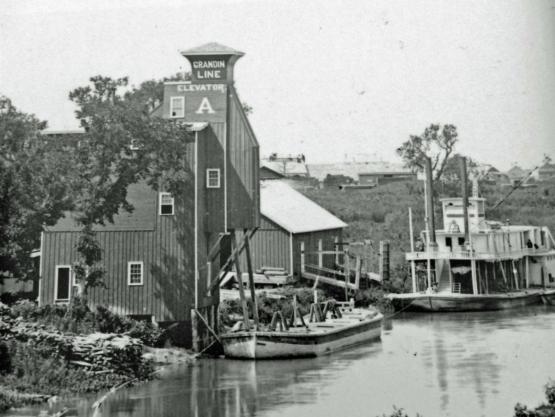
While steamboats could not compete with the railroad there were new farmers along the Red with wheat that needed to be transported to the railhead. Steamboaters turned to short-hauling grain, lumber and other wares. In 1878, the huge Grandin bonanza wheat farm near Halstad, Minnesota, built the J.L. Grandin. It hauled wheat to their elevator in Fargo. Within a few years the railroad
Historical & Cultural Society of Clay County
3. Marker detail: The steamboat, International,
on the Red River
on the Red River
Did you know?
The average trip from Moorhead to Winnipeg and back took 10 days. The International made the fastest recorded round trip at 5 days and 18 hours. Two crewmen were lost overboard on that trip. Wages were $35-$40 per month for the crew.
Erected by River Keepers; and Moorhead, Minnesota.
Topics. This historical marker is listed in these topic lists: Industry & Commerce • Railroads & Streetcars • Settlements & Settlers • Waterways & Vessels. A significant historical year for this entry is 1859.
Location. 46° 54.688′ N, 96° 45.357′ W. Marker is in Moorhead, Minnesota, in Clay County. It can be reached from 36th Avenue North just north of 11th Street North, on the left when traveling north. The marker is located along the interpretive trail in M. B. Johnson Park. Touch for map. Marker is at or near this postal address: 3601 11th Street
Historical & Cultural Society of Clay County
4. Marker detail: The J.L. Grandin taking on wheat in the southern valley

Regionally, this marker is in the American Midwest and in the Corn Belt. Globally, it is in North America, the Western Hemisphere, the Western World, and the Anglosphere. Historically, it finds itself in what was once Rupert’s Land, the territory of the Mississippian Culture, and the Louisiana Purchase.
Other nearby markers. At least 8 other markers are within 3 miles of this marker, measured as the crow flies: M. B. Johnson Park (about 400 feet away, measured in a direct line); Red River of the North (about 700 feet away); In Honor of Those Who Have Served in Defense of Our Country (approx. 1½ miles away); National Guard and Armory (approx. 1½ miles away); Homestead Park (approx. 1.9 miles away); John Bergquist (approx. 1.9 miles away); The Bergquist Cabin (approx. 1.9 miles away); Churchill Residence Hall (approx. 2.4 miles away in North Dakota). Touch for a list and map of all markers in Moorhead.
Related markers. Click here for a list of markers that are related to this marker.
Also see . . . Red River Steamboats (MNopedia).
Historical & Cultural Society of Clay County
5. Marker detail: The J.L. Grandin tied up by the Grandin Lines Elevator
(Creator: Megan Lynn Even) Excerpt: The International first reached Fort Garry in 1862, but it would take another nine years for steamboating to become common. Steamboating was delayed because of low water, lack of freight, the American Civil War, and the US–Dakota War of 1862. After the Northern Pacific Railway reached Moorhead (by early 1872), trade and travel by steamboat took off. The organization of Manitoba as a Canadian province the year before had also prompted settler-colonists to migrate. Many going to Canada went through Fargo-Moorhead, which would become the head of steam navigation. The head had started in Breckenridge, Minnesota, but it moved further and further downstream: to McCauleyville, from there to Moorhead, and finally to Georgetown, Minnesota.(Submitted on February 26, 2025, by Cosmos Mariner of Cape Canaveral, Florida.)
By 1878, Winnipeg had railways and no longer had to rely on the steamboats on the Red River. But the switch to railways took time, and steamboats were used for years after. Stopping steamboat traffic between the US and Canada would take another thirty years.
Photographed by Cosmos Mariner, June 27, 2024
6. Local History Marker
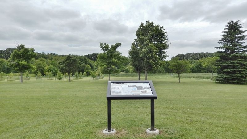
Looking west from the interpretive trail in M. B. Johnson Park. The Red River is obscured by trees in the background.
Credits. This page was last revised on February 26, 2025. It was originally submitted on February 23, 2025, by Cosmos Mariner of Cape Canaveral, Florida. This page has been viewed 273 times since then and 44 times this year. Photos: 1, 2, 3, 4, 5, 6. submitted on February 26, 2025, by Cosmos Mariner of Cape Canaveral, Florida.
