St. George in Washington County, Utah — The American Mountains (Southwest)
Manifest Destiny
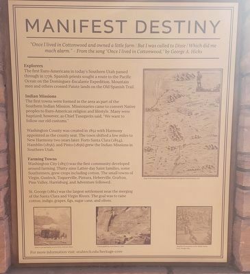
Photographed by Jeremy Snow, February 23, 2025
1. Manifest Destiny Marker
"Once I lived in Cottonwood and owned a little farm / But I was called to Dixie / Which did me much alarm." - From the song "Once I lived in Cottonwood," by George A. Hicks
Explorers
The first Euro-Americans in today's Southern Utah passed through in 1776. Spanish priests sought a route to the Pacific Ocean on the Dominguez-Escalante Expedition. Mountain men and others crossed Paiute lands on the Old Spanish Trail.
Indian Missions
The first towns were formed in the area as part of the Southern Indian Mission. Missionaries came to convert Native peoples to Euro-American religion and lifestyle. Many were baptized; however, as Chief Tusegavits said, "We want to follow our old customs."
Washington County was created in 1852 with Harmony appointed as the county seat. The town shifted a few miles to New Harmony two years later. Forts Santa Clara (1854), Hamblin (1856), and Pinto (1856) grew the Indian Missions in Southern Utah.
Farming Towns
Washington City (1857) was the first community developed around farming. Thirty-nine Latter-day Saint families, some Southerners, grew crops including cotton. The small towns
this page online
St. George (1861) was the largest settlement near the merging of the Santa Clara and Virgin Rivers. The goal was to raise cotton, indigo, grapes, figs, sugar cane, and olives.
For more information visit: utahtech.edu/heritage-cove
Topics. This historical marker is listed in these topic lists: Exploration • Indigenous Peoples and Communities • Settlements & Settlers. A significant historical year for this entry is 1852.
Location. 37° 6.242′ N, 113° 33.917′ W. Marker is in St. George, Utah, in Washington County. It can be reached from East 300 North. Located in the Heritage Cove just east of the Utah Tech University Gardner Student Center. Touch for map. Marker is at or near this postal address: 975 E 300 North, Saint George UT 84770, United States of America. Touch for directions.

Regionally, this marker is in Color Country. It is also in the American Southwest, in the Mountain West, and on the Colorado Plateau. Globally, it is in North America, the Rocky Mountains, the Western Hemisphere, the Western World,
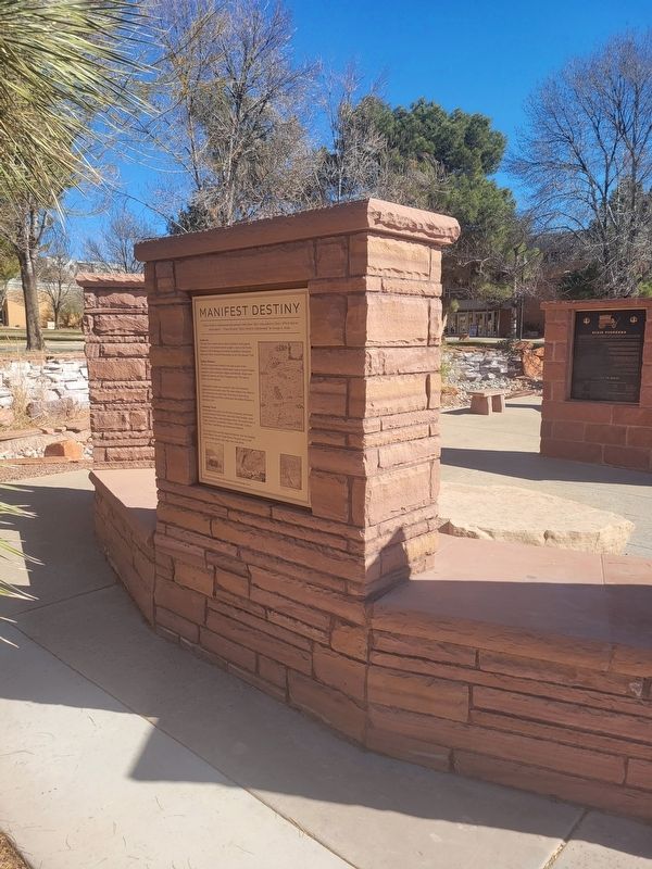
Photographed by Jeremy Snow, February 23, 2025
2. Manifest Destiny Marker
Other nearby markers. At least 8 other markers are within walking distance of this marker: First Peoples (here, next to this marker); The Name “Dixie” (here, next to this marker); Dixie Pioneers (here, next to this marker); University Growth (a few steps from this marker); Black Ridge and Sugarloaf (a few steps from this marker); Struggle to Thrive (a few steps from this marker); Poetry and Music (a few steps from this marker); Education (a few steps from this marker). Touch for a list and map of all markers in St. George.
Credits. This page was last revised on February 27, 2025. It was originally submitted on February 23, 2025, by Jeremy Snow of Cedar City, Utah. This page has been viewed 137 times since then and 29 times this year. Photos: 1, 2. submitted on February 23, 2025, by Jeremy Snow of Cedar City, Utah. • Andrew Ruppenstein was the editor who published this page.
