
New Kent in New Kent County, Virginia — The American South (Mid-Atlantic)
Henry Armistead

Photographed by Brandon D Cross
1. Henry Armistead Marker
Henry had buried $1,100 in the cellar of Cumberland with the intention of purchasing his and his wife's freedom. He harvested oysters and fished the Pamunkey and York Rivers to amass the sum, renting the right to do so from his owner in Richmond. His wife managed the domestic staff at Cumberland. The officer advised him to keep his money a secret as the advance of McClellan's Union Army would allow enslaved residents to flee.
Erected by New Kent Historical Society.
Topics. This historical marker is listed in these topic lists: African Americans • War, US Civil. A significant historical month for this entry is May 1862.
Location. 37° 32.468′ N, 76° 58.757′ W. Marker is in New Kent, Virginia, in New Kent County. It is on Cumberland Road 2 miles New Kent Highway, on the right when traveling north. The marker is located at the entrance to Cumberland Estate. Touch for map.
this page online

Regionally, this marker is on Virginia’s Peninsula and in Coastal Virginia. It is also in the American South, specifically in the Upper South, in the Tidewater, and on the Eastern Seaboard. Globally, it is in the North Atlantic Region, North America, the Western Hemisphere, the Western World, and the Anglosphere. Historically, it finds itself in what was once the territory of the Mississippian Culture, one of the original Thirteen Colonies, one of the Confederate States of America, and the Antebellum South.
Other nearby markers. At least 8 other markers are within walking distance of this marker: Liberation at Cumberland (here, next to this marker); Camp Cumberland (here, next to this marker); Earliest History of Cumberland Plantation (here, next to this marker); Cumberland House During the Civil War (a few steps from this marker); A River in View (about 700 feet away, measured in a direct line); Harriet Tubman (about 700 feet away); Cumberland Town (approx. 0.3 miles away); French Cannon at Cumberland Landing

Photographed by Brandon D Cross
2. Henry Armistead Marker (center)
Also see . . .
1. Cumberland: A Historical Legacy. (Submitted on February 25, 2025, by Brandon D Cross of Flagler Beach, Florida.)
2. Cumberland a House with History. (Submitted on February 25, 2025, by Brandon D Cross of Flagler Beach, Florida.)
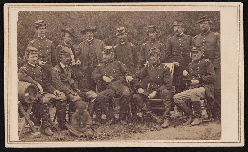
Photographed by James F Gibson, May 14, 1862
3. Twelve officers, Cumberland Landing, Virginia
Library of Congress (LC-DIG-ppmsca-87048)
Credits. This page was last revised on February 28, 2025. It was originally submitted on February 25, 2025, by Brandon D Cross of Flagler Beach, Florida. This page has been viewed 222 times since then and 23 times this year. Photos: 1, 2. submitted on February 25, 2025, by Brandon D Cross of Flagler Beach, Florida. 3. submitted on February 28, 2025. • Bernard Fisher was the editor who published this page.
