Porter in Porter County, Indiana — The American Midwest (Great Lakes)
The J.D. Marshall
Photographed by Christopher Light, May 19, 2006
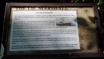
1. The J.D. Marshall Marker
J.D. Marshall Propeller
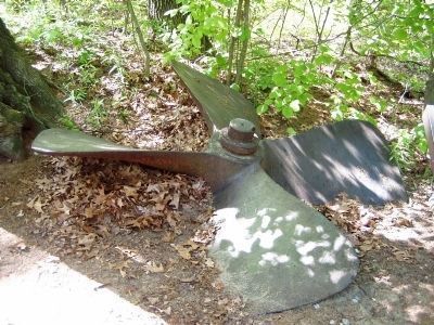
This propeller is from the steam barge J.D. Marshall. It weights over 4,000 pounds! It was made in 1891 and has 4 blades. Modern boats use a 3-blade propeller for improved efficiency with decrease of horsepower.
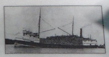
The J.D. Marshall was 154-ft steamship that hauled lumber for twenty years. Then in 1911, the boat was sold and converted into a sand sucker. Sand suckers were used to pull wet sand from the lake bottom into their cargo holds. No one knows for sure what the Marshall was hauling the night of its last journey. Some records say that it was carrying 1,000 tons of sand. Other records say that it was carrying coal and pig iron.
This is what we know for sure: On the night of June 10, 1911, the J.D. Marshall was anchored near where the Beach Pavilion now stands. The hull began to leak. The crew patched the leak, and remained anchored for the night. During the early morning of June 11, a strong storm blew in. The parched area began to leak, and the crewmen went below to fix it. As storm waves continued to pound the J.D. Marshall, it ultimately capsized.
There were ten men on board. Three
this page online
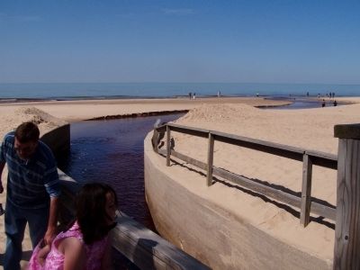
Thousands of people visit the beach at Indiana Dunes State Park each summer. most of them are unaware of this tragic story and the remains of the J.D. Marshall, which now rest just north of the swimming beach, in about 30 feet of water.
Topics. This historical marker is listed in these topic lists: Industry & Commerce • Waterways & Vessels. A significant historical date for this entry is June 10, 1911.
Location. Marker has been reported permanently removed. It was located near 41° 39.571′ N, 87° 3.005′ W. Marker was in Porter, Indiana, in Porter County. It could be reached from Trail 7 north of County Road 100E, on the right when traveling north. After entering the State Park, follow the signs to the nature center. You'll find the propeller at the trailhead, just west of the nature center, north of the parking lot. Touch for map. Marker was in this post office area: Chesterton IN 46304, United States of America.
We have been
Photographed by Christopher Light, May 19, 2006
2. Picture on the marker
Regionally, this marker was in Northwest Indiana, specifically on the Indiana Dunes and Lake Michigan Shore, and in the Calumet Region. It was also in the American Midwest and in the Corn Belt. Globally, it was in North America, on the Great Lakes, in the Western Hemisphere, in the Western World, and in the Anglosphere. Historically, it found itself in what was once the territory of the Mississippian Culture and also the Northwest Territory.

Other nearby markers. At least 8 other markers are within walking distance of this location: 100 Years Indiana Dunes State Park (within shouting distance of this marker); Civilian Conservation Corps Flagpole (within shouting distance of this marker); The Prairie Club Fountain (within shouting distance of this marker); Dunes Nature Preserve (approx. 0.2 miles away); "Works of a Public Nature" (approx. 0.2 miles away); Mt. Tom: A View of Ancient Shorelines (approx. 0.4 miles away); Indiana State Parks: the First 100 Years 1916-2016 (approx. 0.6 miles away); Le Petit Fort
Photographed by Christopher Light, May 19, 2006
3. The propeller from the J.D. Marshall
Photographed by Christopher Light, May 19, 2006
4. Somewhere out there, the JD Marshall lies on the bottom
This is a view north from the beach, where Trail Creek enters Lake Michigan. The Beachhouse is to the left and back of where I was standing.
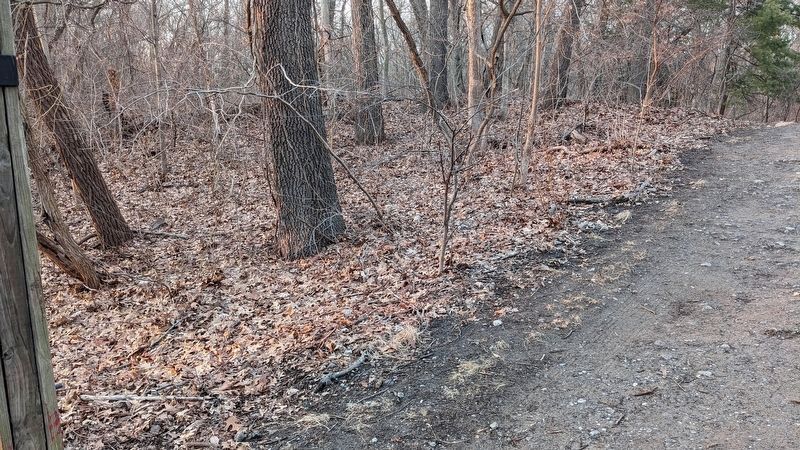
Photographed by Daniel Barriball, February 26, 2025
5. The J.D. Marshall Marker Missing
Credits. This page was last revised on February 27, 2025. It was originally submitted on March 21, 2008, by Christopher Light of Valparaiso, Indiana. This page has been viewed 3,428 times since then and 46 times this year. Last updated on February 26, 2025, by Daniel Barriball of Chesterton, Indiana. Photos: 1, 2, 3, 4. submitted on March 21, 2008, by Christopher Light of Valparaiso, Indiana. 5. submitted on February 26, 2025, by Daniel Barriball of Chesterton, Indiana. • J. Makali Bruton was the editor who published this page.
