
Conjurers Neck in Colonial Heights, Virginia — The American South (Mid-Atlantic)
Fort Clifton
A stronghold that was never taken
Photographed by Bernard Fisher, March 15, 2009
1. Fort Clifton CWT Marker
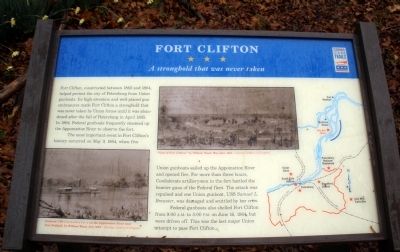
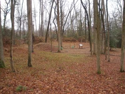
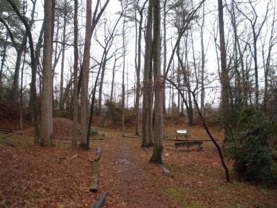
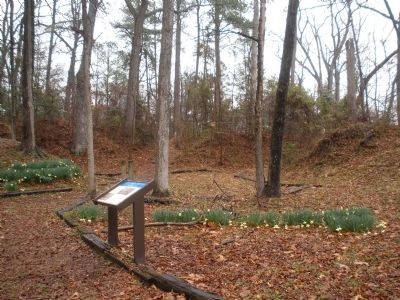
Fort Clifton, constructed between 1862 and 1864, helped protect the city of Petersburg from Union gunboats. Its high elevation and well-placed gun embrasures made Fort Clifton a stronghold that was never taken by Union forces until it was abandoned after the fall of Petersburg in April 1865. In 1864, Federal gunboats frequently steamed up the Appomattox River to observe the fort.
The most important event in Fort Clifton’s history occurred on May 9, 1864, when five Union gunboats sailed up the Appomattox River and opened fire. For more than three hours, Confederate artillerymen in the fort battled the heavier guns of the Federal fleet. The attack was repulsed and one Union gunboat, USS Samuel L. Brewster, was damaged and scuttled by her crew.
Federal gunboats also shelled Fort Clifton from 9:00 A.M. to 5:00 P.M. on June 16, 1864, but were driven off. This was the last major Union attempt to pass Fort Clifton.
Erected by Virginia Civil War Trails.
Topics and series. This historical marker is listed in these topic lists: Forts and Castles • War, US Civil. In addition, it is included in the Virginia Civil War Trails
this page online
Location. 37° 16.858′ N, 77° 21.956′ W. Marker is in Colonial Heights, Virginia. It is in Conjurers Neck. It can be reached from Brockwell Lane 0.3 miles east of Conduit Road, on the left when traveling east. This marker is in Berberich Park behind Tussing Elementary School. Touch for map. Marker is at or near this postal address: 100 Brockwell Ln, Colonial Heights VA 23834, United States of America. Touch for directions.

Regionally, this marker is in Central Virginia. It is also in the American South and specifically in the Upper South. Globally, it is in the North Atlantic Region, North America, the Western Hemisphere, the Western World, and the Anglosphere. Historically, it finds itself in what was once the territory of the Mississippian Culture, one of the original Thirteen Colonies, one of the Confederate States of America, and the Antebellum South.
Other nearby markers. At least 8 other markers are within 3 miles of this marker, measured as the crow flies: A different marker also named Fort Clifton (about 400 feet away, measured in a direct line); Early Grave Markers
Photographed by Bernard Fisher, March 15, 2009
2. Fort Clifton Batteries
More about this marker. On the lower left is a sketch captioned, “Gunboat USS Commodore Perry on the Appomattox River near Port Walthall, by William Waud, July 1864 - Courtesy Library of Congress”
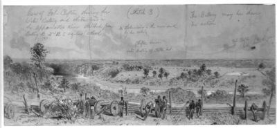
On the center is a sketch captioned, “View of Fort Clifton, by William Waud, May-June 1864 - Courtesy Library of Congress”
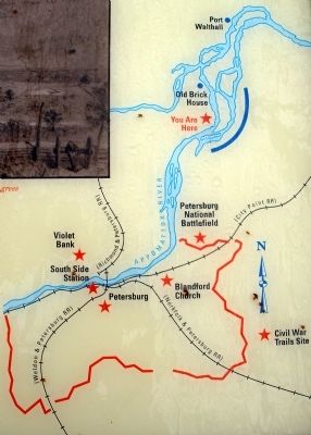
On the right is a regional map.
Also see . . .
1. Fort Clifton. City of Colonial Heights (Submitted on March 16, 2009.)
2. Civil War Traveler. Colonial Heights. (Submitted on March 16, 2009.)
3. Gilmer Civil War Maps Collection at UNC. Plan of batteries at Fort Clifton, Appomattox River. (Submitted on March 16, 2009.)
Photographed by Bernard Fisher, March 15, 2009
3. Fort Clifton Batteries
Photographed by Bernard Fisher, March 15, 2009
4. Fort Clifton Batteries
Photographed by Bernard Fisher, March 15, 2009
5. Location of Fort Clifton.
Photographed by Bernard Fisher, March 15, 2009
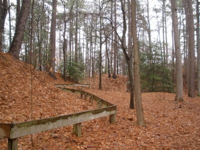
6. Fort Clifton Earthworks
William Waud Library of Congress
7. View of Fort Clifton showing the Water Battery and obstructions in the Appomattox River
Inscribed below title: sketched from Battery B 2nd U.S. regulars (colored). Inscribed above image: obstructions in the river sunk by the rebels; Water Battery of Clifton Fort; Clifton House; The Battery may be shewn in action; Fort Clifton looks down the river. Harper's Weekly, July 23, 1864, p. 473.
Photographed by Bernard Fisher, March 15, 2009
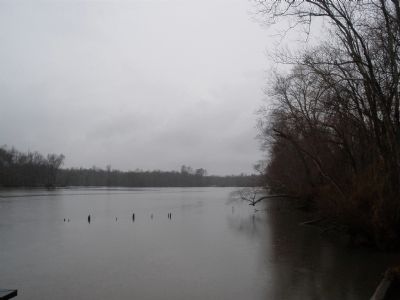
8. Appomattox River below Fort Clifton (facing upriver towards Petersburg)
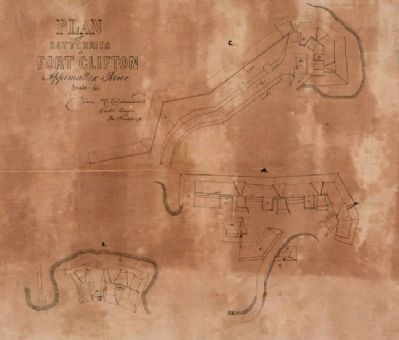
Gilmer Civil War Maps Collection at UNC.
9. Plan of batteries at Fort Clifton, Appomattox River.
Credits. This page was last revised on March 2, 2025. It was originally submitted on March 16, 2009, by Bernard Fisher of Richmond, Virginia. This page has been viewed 2,704 times since then and 72 times this year. Last updated on March 1, 2025, by Evan Dwyer of Richmond, Virginia. Photos: 1, 2, 3, 4, 5, 6. submitted on March 16, 2009, by Bernard Fisher of Richmond, Virginia. 7. submitted on March 27, 2009, by Bernard Fisher of Richmond, Virginia. 8, 9. submitted on March 16, 2009, by Bernard Fisher of Richmond, Virginia. • Devry Becker Jones was the editor who published this page.
