Grand Portage in Cook County, Minnesota — The American Midwest (Upper Plains)
Webster-Ashburton Treaty of 1842
Photographed by Cosmos Mariner, June 21, 2024
1. Webster-Ashburton Treaty of 1842 Marker
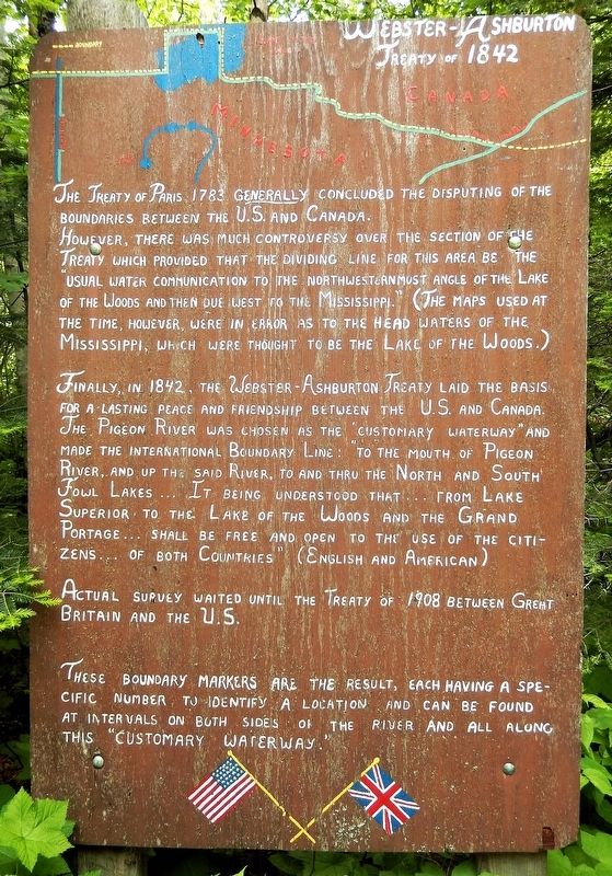
The Treaty of Paris 1783 generally concluded the disputing of the boundaries between the U.S. and Canada. However, there was much controversy over the section of the treaty which provided that the dividing line for this area be the “usual water communication to the northwesternmost angle of the Lake of the Woods and then due west to the Mississippi.” (The maps used at the time, however, were in error as to the head waters of the Mississippi, which were thought to be the Lake of the Woods.)
Finally, in 1842, the Webster-Ashburton Treaty laid the basis for a lasting peace and friendship between the U.S. and Canada. The Pigeon River was chosen as the “customary waterway” and made the international boundary line: “to the mouth of Pigeon River, and up the said River, to and thru the North and South Fowl Lakes… it being understood that… from Lake Superior to the Lake of the Woods and the Grand Portage… shall be free and open to the use of the citizens… of both Countries.” (English and American)
Actual survey waited until the Treaty of 1908 between Great Britain and the U.S.
These boundary markers are the result, each having a specific
this page online
Topics. This historical marker is listed in these topic lists: Peace • Political Subdivisions • Waterways & Vessels. A significant historical year for this entry is 1842.
Location. 48° 0.107′ N, 89° 35.311′ W. Marker is in Grand Portage, Minnesota, in Cook County. It can be reached from Voyageur Highway (State Highway 61) 0.4 miles east of Ryden Road, on the left when traveling east. The marker is located at the east end of the Picnic Trail (interpretive trail) in Grand Portage State Park. Touch for map. Marker is at or near this postal address: 9393 East Minnesota Highway 61, Grand Portage MN 55605, United States of America. Touch for directions.

Regionally, this marker is on the Boundary Waters Canoe Area Wilderness, in the Arrowhead Region, in the Iron Range, and in the North Shore. It is also in the American Midwest and in the Corn Belt. Globally, it is in North America, in the Great North Woods, on the Great Lakes, on Lake Superior’s North Shore, in the Western Hemisphere, in the Western
Photographed by Cosmos Mariner, June 21, 2024
2. Webster-Ashburton Treaty of 1842 Marker
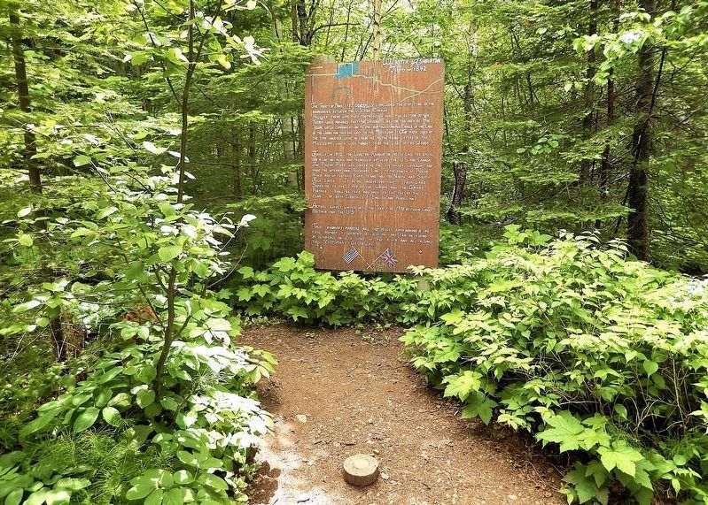
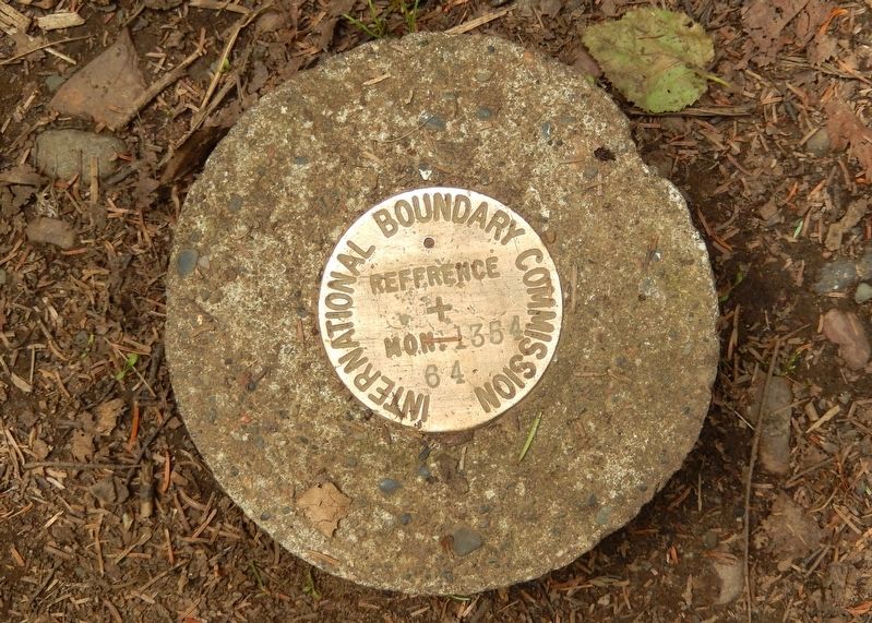
The marker is at the east end of the Picnic Trail (interpretive trail), overlooking the Pigeon River (United States-Canada international border). It is about ¼-mile east of the Grand Portage State Park Welcome Center. An International Boundary marker can be seen in the foreground (bottom center).
Other nearby markers. At least 8 other markers are within 6 miles of this marker, measured as the crow flies: Minnesota's Northern Border / Welcome to Minnesota (approx. ¼ mile away); High Falls (approx. half a mile away); Logs over the High Falls? (approx. half a mile away); Confluence of Cultures (approx. 3.1 miles away); Holy Rosary Catholic Church (approx. 5 miles away); 20th-Century Grand Portage (approx. 5.1 miles away); From Slog to Grog (approx. 5.1 miles away); The Grand Portage (approx. 5.2 miles away). Touch for a list and map of all markers in Grand Portage.
Also see . . .
1. Webster–Ashburton Treaty (Wikipedia).
Excerpt: Negotiated in the US federal capital city of Washington, DC, it was signed August 9, 1842, under the new administration of US President John Tyler. The Daniel Webster–Lord Ashburton negotiations and newly drawn-up 1842 treaty resolved many of the issues of the recent border conflicts(Submitted on March 2, 2025, by Cosmos Mariner of Cape Canaveral, Florida.)and skirmishes between Americans and New Brunswickers in the Aroostook War of 1838–1839. It arose from disputes and controversies over the vague indefinite terms and text of the old peace agreement of the Treaty of Paris of 1783, which ended the American Revolutionary War. The treaty was signed by US Secretary of State Daniel Webster, and British diplomat Alexander Baring, 1st Baron Ashburton.Photographed by Cosmos Mariner, June 21, 20243. International Boundary Marker
2. Webster-Ashburton Treaty, 1842 (US State Department History).
Excerpt: Several disputes had arisen from differing interpretations of the 1783 Treaty of Paris that ended the Revolutionary War. When these differences led New Brunswick officials to arrest some Americans in disputed areas, Maine called out the militia and seized the territory in question, the so-called Aroostock War. The incident dramatized the need for a border settlement. Webster and Ashburton agreed on a division of disputed territory, giving 7,015 square miles to the United States and 5,012 to Great Britain; agreed on the boundary line through the Great Lakes to the Lake of the Woods;(Submitted on March 2, 2025, by Cosmos Mariner of Cape Canaveral, Florida.)and agreed on provisions for open navigation in several bodies of water. The issue of the Oregon border was left to a later date.Photographed by Cosmos Mariner, June 21, 20244. Pigeon River & Pigeon River Provincial ParkLooking north across the Pigeon River from near this marker. Canada's Pigeon River Provincial Park is on the other side of the river.
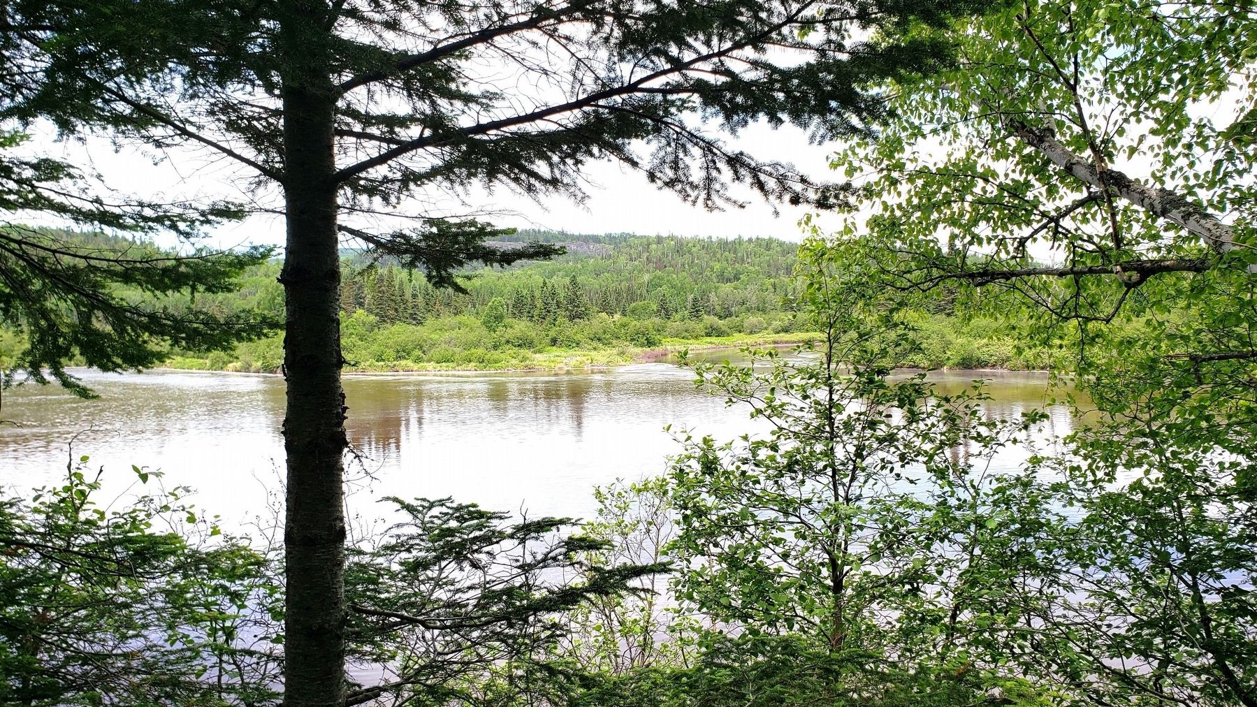
Photographed by Cosmos Mariner, June 21, 2024
5. Pigeon River & Pigeon River Provincial Park
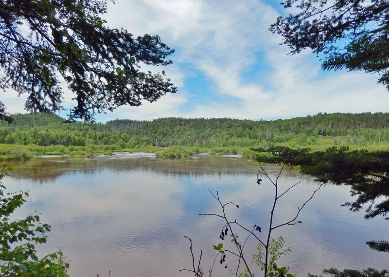
Looking north across the Pigeon River from near this marker. Canada's Pigeon River Provincial Park is on the other side of the river.
Credits. This page was last revised on March 2, 2025. It was originally submitted on March 2, 2025, by Cosmos Mariner of Cape Canaveral, Florida. This page has been viewed 362 times since then and 96 times this year. Photos: 1, 2, 3, 4, 5. submitted on March 2, 2025, by Cosmos Mariner of Cape Canaveral, Florida.
