
Morbach in Bernkastel-Wittlich, Rhineland-Palatinate, Germany — Central Europe
Die Strasse
⎯⎯⎯
The Road
⎯⎯⎯
La Route
| — | Belginum Archäologiepark | — |
Photographed by Andrew Ruppenstein, February 3, 2025
1. Die Strasse / The Road / La Route Marker

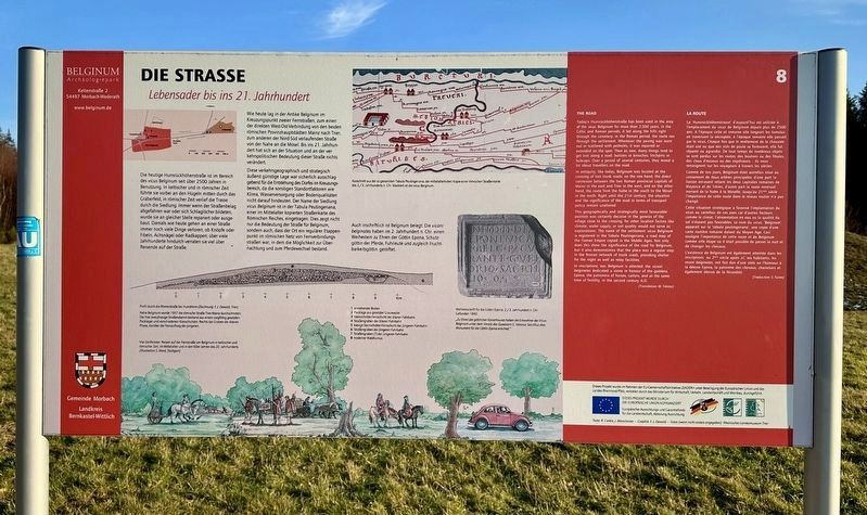
Die Strasse
Lebensader bis ins 21. Jahrhundert
Die heutige Hunsrückhöhenstraße ist im Bereich des vicus Belginum seit über 2500 Jahren in Benutzung. In keltischer und in römischer Zeit führte sie vorbei an den Hügeln mitten durch das Gräberfeld, in römischer Zeit verlief die Trasse durch die Siedlung. Immer wenn der Straßenbelag abgefahren war oder sich Schlaglöcher bildeten, wurde sie an gleicher Stelle repariert oder ausgebaut. Damals wie heute gehen an einer Straße immer noch viele Dinge verloren, ob Knöpfe oder Fibeln, Achsnägel oder Radkappen; über viele Jahrhunderte hindurch verraten sie viel über Reisende auf der Straße.
Wie heute lag in der Antike Belginum im Kreuzungspunkt zweier Fernstraßen, zum einen der direkten West-Ost-Verbindung von den beiden römischen Provinzhauptstädten Mainz nach Trier, zum anderen der Nord-Süd verlaufenden Straße von der Nahe an die Mosel. Bis ins 21. Jahrhundert hat sich an der Situation und an der verkehrspolitischen Bedeutung dieser Straße nichts verändert.
Diese verkehrsgeographisch und strategisch äußerst günstige Lage war sicherlich ausschlaggebend für die Entstehung des Dorfes im Kreuzungsbereich, da die sonstigen Standortfaktoren wie Klima, Wasserversorgung oder Bodenqualitäten nicht darauf hindeuten. Der Name
this page online
The Road
Today's Hunsrückhöhenstraße has been used in the area of the vicus Belginum for more than 2,500 years. In the Celtic and Roman periods, it led along the hills right through the cemetery; in the Roman period, the route ran through the settlement. Whenever the paving was worn out or scattered with potholes, it was repaired or extended on the spot. Then as now, many things tend to get lost along a road: buttons or brooches, linchpins or hubcaps. Over a period of several centuries, they reveal a lot about travellers on the road.
In antiquity, like today, Belginum was located at the crossing of two trunk roads: on the one hand, the direct connexion between the two Roman provincial capitals of Mainz in the east and Trier in the west, and on the other hand, the route from the Nahe in the south to the Mosel in the north. Right until the 21st century, the situation and the significance of the road in terms of transport policy
Photographed by Andrew Ruppenstein, February 3, 2025
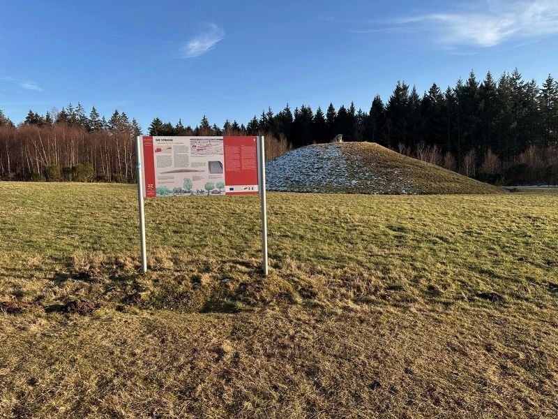
2. Die Strasse / The Road / La Route Marker - wide view
This geographically and strategically most favourable position was certainly decisive in the genesis of the village close to the crossing; for other location factors like climate, water supply, or soil quality would not serve as explanations. The name of the settlement vicus Belginum is registered in the Tabula Peutingeriana, a road map of the Roman Empire copied in the Middle Ages. Not only does this show the significance of the road for Belginum, but it also demonstrates that the place was a regular stop in the Roman network of trunk roads, providing shelter for the night as well as relay facilities.
In inscriptions, too, Belginum is attested: the vicani belginates dedicated a stone in honour of the goddess Epona, the patroness of horses, carters, and at the same time of fertility, in the second century A.D.
(Translation: M. Tröster)
La Route
La 'Hunsrückhöhenstrasse' d'aujourd'hui est utilisée à l'emplacement du vicus de Belginum depuis plus de 2500 ans. A l'époque celte et romaine elle longeait les tumulus en traversant la nécropole, à l'époque romaine elle passait par le vicus. Chaque fois que le revêtement de la chaussée était usé ou que des nids de poule se formaient, elle fut réparée ou agrandie. De tout temps de nombreux objets se sont perdus sur
Photographed by Andrew Ruppenstein, February 3, 2025
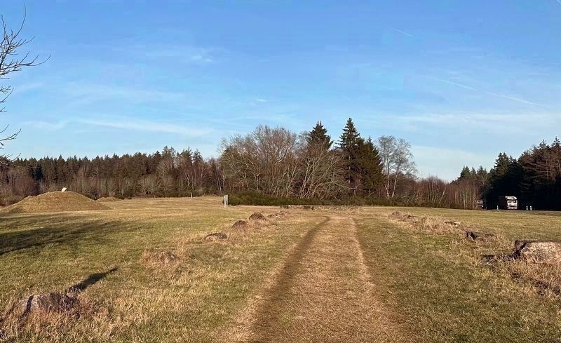
3. Die Strasse / The Road / La Route - now Belginumweg
Looking east (from Marker 6) along the road alignment as it heads east through the Roman/Celtic cemetery toward the subject marker, some 200 meters further east. The more modern alignment of the Hunsrückhöhenstraße runs parallel to this less than 50 meters to the south (in the very right of this picture one can see a truck traveling that road).
Comme de nos jours, Belginum était autrefois situé au croisement de deux artères principales: d'une part la liaison est-ouest reliant les deux capitales romaines de Mayence et de Trèves, d'autre part la route nord-sud menant de la Nahe à la Moselle. Jusqu'au 21 siècle l'importance de cette route dans le réseau routier n'a pas changé.
Cette situation stratégique a favorisé l'implantation du vicus au carrefour de ces axes car d'autres facteurs comme le climat, l'alimentation en eau ou la qualité du sol n'étaient pas favorables. Le nom du vicus, 'Belginum', apparaît sur la 'tabula peutingeriana', une copie d'une carte routière romaine datant du Moyen Age. Ceci souligne l'importance de cette route et de Belginum comme ville étape où il était possible de passer la nuit et de changer les chevaux.
L'existence de Belginum est également attestée dans les inscriptions au 2ème siècle après J-C ses habitants, les vicani belginates ont fait don d'une stèle en l'honneur à la déesse Epona, la patronne des chevaux, charretiers et également déesse de la fécondité.
(Traduction: S. Furon)
Erected by Belginum Archäologiepark. (Marker Number 8.)
Topics.
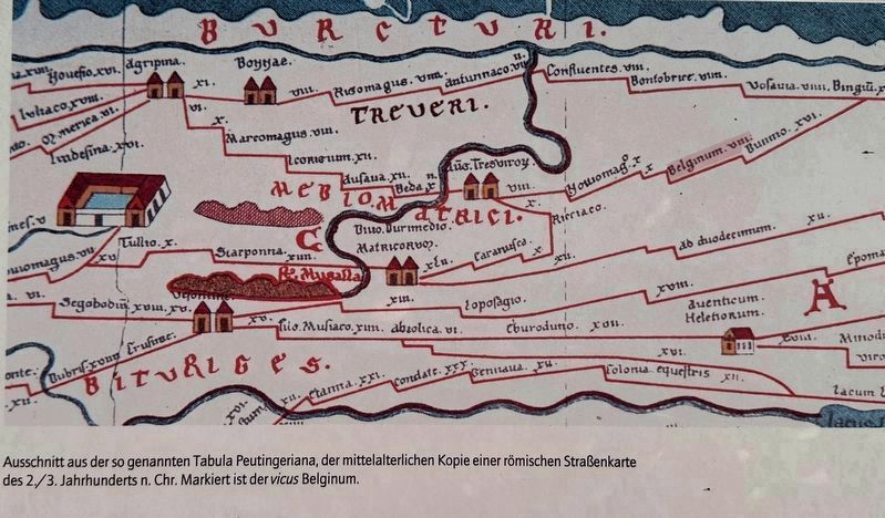
4. Marker inset map: Tabula Peutingeriana, medieval copy of Roman road chart
The location of vicus Belginum is in the upper right third, shaded in red.
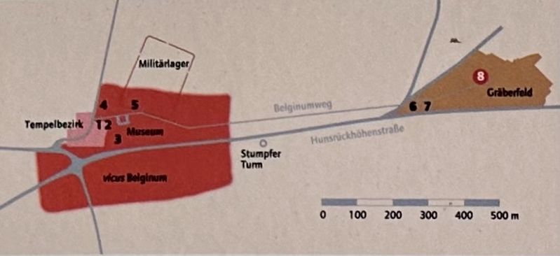
Location. 49° 51.659′ N, 7° 10.599′ E. Marker is in Morbach, Rheinland-Pfalz (Rhineland-Palatinate), in Bernkastel-Wittlich. It can be reached from Hunsrückhöhenstraße (Rheinland-Pfalz Route B50). The marker is located in Belginum Archäologiepark, about 800 meters east of the museum. There is a parking lot by the museum. Touch for map. Marker is at or near this postal address: 2 Keltenstrasse, Morbach RP 54497, Germany. Touch for directions.

Regionally, this marker is in the German Rhineland. Globally, it is in Europe, the European Union, Atlantic Europe, Central Europe, the Schengen Area, Western Europe, and the Western World. Historically, it finds itself in what was once the Roman Empire, the Holy Roman Empire, and the former West Germany.
Also see . . . Belginum Archäologiepark (in German only). The archaeological park’s home page. (Submitted on March 5, 2025.)
Photographed by Andrew Ruppenstein, February 3, 2025
5. Marker inset map: showing the location of The Road Marker (No. 8)
Credits. This page was last revised on March 5, 2025. It was originally submitted on March 4, 2025, by Andrew Ruppenstein of Lamorinda, California. This page has been viewed 124 times since then and 10 times this year. Photos: 1. submitted on March 5, 2025, by Andrew Ruppenstein of Lamorinda, California. 2. submitted on March 4, 2025, by Andrew Ruppenstein of Lamorinda, California. 3. submitted on March 5, 2025, by Andrew Ruppenstein of Lamorinda, California. 4. submitted on March 4, 2025, by Andrew Ruppenstein of Lamorinda, California. 5. submitted on March 5, 2025, by Andrew Ruppenstein of Lamorinda, California.
