Fort Eustis in Newport News, Virginia — The American South (Mid-Atlantic)
Magruder Defense Line
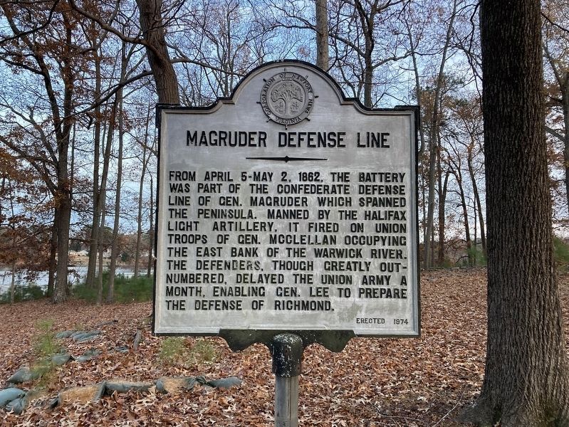
Photographed by Evan Dwyer, December 14, 2024
1. Magruder Defense Line Marker
Erected 1974 by Fort Eustis Historical and Archaeological Association.
Topics. This historical marker is listed in this topic list: War, US Civil. A significant historical year for this entry is 1862.
Location. 37° 8.668′ N, 76° 34.118′ W. Marker is in Newport News, Virginia. It is in Fort Eustis. It is on Wilson Avenue east of Pershing Avenue, on the right when traveling east. This marker is on post at Fort Eustis. Post access is restricted to authorized personnel and sponsored or escorted visitors. Touch for map. Marker is in this post office area: Fort Eustis VA 23604, United States of America. Touch for directions.

Regionally, this marker is on Virginia’s Peninsula, in Hampton Roads, in Coastal Virginia, and in the Hampton Roads Metropolitan
this page online
Other nearby markers. At least 8 other markers are within 2 miles of this marker, measured as the crow flies: Cobra Helicopter (approx. 0.7 miles away); Bolthorpe Plantation (approx. 0.9 miles away); The Battle of Lee’s Mill (approx. 1.3 miles away); Union Occupation (approx. 1.3 miles away); The Warwick-Yorktown Line (approx. 1.4 miles away); Fortification Design (approx. 1.4 miles away); YAC-1 / CV-2 / CV-7 Caribou (approx. 1.4 miles away); The Warwick River (approx. 1.4 miles away). Touch for a list and map of all markers in Newport News.
More about this marker. The marker is on the right after turning from Wilson Avenue towards the Warwick Pier & Boat Ramp.
Regarding Magruder Defense Line. The

Photographed by Evan Dwyer, December 14, 2024
2. Magruder Defense Line Marker
Viewed from the paved drive to Warwick Pier & Boat Ramp. The earthworks are surrounded by black sandbags and feature small trees growing on & through them along the hill's crest.
This defensive line is more precisely the Yorktown-Warwick Line, as Gen. Magruder had an early line between Young's Mill and Ship Point further to the southeast across the Peninsula that is also sometimes referred to as Magruder's Line or Magruder's First Line. The marker references the second line, which ran from about this point (not including the Miner Farm Line on Mulberry Island) out to the historic British fortifications surrounding Yorktown on the opposite side of the Peninsula.
Other elements of this defensive line are preserved in the woods along the Warwick River's banks within Fort Eustis, and also publicly in Newport News Park and in Yorktown Battlefield, part of the Colonial National Historical

Photographed by Evan Dwyer, December 14, 2024
3. Confederate Battery
This view is from the front of the degraded earthen battery referenced in the marker. View is facing southwest.

Photographed by Evan Dwyer
4. Yorktown-Warwick Line Map
The battery next to the marker is in the vicinity of the "Southall's Landg" text on this map of the line, abstracted from “Map No.1, Yorktown to Williamsburg, 1862” by Brig. Gen. A. A. Humphreys, held in the Library of Congress.
Credits. This page was last revised on March 6, 2025. It was originally submitted on March 5, 2025, by Evan Dwyer of Richmond, Virginia. This page has been viewed 213 times since then and 28 times this year. Photos: 1, 2, 3, 4. submitted on March 5, 2025, by Evan Dwyer of Richmond, Virginia. • Bernard Fisher was the editor who published this page.
