Bonne Terre in St. Francois County, Missouri — The American Midwest (Upper Plains)
Bonne Terre

Photographed by Delbert Botes, September 1, 2024
1. Bonne Terre Marker, Side One
The city of Bonne Terre, named for the lead-bearing "good earth" of the area, lies in the oldest and largest mining district of Missouri, leading lead producing state in the U. S. since 1908.
Missouri's lead is the base of its first permanent settlement and major industry. Lead, long used by the Indians and known to French gold and silver seekers of the early 1700's, was not seriously mined until failure of John Law's "Mississippi Scheme" made it apparent that there was no gold or silver in the area. After the "Mississippi Bubble" of hoped for riches burst, 1720, an employee of the French Company of the Indies, Philip Renault, opened lead diggings in this Lead Belt region of Missouri.
Jean Baptiste Pratte operated the first lead diggings here at Bonne Terre in the late 1790's. In 1864, the New York chartered St. Joseph Lead Company bought the 946-acre Pratte lead diggings, then owned by Anthony La Grave, for $75,000. With early use of the diamond drill in prospecting and with the rich deposits of lead, the company has become the nation's top lead producer.
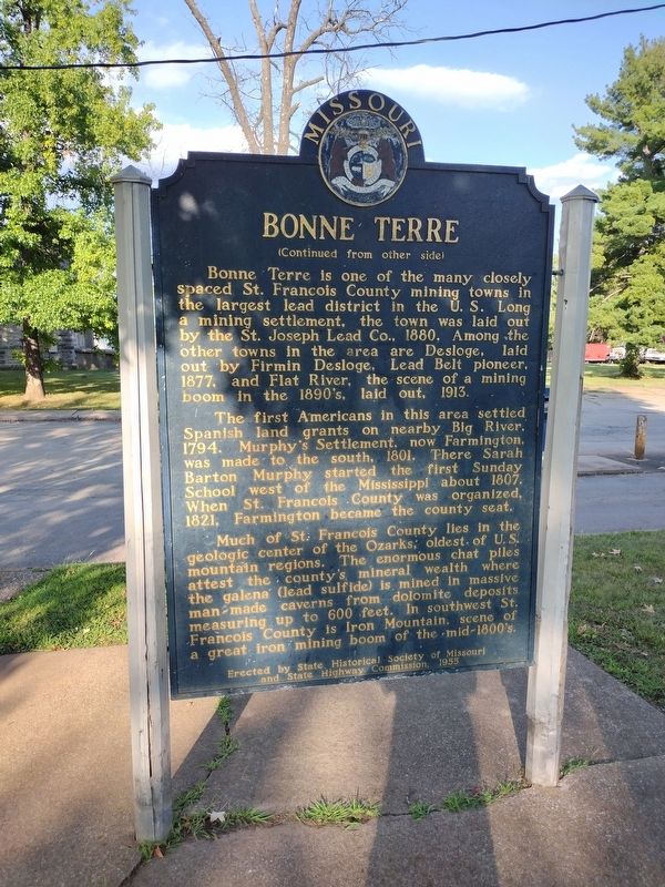
Bonne Terre is one of the many closely spaced St. Francois
this page online
The first Americans in this area settled Spanish land grants on nearby Big River, 1794. Murphy's Settlement, now Farmington, was made to the south, 1801. There Sarah Barton Murphy started the first Sunday School west of the Mississippi about 1807. When St. Francois County was organized, 1821, Farmington became the county seat.
Much of St. Francois County lies in the geologic center of the Ozarks, oldest of U. S. mountain regions. The enormous chat piles attest the county's mineral wealth where the galena (lead sulfide) is mined in massive man-made caverns from dolomite deposits measuring up to 600 feet. In southwest St. Francois County is Iron Mountain, scene of a great iron mining boom of the mid-1800's.
Erected 1955 by State Historical Society of Missouri and State Highway Commission.
Topics and series.
Photographed by Delbert Botes, September 1, 2024
2. Bonne Terre Marker, Side Two
Location. 37° 55.294′ N, 90° 32.982′ W. Marker is in Bonne Terre, Missouri, in St. Francois County. It is at the intersection of South Allen Street and Main Street, on the right when traveling south on South Allen Street. Marker is located in Bonne Terre Bicentennial Park at the intersection of Main Street, East School Street and South Allen Street. Touch for map. Marker is at or near this postal address: 102 Main St, Bonne Terre MO 63628, United States of America. Touch for directions.

Regionally, this marker is in Southeast Missouri. It is also in the American Ozarks, in the Lewis & Clark Corridor, and in the Corn Belt. Globally, it is in North America, the Western Hemisphere, the Western World, and the Anglosphere. Historically, it finds itself in what was once the territory of the Mississippian Culture, the Louisiana Purchase, and the Antebellum
Photographed by Delbert Botes, September 1, 2024
3. Bonne Terre Marker
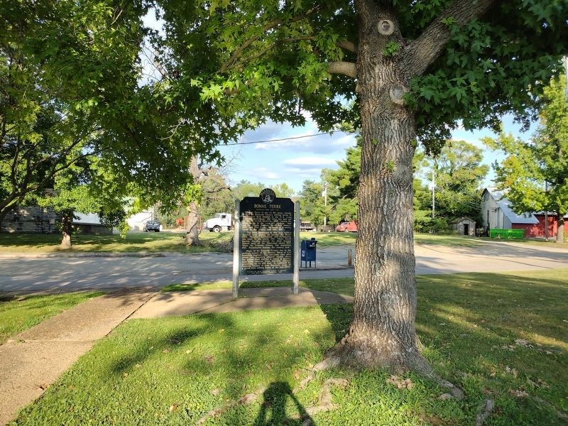
View of the marker from within Bonne Terre Bicentennial park, looking east towards South Allen Street.
Other nearby markers. At least 8 other markers are within 10 miles of this marker, measured as the crow flies: These Gave All (approx. half a mile away); Veterans Memorial (approx. 5.9 miles away); The "Old Elvins" Veterans Park Memorial (approx. 6 miles away); a different marker also named Veterans Memorial (approx. 7½ miles away); Slave Cabin (approx. 8.2 miles away); Artesian Spring / Valles Mines (approx. 8.2 miles away); In Memory of Aime Amant Vaille (approx. 8.2 miles away); Dedicated to all our Veterans (approx. 9.4 miles away).
Credits. This page was last revised on March 6, 2025. It was originally submitted on March 6, 2025, by Delbert Botes of Columbia, Missouri. This page has been viewed 572 times since then and 151 times this year. Photos: 1, 2, 3. submitted on March 6, 2025, by Delbert Botes of Columbia, Missouri. • Devry Becker Jones was the editor who published this page.
