Pocatello in Bannock County, Idaho — The American West (Mountains)
Copper Mines in the Pocatello Formation
| — | Portneuf Gap-Gittins Cutoff Historic Loop | — |
Photographed by Cosmos Mariner, July 10, 2024
1. Copper Mines in the Pocatello Formation Marker
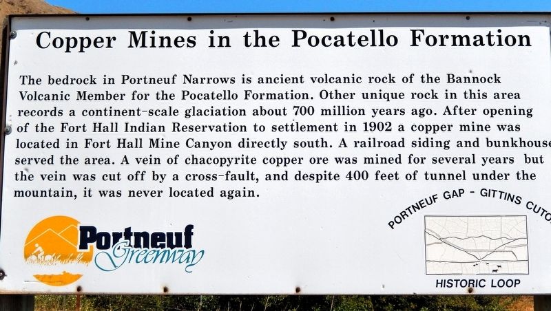
The bedrock in Portneuf Narrows is ancient volcanic rock of the Bannock Volcanic Member for the Pocatello Formation. Other unique rock in this area records a continent-scale glaciation about 700 million years ago. After opening of the Fort Hall Indian Reservation to settlement in 1902 a copper mine was located in Fort Hall Mine Canyon directly south. A railroad siding and bunkhouse served the area. A vein of chacopyrite copper ore was mined for several years but the vein was cut off by a cross-fault, and despite 400 feet of tunnel under the mountain, it was never located again.
Erected by Portneuf Greenway.
Topics. This historical marker is listed in these topic lists: Indigenous Peoples and Communities • Industry & Commerce • Settlements & Settlers. A significant historical year for this entry is 1902.
Location. 42° 47.742′ N, 112° 20.913′ W. Marker is in Pocatello, Idaho, in Bannock County. It is on South 5th Avenue (Old U.S. 91) 0.3 miles west of North Blackrock Canyon Road, on the right when traveling west. The marker is located in a pull-out on the north side of the highway. Touch for map. Marker is in
this page online

Regionally, this marker is in Bear River Country. It is also in the American Mountain West. Globally, it is in North America, the Western Hemisphere, the Western World, and the Anglosphere.
Other nearby markers. At least 8 other markers are within 5 miles of this marker, measured as the crow flies: Gateway to the Pacific Northwest (here, next to this marker); Why is Portneuf Gap Here? (here, next to this marker); Utah and the Northern Railway (approx. 0.8 miles away); Port of Entry (approx. 0.8 miles away); Oregon Short Line & Union Pacific (approx. 0.8 miles away); Idaho's 1st Railroad (approx. 4.4 miles away); Fort Hall (approx. 4.9 miles away); Old Fort Hall (approx. 4.9 miles away). Touch for a list and map of all markers in Pocatello.
Related markers. Click here for a list of markers that are related to this marker. Portneuf Gap-Gittins Cutoff Historic Loop
Also see . . . Fort Hall Mine.
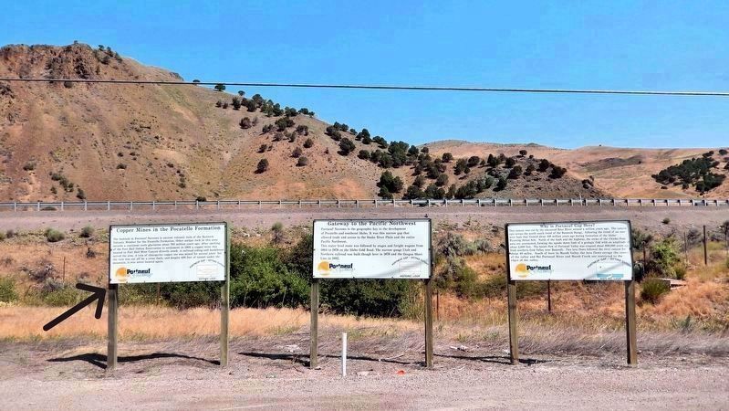
Excerpt: Copper was mined in the 1890s and early 1900s in the Fort Hall Mine west of Portneuf Narrows. A railroad siding was built(Submitted on March 7, 2025, by Cosmos Mariner of Cape Canaveral, Florida.)and a bunkhouse existed at the mouth of the canyon. In 1905 it is reported that Eugene O. Leonard, the founder of Idaho State University pharmacy school, made a trip to visit the mine, operated at that time by Henry Palmer. Leonard observed a rich vein of chalcopyrite Copper ore in one of the mine's drainage pits. This vein was covered up during subsequent operations, and even though 4,000 feet of tunnel were dug in the mine, its location was never found again.Photographed by Cosmos Mariner, July 10, 20242. Copper Mines in the Pocatello Formation MarkerLooking north; this is the leftmost of three related markers located at this pull-out on the old highway. Interstate 15 parallels in the background.
Credits. This page was last revised on March 8, 2025. It was originally submitted on March 6, 2025, by Cosmos Mariner of Cape Canaveral, Florida. This page has been viewed 351 times since then and 123 times this year. Photos: 1, 2. submitted on March 6, 2025, by Cosmos Mariner of Cape Canaveral, Florida.
