Smithfield in Isle of Wight County, Virginia — The American South (Mid-Atlantic)
Bennett’s Plantation
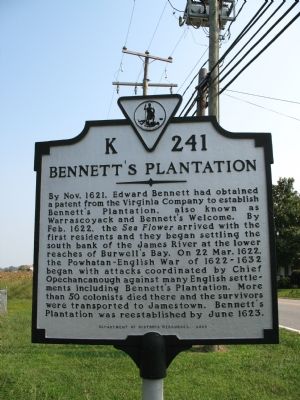
Photographed by Laura Troy, September 23, 2007
1. Bennett's Plantation Marker
Erected 2000 by Department of Historic Resources. (Marker Number K-241.)
Topics and series. This historical marker is listed in this topic list: Colonial Era. In addition, it is included in the Virginia Department of Historic Resources (DHR) series list. A significant historical month for this entry is June 1623.
Location. 37° 0.832′ N, 76° 38.053′ W. Marker is in Smithfield, Virginia, in Isle of Wight County. It is on Old Stage Highway (Virginia Route 10) north of Blounts Corner Road, on the right
this page online

Regionally, this marker is in Coastal Virginia and in the Hampton Roads Metropolitan Area. It is also in the American South, specifically in the Upper South, in the Tidewater, and on the Eastern Seaboard. Globally, it is in the North Atlantic Region, North America, the Western Hemisphere, the Western World, and the Anglosphere. Historically, it finds itself in what was once the territory of the Mississippian Culture, one of the original Thirteen Colonies, one of the Confederate States of America, and the Antebellum South.
Other nearby markers. At least 8 other markers are within 2 miles of this marker, measured as the crow flies: Basse’s Choice (here, next to this marker); Welcome to Fort Boykin Historic Park (approx. 1.6 miles away); Welcome to Fort Boykin (approx. 1.7 miles away); Fort Boykin (approx. 1.7 miles away); The Historic James and its Tributaries (approx. 1.7 miles away); Camp Eustis Attacks Fort Boykin
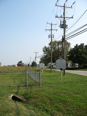
Photographed by Laura Troy, September 23, 2007
2. Bennett's Plantation and Basse's Choice
Another marker is no longer nearby. Fort Boykin Historic Park (was approx. 1.7 miles away but has been replaced with another marker now near it).
Credits. This page was last revised on June 16, 2016. It was originally submitted on September 23, 2007, by Laura Troy of Burke, Virginia. This page has been viewed 8,479 times since then and 494 times this year. Photos: 1, 2. submitted on September 23, 2007, by Laura Troy of Burke, Virginia. • J. J. Prats was the editor who published this page.
