King George in King George County, Virginia — The American South (Mid-Atlantic)
Belle Grove Plantation
Booth's Pursuer's Close In
| — | John Wilkes Booth - Chasing Lincoln's Assassin | — |
Photographed by Mark P Brock-Cancellieri, March 1, 2025
1. Belle Grove Plantation Marker
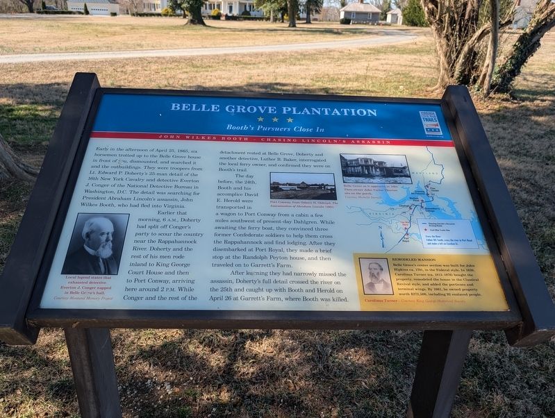
Earlier that morning, 6 A.M., Doherty had split off Conger's party to scour the country near the Rappahannock River. Doherty and the rest of his men rode inland to King George Court House and then to Port Conway, arriving here around 2 P.M.. While Conger and the rest of the detachment rested at Belle Grove, Doherty and another detective, Luther B. Baker, interrogated the local ferry owner, and confirmed they were on Booth's trail.
The day before, the 24th, Booth and his accomplice David E. Herold were transported in a wagon to Port Conway from a cabin a few miles southwest of present-day Dahlgren. While awaiting the ferry boat, they convinced three former Confederate soldiers
this page online
After learning they had narrowly missed the assassin, Doherty's full detail crossed the river on the 25th and caught up with Booth and Herold on April 26 at Garrett's Farm, where Booth was killed.
(sidebar)
Remodeled Mansion
Belle Grove's center section was built for John Hipkins ca. 1791, in the Federal style. In 1839, Carolinus Turner (ca. 1813-1876) bought the property, remodeled the house in the Classical Revival style, and added the porticoes and terminal wings. By 1861, he owned property worth $272,500, including 92 enslaved people.
Carolinus Turner - Courtesy King George Historical Society
(captions)
Local legend states that exhausted detective Everton J. Conger napped in Belle Grove's hall. Courtesy Montana Memory Project
Port Conway, from Osborn H. Oldroyd, The Assassination of Abraham Lincoln (1901)
Belle Grove as it appeared in 1894. Then owner John Tayloe Thorton sits on the porch. Courtesy Michelle Darnell
Erected by Virginia
Photographed by Mark P Brock-Cancellieri, March 1, 2025
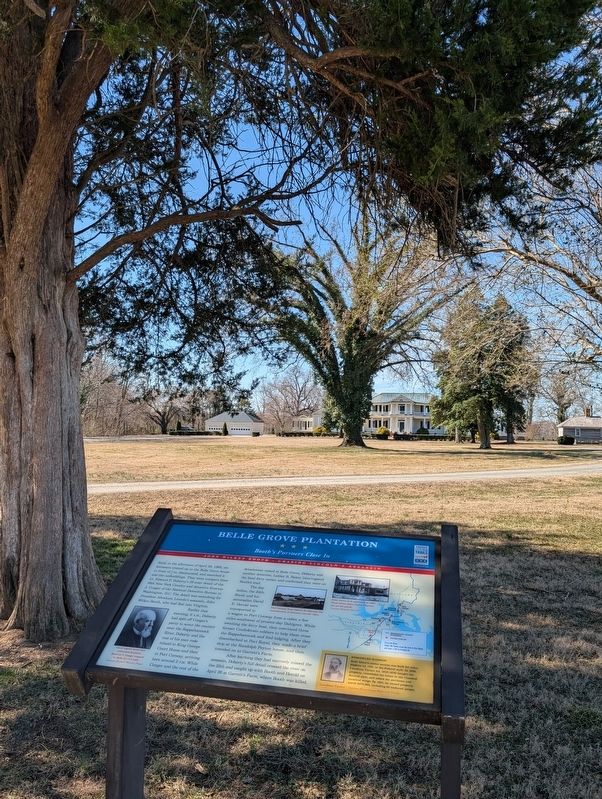
2. Belle Grove Plantation and Marker
Topics and series. This historical marker is listed in this topic list: War, US Civil. In addition, it is included in the Virginia Civil War Trails series list. A significant historical date for this entry is April 25, 1865.
Location. 38° 10.801′ N, 77° 11.233′ W. Marker is in King George, Virginia, in King George County. It is on Belle Grove Drive 0.2 miles west of James Madison Parkway (U.S. 301), on the right when traveling west. Touch for map. Marker is at or near this postal address: 9221 Belle Grove Dr, King George VA 22485, United States of America. Touch for directions.

Regionally, this marker is in the American South, specifically in the Upper South, in the Mid-Atlantic, in the Tidewater, in the Chesapeake Bay Region, and on the Eastern Seaboard. Globally, it is in the North Atlantic Region, North America, the Western Hemisphere, the Western World, and the Anglosphere. Historically, it finds itself in what was once the territory of the Mississippian Culture, one of the original Thirteen Colonies, one of the Confederate States of America, and the Antebellum South.
Other nearby markers. At least 8 other markers are within walking distance of this marker: This monument, until 1983 located on the Belle Grove Lawn (about 400 feet away, measured in a direct line); Emmanuel Episcopal Church (about 500 feet away); Emmanuel Church (about 500 feet away); a different marker also named Emmanuel Church (about 500 feet away); James Madison's Birthplace (about 500 feet away); King George County / Caroline County (about 600 feet away); Port Royal Harbor (approx. half a mile away); Port Royal (approx. half a mile away). Touch for a list and map of all markers in King George.
Another marker is no longer nearby. Birthplace of Madison (was about 500 feet away but has been replaced with another marker now near it).
Credits. This page was last revised on July 24, 2025. It was originally submitted on March 12, 2025, by Mark P. Brock-Cancellieri of Baltimore, Maryland. This page has been viewed 349 times since then and 66 times this year. Photos: 1, 2. submitted on March 12, 2025, by Mark P. Brock-Cancellieri of Baltimore, Maryland. • Bernard Fisher was the editor who published this page.
