Rogers Park in Chicago in Cook County, Illinois — The American Midwest (Great Lakes)
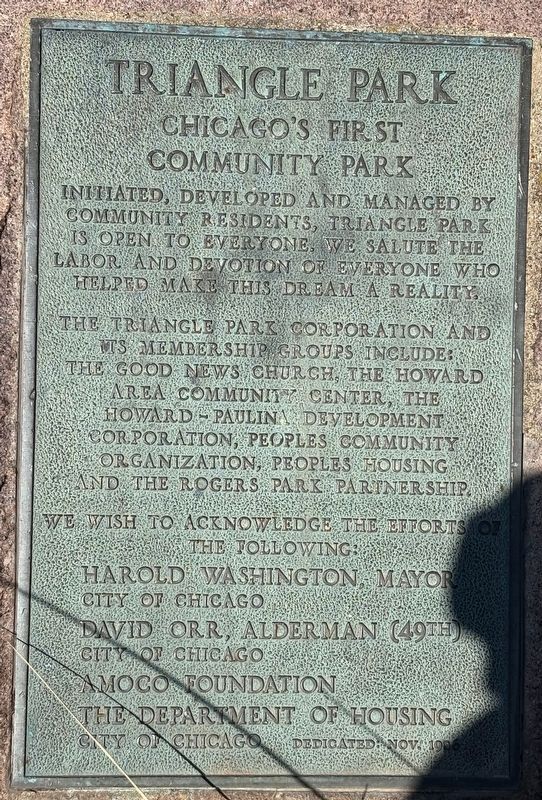
Triangle Park
Chicago's First Community Park
Photographed by Sean P. Flynn, March 12, 2025
1. Triangle Park Marker
The Triangle Park Corporation and its membership groups include: The Good News Church, the Howard Area Community Center, the Howard-Paulina Development Corporation, Peoples Community Organization, Peoples Housing and the Rogers Park Partnership.
We wish to acknowledge the efforts of the following: Harold Washington, Mayor, City of Chicago David Orr, Alderman (49th), City of Chicago, Amoco Foundation, the Department of Housing, City of Chicago
Dedicated Nov. 1986
Erected 1986 by Triangle Park Corporation.
Topics. This historical marker is listed in these topic lists: Parks & Recreational Areas • Political Subdivisions • Religion & Religious Structures. A significant historical year for this entry is 1986.
Location. 42° 1.351′ N, 87° 40.464′ W. Marker is in Chicago, Illinois, in Cook County. It is in Rogers Park. It is at the intersection of West Juneway Terrace and Heritage Avenue, on the left when traveling east on West Juneway Terrace. Touch for map. Marker is in this post office area: Chicago IL 60626, United States of America. Touch for directions.

Regionally, this marker is on Chicago’s North Side. It is also in the American Midwest. Globally, it is in North America, on the Great Lakes, in the Western Hemisphere, in the Western World, and in the Anglosphere. Historically, it finds itself in what was once the Viceroyalty of New France, the territory of the Mississippian Culture, and the Northwest Territory.
Other nearby markers. At least 8 other markers are within walking distance of this marker: Calvary Cemetery (approx. ¼ mile away); Joyce Kilmer Triangle (approx. 0.4 miles away); Vera Megowan Park
this page online
More about this marker. This is almost certainly the northernmost historical marker inside Chicago's city limits. Juneway Terrace is the northernmost east-west street in Chicago, part of a roughly 7-block-by-2-block enclave of the Rogers Park neighborhood next to Lake Michigan that forms the farthest north incorporated section of the city. Triangle Park's northern boundary is Chicago's border with suburban Evanston; this historical marker itself is about 60 yards south of that border (visible in the form of the fence for neighboring Calvary Cemetery).
Regarding Triangle Park. The park was created in the 1940s when several buildings along Juneway Terrace were torn down. While owned by the City of Chicago, the development of this land into a park was driven and managed by local residents. According to a Chicago Park District history

Photographed by Sean P. Flynn, March 12, 2025
2. Triangle Park
The fence in the background is Calvary Cemetery, located in the neighboring suburb of Evanston. This marker is about 60 yards south of the City of Chicago's northernmost boundary. The signs in the background are for the Fit-Trail exercise program.
Also see . . . Chicago Park District: Triangle Park. (Submitted on March 13, 2025, by Sean P. Flynn of Oak Park, Illinois.)
Credits. This page was last revised on March 13, 2025. It was originally submitted on March 13, 2025, by Sean P. Flynn of Oak Park, Illinois. This page has been viewed 232 times since then and 63 times this year. Photos: 1, 2. submitted on March 13, 2025, by Sean P. Flynn of Oak Park, Illinois.
