Near Smithfield in Isle of Wight County, Virginia — The American South (Mid-Atlantic)
Surry County / Isle of Wight County
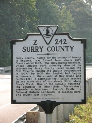
Surry County. Surry County, named for the county of Surrey in England, was formed from James City County about 1652. The Quiyoughcohannocks, whose villages were primarily situated in present-day Surry County, were among the first Virginia Indians the English encountered in 1607. By 1609 the English had begun settlements in the county at Hog Island and Smith’s Fort, a defensive fortification erected on the south side of the James River along Gray’s Creek. One of the nation’s outstanding examples of high-style 17th-century domestic architecture, Bacon’s Castle, a Nation Historic Landmark, is located here. The County seat is Surry.
Isle of Wight County. Originally called Warrosquyoake County, for the Warraskoyack Indians who lived here. Isle of Wight County was one of the original eight shires (counties) recognized in Virginia by 1634. It was renamed Isle of Wight in 1637, probably for the island off the south coast of England. Led by Capt. Christopher Lawne, the English first settled here in 1619 on Lawne’s Creek. A part of the county became Southampton County in 1749 while a portion of Nansemond County was added to Isle of Wight County in 1769. St. Luke’s Church, a National Historic Landmark, is located here. Isle of Wight is the county seat.
Erected 2003 by Department of Historic Resources. (Marker Number Z-242.)
Topics and series. This historical marker is listed in these topic lists: Architecture • Churches & Religion • Colonial Era • Native Americans • Political Subdivisions • Settlements & Settlers. In addition, it is included in the National Historic Landmarks, and the Virginia Department of Historic Resources (DHR) series lists. A significant historical year for this entry is 1652.
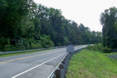
Location. 37° 4.492′ N, 76° 41.597′ W. Marker is near Smithfield, Virginia, in Isle of Wight County. Marker is on Colonial Trail E (Route 10), on the right when traveling north. Touch for map. Marker is at or near this postal address: 4540 Old Stage Hwy, Smithfield VA 23430, United States of America. Touch for directions.
Other nearby markers. At least 8 other markers are within 3 miles of this marker, measured as the crow flies. Fort Huger (approx. half a mile away); Poole’s Funeral Home (approx. 1.1 miles away); Old Town (approx. 1.6 miles away); Lawne’s Creek Church (approx. 2.1 miles away); Bacon’s Castle (approx. 2.9 miles away); Hog Island (approx. 2.9 miles away); Encampment (approx. 3 miles away); Fifth Battalion Virginia Infantry (approx. 3 miles away). Touch for a list and map of all markers in Smithfield.
Credits. This page was last revised on July 7, 2021. It was originally submitted on September 23, 2007, by Laura Troy of Burke, Virginia. This page has been viewed 1,797 times since then and 61 times this year. Photos: 1. submitted on September 23, 2007, by Laura Troy of Burke, Virginia. 2, 3. submitted on July 9, 2010, by Forest McDermott of Masontown, Pennsylvania. • J. J. Prats was the editor who published this page.


