Buffalo Valley in Putnam County, Tennessee — The American South (East South Central)
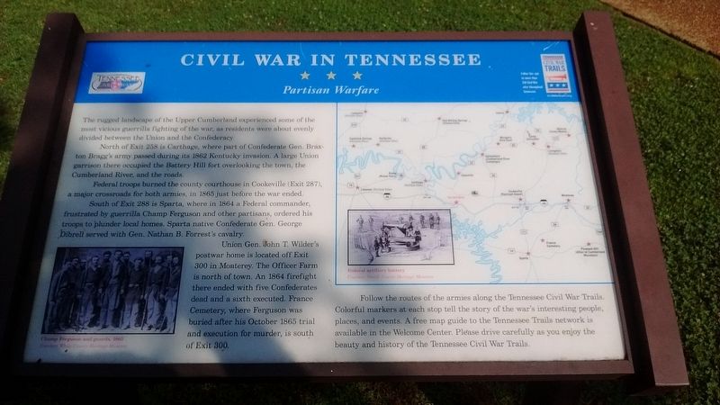
Civil War in Tennessee
Partisan Warfare
Photographed by Tom Bosse, June 17, 2017
1. Civil War in Tennessee Marker
The rugged landscape of the Upper Cumberland experienced some of the most vicious guerrilla fighting of the war, as residents were about evenly divided between the Union and the Confederacy.
North of Ext 258 is Carthage, where part of Confederate Gen. Braxton Bragg's army passed during its 1862 Kentucky invasion. A large Union garrison there occupied the Battery Hill fort overlooking the town, the Cumberland river and the roads.
Federal troops burned the county courthouse in Cookeville (Exit 287), a major crossroads for both armies, in 1865 just before the war ended.
South of Exit 288 is Sparta, where in 1864 a Federal commander, frustrated by guerrilla Champ Ferguson and other partisans, ordered his troops to plunder local homes. Sparta native Confederate Gen. George Dibrell served with Gen. Nathan B. Forrest's cavalry.
Union Gen. John T. Wilder's postwar home is located off Exit 300 in Monterey. The Officer Farm is north of town. An 1864 firefight there ended with five Confederates dead and a sixth executed. France Cemetery, where Ferguson was buried after his October 1865 trial and execution for murder, is
this page online
Follow the routes of the armies along the Tennessee Civil War Trails. Colorful markers at each stop tell the story of the war's interesting people, places, and events. A free map guide to the Tennessee Trails network is available in the Welcome Center. Please drive carefully as you enjoy the beauty and history of the Tennessee Civil War Trails.
Erected by Tennessee Civil War Trails.
Topics and series. This historical marker is listed in this topic list: War, US Civil. In addition, it is included in the Tennessee Civil War Trails series list. A significant historical month for this entry is October 1865.
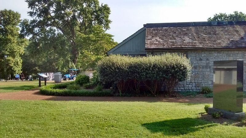
Location. Marker has been permanently removed. It was located near 36° 8.401′ N, 85° 48.367′ W. Marker was in Buffalo Valley, Tennessee, in Putnam County. It could be reached from Interstate 40 at milepost 266, on the right when traveling west. Marker is located at the Smith County Rest Area on I-40. Touch for map. Marker was in this post office area: Buffalo Valley TN 38548, United States of America.
We have been informed that this marker is no longer there and will not be replaced. This page is an archival view of what was.
Regionally,
Photographed by Tom Bosse, June 17, 2017
2. Civil War in Tennessee Marker

Other nearby markers. At least 8 other markers are within 4 miles of this location, measured as the crow flies: Tennessee Veterans (here, next to this marker); U.S. Senator Albert Gore, Sr. (a few steps from this marker); Tennessee Civil War Trails (a few steps from this marker); Jim Denny (approx. 1.3 miles away); Buffalo Valley School (approx. 1.3 miles away); Center Hill Dam / Center Hill Powerhouse (approx. 3 miles away); Site of Roulston Stand (approx. 3.1 miles away); Last Stagecoach Hold-Up (approx. 3.3 miles away). Touch for a list and map of all markers in Buffalo Valley.
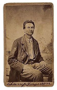
Also see . . . Champ Ferguson. Wikipedia entry (Submitted on March 1, 2021, by Larry Gertner of New York, New York.)
Photographed by Tom Bosse
3. Champ Ferguson
Credits. This page was last revised on March 16, 2025. It was originally submitted on July 15, 2017, by Tom Bosse of Jefferson City, Tennessee. This page has been viewed 1,200 times since then and 67 times this year. Last updated on March 16, 2025, by Mark Parker of Hickory, North Carolina. Photos: 1, 2, 3. submitted on July 15, 2017, by Tom Bosse of Jefferson City, Tennessee. • Devry Becker Jones was the editor who published this page.
