Farmington near Mocksville in Davie County, North Carolina — The American South (South Atlantic)
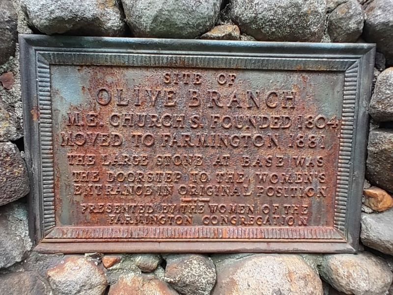
Site of Olive Branch
Photographed by Mark Parker, August 19, 2022
1. Site of Olive Branch Marker
Site of
Olive Branch
M.E. Church S. Founded 1804
Moved to Farmington 1881
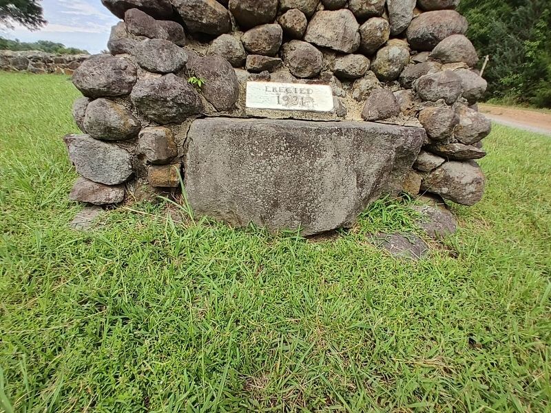
The large stone at base was the doorstep to the women's entrance in original position
Erected 1931 by Women of the Farmington Congregation.
Topics. This historical marker is listed in these topic lists: Religion & Religious Structures • Women. A significant historical year for this entry is 1881.
Location. 35° 59.692′ N, 80° 32.015′ W. Marker is near Mocksville, North Carolina, in Davie County. It is in Farmington. It is at the intersection of Hubert Road and Farmington Road, on the left when traveling west on Hubert Road. Touch for map. Marker is at or near this postal address: 122 Hubert Rd, Mocksville NC 27028, United States of America. Touch for directions.

Regionally, this marker is in the Piedmont. It is also in the American South and specifically in the Upper South. Globally, it is in North America, the Western Hemisphere, the Western World, and the Anglosphere. Historically, it finds itself in what was once the territory of the Mississippian Culture, one of the original Thirteen Colonies, one of the Confederate
this page online
Other nearby markers. At least 8 other markers are within 7 miles of this marker, measured as the crow flies: Brock Memorial (approx. one mile away); The British Army (approx. 1.4 miles away); Daniel Boone / Greene and Cornwalis (approx. 1.4 miles away); Historic Huntsville Methodist Church (approx. 6 miles away); In 1827 (approx. 6.4 miles away); Basil Gaither (approx. 6.4 miles away); The Boone Family in Davie County (approx. 6.4 miles away); Fries Manufacturing and Power Co. (approx. 6.4 miles away). Touch for a list and map of all markers in Mocksville.
Another marker is no longer nearby. Raiding Huntsville (was approx. 6.1 miles away but has been permanently removed).
Also see . . . Olive Branch Church.
Let us for a few minutes recall how the building itself looked as it stood in a grove of beautiful virgin forest trees. It was a frame structure of good proportions with a medium high gable roof. Two doors on the east side were reached by steps made of large solid rocks. Speaking of these rock steps reminds me of(Submitted on March 17, 2025, by Mark Parker of Hickory, North Carolina.)
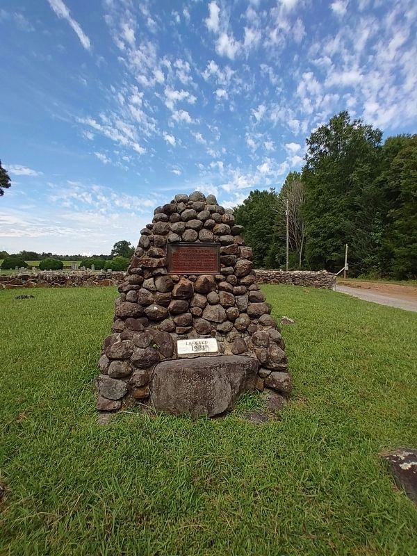
one custom which the men and women strictly observed,and which now seems very strange to us.Photographed by Mark Parker, August 19, 20222. Full view of Olive Branch Church Marker. Cemetery is in the background
Those steps divided the “sheep from the goats” so to speak. That is, the women from the men. The men used the left entrance and the women used the right entrance, and neither dared to cross the door steps of the other. If a young man brought his best girl to church he left her at the steps, and she entered the womens entrance and he the mens. Nor were they allowed the pleasure of sitting by one another after passing into the church...
Photographed by Mark Parker, August 19, 2022
3. The door step to the women's entrance in its original position
Photographed by Mark Parker, August 19, 2022
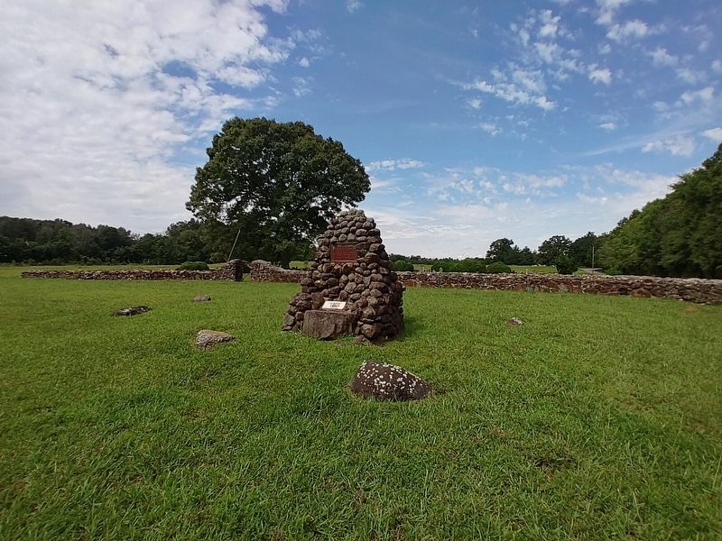
4. Wide view of Olive Branch Marker and cemetery

Photographed by Mark Parker, August 19, 2022
5. Site of Olive Branch Methodist Church sign, on the Farmington Road side of the property
Credits. This page was last revised on March 17, 2025. It was originally submitted on March 17, 2025, by Mark Parker of Hickory, North Carolina. This page has been viewed 180 times since then and 34 times this year. Photos: 1, 2, 3, 4, 5. submitted on March 17, 2025, by Mark Parker of Hickory, North Carolina. • James Hulse was the editor who published this page.
