Tinicum Township near Essington in Delaware County, Pennsylvania — The American Northeast (Mid-Atlantic)
New Sweden
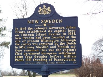
Photographed by Beverly Pfingsten, December 27, 2008
1. New Sweden Marker
Erected 1988 by Pennsylvania Historical and Museum Commission.
Topics and series. This historical marker is listed in these topic lists: Colonial Era • Settlements & Settlers. In addition, it is included in the Pennsylvania Historical and Museum Commission (PHMC) series list. A significant historical year for this entry is 1643.
Location. 39° 51.676′ N, 75° 18.161′ W. Marker is near Essington, Pennsylvania, in Delaware County. It is in Tinicum Township. It is on Taylor Avenue, on the right when traveling south. Marker is in Governor Printz Park. Touch for map. Marker is at or near this postal address: 105 Taylor Ave, Essington PA 19029, United States of America. Touch for directions.

Regionally, this marker is in Southeast
this page online
Other nearby markers. At least 8 other markers are within walking distance of this marker: Johan Printz (within shouting distance of this marker); Governor Printz Park (about 400 feet away, measured in a direct line); Governor Johan Printz (about 600 feet away); Lazaretto Quarantine Station (approx. 0.2 miles away); Tinicum (approx. 0.6 miles away); Tinicum Township (approx. 0.6 miles away); A Group of Citizens with a Vision (approx. 0.8 miles away); John Heinz National Wildlife Refuge at Tinicum (approx. 0.8 miles away). Touch for a list and map of all markers in Essington.
Also see . . . New Sweden - Behind the Marker. ExplorePAHistory.com (Submitted on July 19, 2011, by Mike Wintermantel of Pittsburgh, Pennsylvania.)
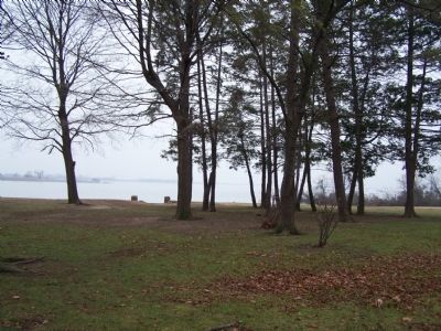
Photographed by Beverly Pfingsten, December 27, 2008
2. Governor Printz Park and Delaware River
Credits. This page was last revised on March 31, 2025. It was originally submitted on December 27, 2008, by Bill Pfingsten of Bel Air, Maryland. This page has been viewed 2,994 times since then and 87 times this year. Last updated on March 20, 2025, by Carl Gordon Moore Jr. of North East, Maryland. Photos: 1, 2. submitted on December 27, 2008, by Bill Pfingsten of Bel Air, Maryland. • Devry Becker Jones was the editor who published this page.
