Clayton in Panola County, Texas — The American South (West South Central)
Old Bethel Baptist Church History
Photographed by James Hulse, March 15, 2025
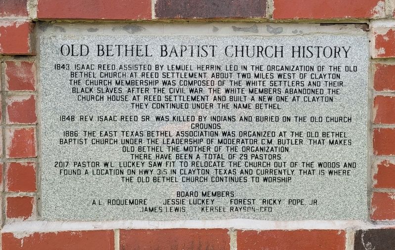
1. Old Bethel Baptist Church History Marker
1843: Isaac Reed assisted by Lemuel Herrin. Led in the organization of the Old Bethel Church at Reed Settlement, about two miles west of Clayton. The church membership was composed of the White settlers and their Black slaves. After the Civil War, the White members abandoned the church house at Reed Settlement and built a new one at Clayton. They continued under the name Bethel.
1848: Rev. Isaac Reed, Sr. was killed by Indians and buried on the Old Church grounds.
1886: The East Texas Bethel Association was organized at the Old Bethel Baptist Church under the leadership of moderator C.M. Butler, that makes Old Bethel the mother of the organization. There have been a total of 29 pastors.
2017: Pastor W.L. Luckey saw fit to relocate the church out of the woods and found a location on Hwy 315 in Clayton, Texas and currently, that is where the Old Bethel Church continues to worship.
Board Members: Al Roouemore • Jessie Luckey • Forest "Ricky" Pope, Jr. • James Lewis • Kersel Rayson-CFO
Topics. This historical marker is listed in these topic lists: African Americans • Indigenous Peoples and Communities
this page online
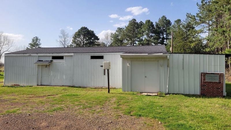
Location. 32° 6.306′ N, 94° 27.642′ W. Marker is in Clayton, Texas, in Panola County. It is at the intersection of State Road 315 and County Road 112, on the right when traveling west on State Road 315. The marker is located at the east front side of the of the building. Touch for map. Marker is at or near this postal address: 3717 TX-315, Carthage TX 75633, United States of America. Touch for directions.

Regionally, this marker is in the American South, specifically in the Deep South, and in the Piney Woods. Globally, it is in North America, a Gulf of Mexico state, the Western Hemisphere, the Western World, and the Anglosphere. Historically, it finds itself in what was once New Spain, the Republic of Texas, one of the Confederate States of America, and the Antebellum South.
Other nearby markers. At least 8 other markers are within 7 miles of this marker, measured as the crow flies: Church Bethel (approx. 1.3 miles away); Rev. Isaac Reed (approx. 2.7 miles away); Cedar Grove Baptist Church (approx. 2.9 miles away); Allison Chapel United Methodist Church
Photographed by James Hulse, March 15, 2025
2. Old Bethel Baptist Church History and Marker
Credits. This page was last revised on March 20, 2025. It was originally submitted on March 20, 2025, by James Hulse of Medina, Texas. This page has been viewed 377 times since then and 82 times this year. Photos: 1, 2. submitted on March 20, 2025, by James Hulse of Medina, Texas.
