Loris in Horry County, South Carolina — The American South (South Atlantic)
Chicken Bog
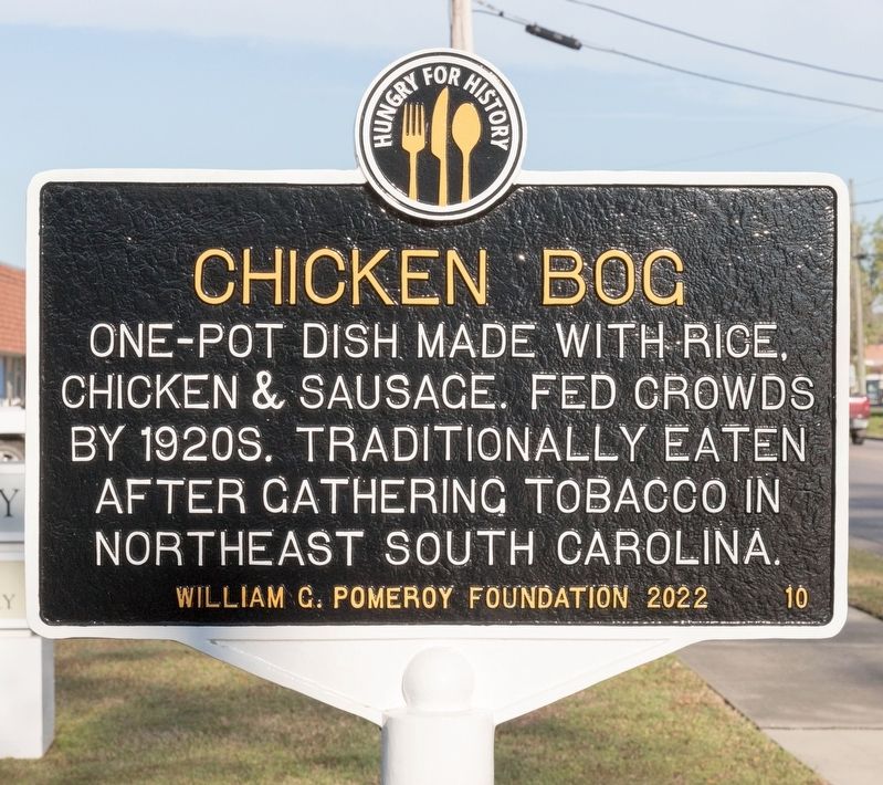
Photographed by J. J. Prats, March 19, 2025
1. Chicken Bog Marker
Erected 2022 by William G. Pomeroy Foundation. (Marker Number 10.)
Topics and series. This historical marker is listed in this topic list: Agriculture. In addition, it is included in the Hungry for History series list.
Location. 34° 3.286′ N, 78° 53.215′ W. Marker is in Loris, South Carolina, in Horry County. It is on Main Street west of Red Bluff Road. It is in front of the Loris branch of the Horry County Memorial Library. Touch for map. Marker is at or near this postal address: 4316 Main St, Loris SC 29569, United States of America. Touch for directions.

Regionally, this marker is in South Carolina’s Pee Dee. It is also in the American South, specifically in the Deep South, and on the Eastern Seaboard. Globally, it is in the North Atlantic Region, North America, the Western Hemisphere, the Western World, and the Anglosphere. Historically, it finds itself in what was once the territory of the Mississippian
this page online
Other nearby markers. At least 8 other markers are within 14 miles of this marker, measured as the crow flies: Loris Training School (approx. ¾ mile away); Mt. Tabor (approx. 6.7 miles away in North Carolina); The Tabor City Tribune (approx. 7.1 miles away in North Carolina); Green Sea Baptist Church (approx. 7.2 miles away); Taking Stock of Animals on the Farm (approx. 13.8 miles away); Children on the Farm (approx. 13.8 miles away); Farm House (approx. 13.8 miles away); The Legacy of Farm to Table (approx. 13.8 miles away).
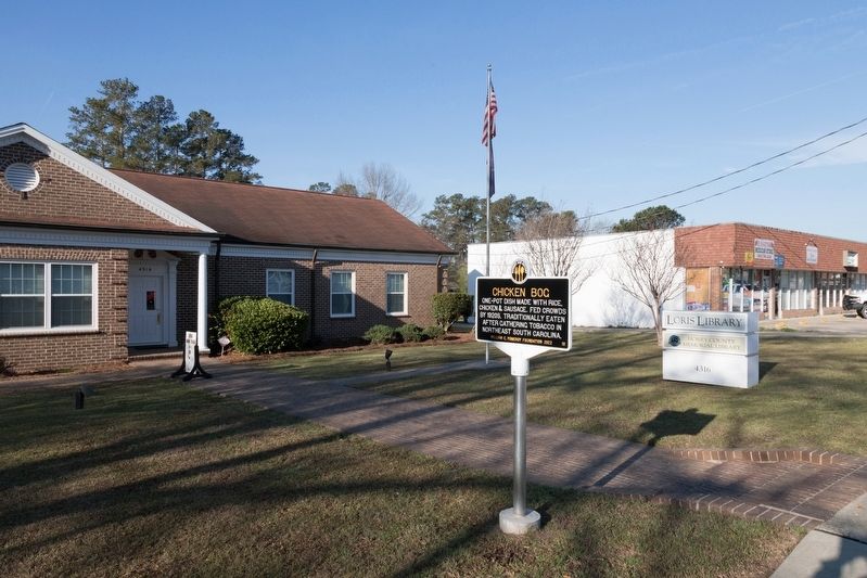
Photographed by J. J. Prats, March 19, 2025
2. Loris Public Library and the Chicken Bog Marker
Credits. This page was last revised on March 20, 2025. It was originally submitted on March 20, 2025, by J. J. Prats of Powell, Ohio. This page has been viewed 276 times since then and 58 times this year. Photos: 1, 2. submitted on March 20, 2025, by J. J. Prats of Powell, Ohio.
