Winchester, Virginia — The American South (Mid-Atlantic)
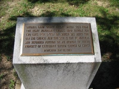
Original Land Grant
Erected 1984.
Topics. This historical marker is listed in these topic lists: Cemeteries & Burial Sites • Churches & Religion • Settlements & Settlers. A significant historical date for this entry is May 27, 1775.
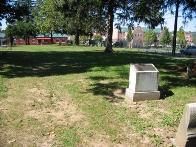
Location. 39° 11.049′ N, 78° 9.609′ W. Marker is in Winchester, Virginia. Marker is at the intersection of Morgan Drive, on the right when traveling south on Morgan Drive. Located in the Centenary Reform section of the Mt. Hebron Cemetery. Entrance to the Cemetery is at the intersection of Boscawen Street and East Lane. Touch for map. Marker is at or near this postal address: 305 East Boscawen Street, Winchester VA 22601, United States of America. Touch for directions.
Other nearby markers. At least 8 other markers are within walking distance of this marker. General Daniel Morgan (about 300 feet away, measured in a direct line); Lutheran Pioneers (about 300 feet away); Jacob Baker Lot And Virginia City Addition (about 400 feet away); Major General Daniel Morgan (about 400 feet away); Old Stone Presbyterian Church (about 400 feet away); Revolutionary War Soldiers in Mt. Hebron Cemetery (about 500 feet away); The Virginia Woolen Company and Lewis Jones Knitting Mill (about 500 feet away); Mount Hebron Cemetery and Gatehouse (about 500 feet away). Touch for a list and map of all markers in Winchester.
Also see . . . Mt. Hebron Cemetery History. Cemetery website entry (Submitted on January 24, 2010, by Craig Swain of Leesburg, Virginia.)
Credits. This page was last revised on January 12, 2024. It was originally submitted on January 24, 2010, by Craig Swain of Leesburg, Virginia. This page has been viewed 868 times since then and 34 times this year. Photos: 1, 2. submitted on January 24, 2010, by Craig Swain of Leesburg, Virginia.

