Pinehill in Rusk County, Texas — The American South (West South Central)
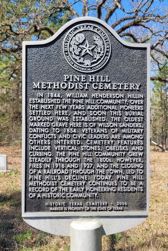
Pine Hill Methodist Cemetery
Photographed by James Hulse, March 16, 2025
1. Pine Hill Methodist Cemetery Marker
Erected 2009 by Texas Historical Commission. (Marker Number 15729.)
Topics. This historical marker is listed in this topic list: Cemeteries & Burial Sites. A significant historical year for this entry is 1844.
Location. 32° 5.509′ N, 94° 36.733′ W. Marker is in Pinehill, Texas, in Rusk County. It is on Farm to Market Road 1798 0.7 miles south of Farm to Market Road 2867, on the right when traveling south. The marker is located along the highway. Touch for map. Marker is at or near this postal address: 9743 FM1798, Long Branch TX 75669, United States of America. Touch for directions.

Regionally, this marker is in the American South, specifically in the Deep South, and in the Piney Woods. Globally, it is in North America, a Gulf of Mexico state, the Western Hemisphere, the Western World, and the Anglosphere. Historically, it finds itself in what was once New Spain, the Republic of Texas, one of the Confederate States of America, and the Antebellum South.
Other nearby markers. At least 8 other markers are within 5 miles of this marker, measured as the crow flies: Buckner Cemetery (approx. 1.3 miles away);
this page online
Photographed by James Hulse, March 16, 2025
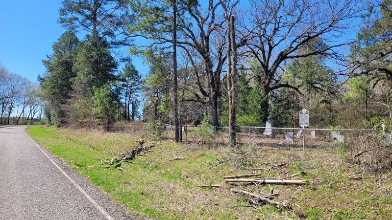
2. The view of the Pine Hill Methodist Cemetery and Marker along the highway
Credits. This page was last revised on March 22, 2025. It was originally submitted on March 22, 2025, by James Hulse of Medina, Texas. This page has been viewed 355 times since then and 79 times this year. Photos: 1, 2. submitted on March 22, 2025, by James Hulse of Medina, Texas.
