Near Henderson in Rusk County, Texas — The American South (West South Central)
Bridges Cemetery

Photographed by James Hulse, March 16, 2025
1. Bridges Cemetery Marker
The Reverend Julius Caesar Alford Bridges of Georgia married Mary Ann Cosper in 1857 in Alabama. Some years later, they left that state with their ten children in twenty covered wagons and settled in Chapman. Bridges, a Confederate veteran, purchased the land on which the Buckner family and community cemetery was located for $100 in gold and later added more land. He served at the nearby Church Hill Methodist Church from 1880 until his death in October 1881. One of J.C. and Mary Bridges' eight sons, Francis "Frank" Bridges, married Mary E. Lowrie in 1884. Frank Bridges had many occupations during his lifetime. At one point he served as the first postmaster of the Chapman community. Bridges descendants continued to make their homes in the area.
The Bridges Cemetery remains in service to Rusk County and the Chapman community. Among the pioneer families represented here are the Brooks, Futch, Garrison, Gossett, Jimmerson, Lowrie, Shumate, Snelgrove, Smith and Wylie families. In 1999 there were thirty-eight veterans buried in the cemetery. They served in a variety of U.S. and international conflicts including the Civil War, World War I, World War II, the Korean War war and Vietnam. Others served the U.S. Armed Forces in peacetime. Unmarked graves in the back of the cemetery are believed to be those of slaves. The Bridges Cemetery is a chronicle of early Rusk County history.
Erected 1999 by Texas Historical Commission. (Marker Number 12172.)
Topics. This historical marker is listed in this topic list: Cemeteries & Burial Sites. A significant historical month for this entry is October 1881.
Location. 32° 8.333′ N, 94° 37.795′ W.
this page online

Regionally, this marker is in the American South, specifically in the Deep South, and in the Piney Woods. Globally, it is in North America, a Gulf of Mexico state, the Western Hemisphere, the Western World, and the Anglosphere. Historically, it finds itself in what was once New Spain, the Republic of Texas, one of the Confederate States of America, and the Antebellum South.
Other nearby markers. At least 8 other markers are within 4 miles of this marker, measured as the crow flies: Blossom Hill United Methodist Church (approx. 0.9 miles away); Buckner Cemetery (approx. 2½ miles away); Trammel's Trace (approx. 2.8 miles away); Pine Grove Cumberland Presbyterian Church (approx. 2.9 miles away); Richard Brown (approx. 2.9 miles away); John Strong / Mary Ann (Whatley) Strong
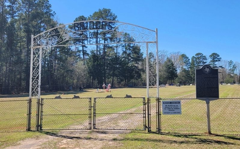
Photographed by James Hulse, March 16, 2025
2. Bridges Cemetery and Marker
Credits. This page was last revised on March 22, 2025. It was originally submitted on March 22, 2025, by James Hulse of Medina, Texas. This page has been viewed 261 times since then and 42 times this year. Photos: 1, 2. submitted on March 22, 2025, by James Hulse of Medina, Texas.
