Straban Township in Gettysburg in Adams County, Pennsylvania — The American Northeast (Mid-Atlantic)
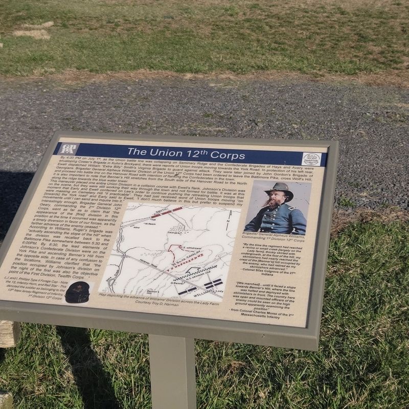
The Union 12th Corps
Photographed by Mike McKeown, March 23, 2025
1. The Union 12th Corps Marker
This maneuver placed one entire Union Division in a collision course with Ewell's flank. Johnson's Division was on the scene, but they were still working their way through the town and not formed for battle. It was at this moment that Early and Ewell conferred on Lee's order to continue pushing the retreating
this page online
According to Williams, Ruger's brigade was "actually ascending the slope of the hill" when the division was recalled back to the Baltimore Pike somewhere between 5:30 and 6:00PM. By 6:30, the lead elements of Johnson's Confederate Division were on the York Pike and ascending Benner's Hill from the opposite side. In case of any confusion to locations, Williams clarified that "the position occupied by Johnson's division on the night of the first was also the objective point of the First Division, Twelfth Corps..."
"By the time the regiment had reached a ravine or small creed [largely on the Lady farm], thickly skirted with undergrowth, at the foot of the hill, my skirmishers had nearly reached the crest of the [Benner's] hill occupied by the enemy, who had retired as my skirmishers advanced." - Colonel Silas Colgrove of the 27th Indiana.
"[We marched]…until it faced a slope towards Benner's Hill, where the line was halted and deployed with skirmishers in front. The country here was open and mounted officers of the enemy could be seen on the high ground apparently examining the position" - from Colonel Charles Morse of the 2nd Massachusetts Infantry
(captions)
L.J. and I. Phillips Type II Forage Cap - Note the 13, Infantry Horn, and Red Star - This denoted the soldier as belonging to the 13th New Jersey Regiment of Infantry, 1st Division 12th Corps.
Map depicting the advance of William's Division across the Lady Farm
Courtesy Troy D. Harmmon
Brigadier General Alpheus Williams, Commanding 1st Division 12th Corps
Erected 2024
Photographed by Mike McKeown, March 23, 2025
2. The Union 12th Corps Marker
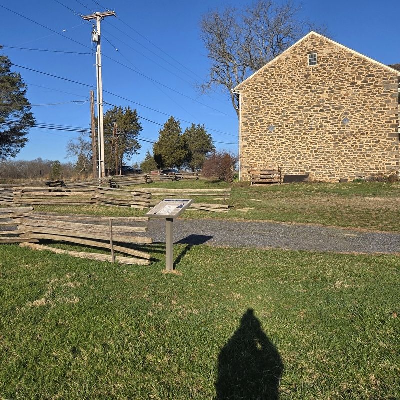
marker at a distance
Topics. This historical marker is listed in this topic list: War, US Civil. A significant historical date for this entry is July 1, 1863.
Location. 39° 49.662′ N, 77° 12.425′ W. Marker is in Gettysburg, Pennsylvania, in Adams County. It is in Straban Township. It is on Hanover Road (Pennsylvania Route 116) 0.8 miles east of Sixth Street (U.S. 15), on the left when traveling east. Near the south parking area of the Historic Daniel Lady Farm. Touch for map. Marker is at or near this postal address: 1008 Hanover Rd, Gettysburg PA 17325, United States of America. Touch for directions.

Regionally, this marker is in South-Central Pennsylvania. It is also in the American Northeast, in the Mid-Atlantic, in Appalachia, and specifically in Northern Appalachia. Globally, it is in North America, the Western Hemisphere, the Western World, and the Anglosphere. Historically, it finds itself in what was once the Haudenosaunee (Iroquois) Confederacy and also one of the original Thirteen Colonies.
Other nearby markers. At least 8 other markers are within walking distance of this marker: CSA Field Hospital (a few steps from this marker); Home, Headquarters, Hospital (within shouting distance of this marker); General Lee on The Lady Farm (within shouting distance of this marker); Home, Headquarters, Hospital (cont'd) (within shouting distance of this marker); Daniel Lady Farm (within shouting distance of this marker); Civil War Memorial (within shouting distance of this marker); Milledge's Battery - Nelson's Battalion (approx. 0.3 miles away); Nelson's Battalion (approx. 0.3 miles away). Touch for a list and map of all markers in Gettysburg.
Also see . . . Historic Daniel Lady Farm. (Submitted on March 23, 2025.)
Credits. This page was last revised on March 25, 2025. It was originally submitted on March 23, 2025, by Mike McKeown of Baltimore, Maryland. This page has been viewed 213 times since then and 38 times this year. Last updated on March 23, 2025, by Mike McKeown of Baltimore, Maryland. Photos: 1, 2. submitted on March 23, 2025, by Mike McKeown of Baltimore, Maryland. • Bernard Fisher was the editor who published this page.
