Surry in Surry County, Virginia — The American South (Mid-Atlantic)
Surry County Confederate Monument
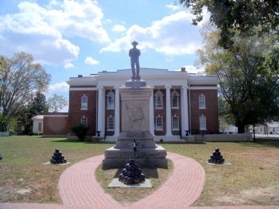
September 18, 2010
1. Surry County Confederate Monument
1861-1865
To
the Confederate Soldiers
of Surry County.
“That we through life may not
forget
to love the thin gray line.”
Erected by the Confederate
Memorial Association of Surry
County A.D. 1909.
Erected 1909 by Confederate Memorial Association of Surry County.
Topics. This monument and memorial is listed in this topic list: War, US Civil.
Location. Monument has been permanently removed. It was located near 37° 8.27′ N, 76° 50.077′ W. Monument was in Surry, Virginia, in Surry County. It was at the intersection of Colonial Trail East (Virginia Route 10) and Rolfe Highway ( Route 31) on Colonial Trail East. Touch for map. Monument was at or near this postal address: 28 Colonial Trail East, Surry VA 23883, United States of America.
We have been informed that this monument is no longer there and will not be replaced. This page is an archival view of what was.
Regionally, this memorial monument was in Coastal Virginia and in the Hampton Roads Metropolitan Area. It was also in the American South, specifically in the Upper South, in the

this page online
Other nearby markers. At least 8 other markers are within 2 miles of this location, measured as the crow flies: Surry County War Memorial (a few steps from this marker); Surry County Virginia (a few steps from this marker); Capt. Jacob Faulcon, C.S.A. (within shouting distance of this marker); Chanco (within shouting distance of this marker); Smith’s Fort Plantation (about 600 feet away, measured in a direct line); Surry County WWII Veterans Memorial (approx. 0.3 miles away); a different marker also named Organization of the Christian Church (approx. 1.3 miles away); Christian Church (approx. 1.3 miles away). Touch for a list and map of all markers in Surry.
Another marker is no longer nearby. Organization of the Christian Church (was approx. 1.3 miles away but has been replaced with another marker now near it).
Credits. This page was last revised on March 25, 2025. It was originally submitted on September 22, 2010, by Bernard Fisher of Richmond, Virginia. This page has been viewed 1,946 times since then and 41 times this year. Last updated on March 24, 2025, by Evan Dwyer of Richmond, Virginia. Photo 1. submitted on September 22, 2010.
