Winchester, Virginia — The American South (Mid-Atlantic)
A View of Winchester in 1745 - The Four Public Lots
Inscription.
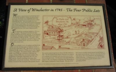
Winchester, originally known as Frederick Town, was officially founded in 1744 by Col. James Wood. It was the first British town established west of the Blue Ridge mountains and in believed to have looked something like this. These four public lots were conveyed to the town by Wood from land he purchased from Thomas, Lord Fairfax, who owned over 5,282,000 acres of land stretching from the headwaters of the Rappahannock and Potomac rivers to the Chesapeake Bay, roughly the size of the state of Massachusetts.
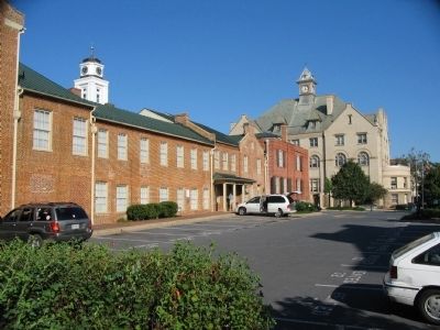
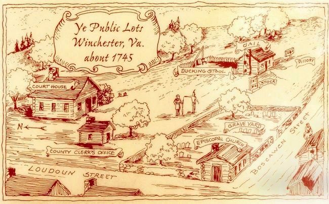
The original log courthouse finished in 1751 was forty feet square. The present Greek Revival style county courthouse sits on the same site. It was designed by Baltimore, Maryland, architect Robert Cary Long, Jr., and completed in 1840 for $12,000. The clerk's office located next to the courthouse, was built of logs in 1747. It was used by Colonel Wood, who served as the first clerk of the county court.
On the northeast corner of Loudoun and Boscawen streets stood the first Episcopal or Anglican church, a log structure built about 1745. This church was part of Frederick Parish, created in 1738 by an act of the Virginia House of Burgesses. The present church, which is two blocks west of this site, was built in 1828 from the designs of Robert Mills, the renowned architect who designed the Washington Monument, the U.S. Post Office and the Treasury buildings and many other notable public and private structures. The tomb of Lord Fairfax is located in the courtyard of the present church.
Two rectors played significant roles in the Revolutionary War. The Reverend Charles Mynn Thurston was captain of a company of volunteers who marched away to join the Continental forces. The Reverend Alexander Balmain, rector in 1781, was chaplain to General Peter Muhlenburg's 8th Virginia Continental Army Brigade. The site of the first church included a burial ground located behind the church next to the jail. Next to it was a log structure built about 1745 It was flanked by the instruments of justice of the day: a whipping post, two sets of stocks, and a dunking stool to punish offenders such as gossiping citizens.
Erected by the Members of Frederick Episcopal Parhish in cooperation with F&M Bank.
Topics. This historical marker is listed in these topic lists: Churches & Religion • Government & Politics • Settlements & Settlers. A significant historical year for this entry is 1744.
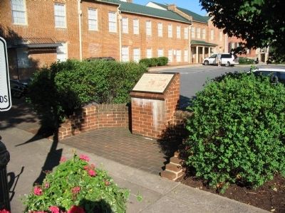
Location. 39° 11.05′ N, 78° 9.93′ W. Marker is in Winchester, Virginia. Marker is at the intersection of North Loudoun Street and East Boscawan Street, on the right when traveling north on North Loudoun Street. Loudoun Street is closed to vehicle traffic near the marker. Touch for map. Marker is in this post office area: Winchester VA 22601, United States of America. Touch for directions.
Other nearby markers. At least 8 other markers are within walking distance of this marker. The Wilbur M. Feltner Building (here, next to this marker); Frederick County Courthouse (within shouting distance of this marker); Confederate Memorial (within shouting distance of this marker); Lord Fairfax (within shouting distance of this marker); Colonel James Wood (within shouting distance of this marker); George Washington's Political Career Began on this Site (within shouting distance of this marker); Miller Drug Store (within shouting distance of this marker); Second Battle of Winchester (about 300 feet away, measured in a direct line). Touch for a list and map of all markers in Winchester.
Credits. This page was last revised on April 17, 2020. It was originally submitted on January 24, 2010, by Craig Swain of Leesburg, Virginia. This page has been viewed 1,839 times since then and 31 times this year. Photos: 1, 2, 3. submitted on January 24, 2010, by Craig Swain of Leesburg, Virginia. 4. submitted on January 26, 2016, by Allen C. Browne of Silver Spring, Maryland.


