Strong Township near Strong City in Chase County, Kansas — The American Midwest (Upper Plains)
Curious Outbuildings
Photographed by William Fischer, Jr., May 2, 2011
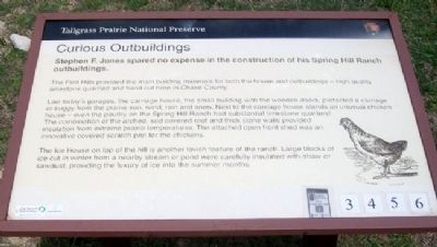
1. Curious Outbuildings Marker
Stephen F. Jones spared no expense in the construction of his Spring Hill Ranch outbuildings.
The Flint Hills provided the main building materials for the ranch -- high quality limestone quarried and hand cut here in Chase County.
Like today's garages, the carriage house, the small building with the wooden doors, protected a carriage or buggy from the prairie sun, wind, rain and snow. Next to the carriage house stands an unusual chicken house -- even the poultry on the Spring Hill Ranch had substantial limestone quarters! The combination of the arched, sod-covered roof and thick stone walls provided insulation from extreme prairie temperatures. The attached open front shed was an innovative covered scratch pen for the chickens, but has been remodeled for use as a shed over the years.
The ice house on top of the hill is another lavish feature of the ranch. Large blocks of ice cut in winter from a nearby stream or pond were carefully insulated with straw or sawdust, providing the luxury of ice into the summer months.
Erected by National Park Service, U.S. Department of the Interior.
Topics. This historical marker
this page online
Location. 38° 26.03′ N, 96° 33.502′ W. Marker is near Strong City, Kansas, in Chase County. It is in Strong Township. It can be reached from Kansas 177. Marker is on the grounds of the former Spring Hill Ranch headquarters, off Kansas Highway 177, about 2.5 miles north of Strong City. Touch for map. Marker is at or near this postal address: 2480 Highway 177, Strong City KS 66869, United States of America. Touch for directions.

Regionally, this marker is in the Flint Hills. It is also in the American Midwest, in the Corn Belt, on the prairies, and on the Southern Plains. Globally, it is in North America, the Western Hemisphere, the Western World, and the Anglosphere. Historically, it finds itself in what was once the Louisiana Purchase.
Other nearby markers. At least 8 other markers are within 3 miles of this marker, measured as the crow flies: Prairie for the People (a few steps from this marker); Spring Hill Ranch (a few steps from this marker); Little Barn on the Prairie (a few steps from this marker); Welcome to the Preserve (within shouting distance of this marker); Vital Necessities (within shouting distance of this marker); Welcome to Tallgrass Prairie National Preserve / Tallgrass Prairie A Place to Explore (about 600 feet away, measured in a direct line); Back to Basics (approx. half a mile away); W.B. Strong Memorial Railroad Park (approx. 2.9 miles away). Touch for a list and map of all markers in Strong City.
Also see . . . Tallgrass Prairie National Preserve. (Submitted on November 14, 2011, by William Fischer, Jr. of Reynoldsburg, Ohio.)
Credits. This page was last revised on April 3, 2025. It was originally submitted on November 14, 2011, by William Fischer, Jr. of Reynoldsburg, Ohio. This page has been viewed 657 times since then and 23 times this year. Last updated on March 25, 2025, by Ian Lefkowitz of New York, New York. Photo 1. submitted on November 14, 2011, by William Fischer, Jr. of Reynoldsburg, Ohio. • Devry Becker Jones was the editor who published this page.
Editor’s want-list for this marker. Distance shot of the marker and outbuildings. • Can you help?
