Central Oklahoma City in Oklahoma County, Oklahoma — The American South (West South Central)
The Canal
Fall 1889 to Christmas 1890
| — | The '89er Trail | — |
Photographed by James Hulse, September 18, 2025
1. The Canal Marker
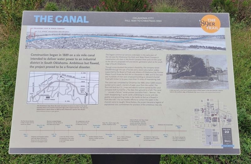
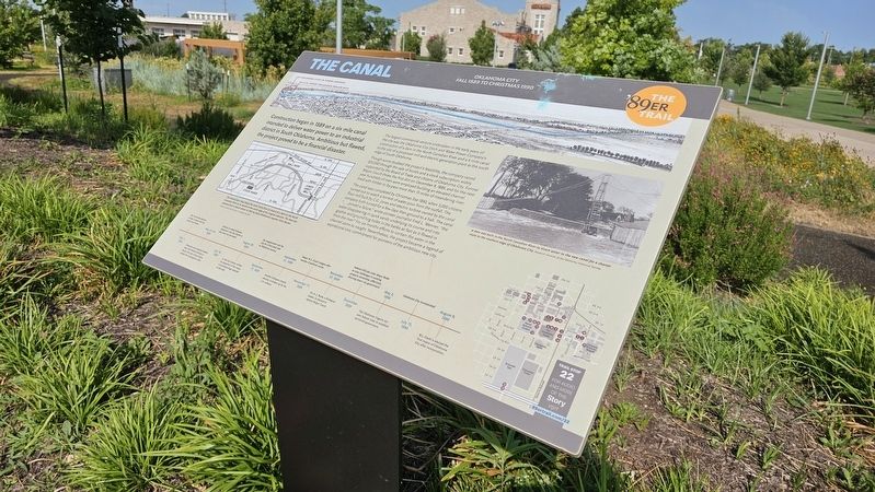
The largest commercial venture undertaken in the early years of the city was the Oklahoma City Ditch and Water Power Company's construction of a dam in the North Canadian River and a 6 mile canal to the site of a proposed mill and electric generation plant at the south edge of South Oklahoma.
Though some doubted the project's feasibility, the company raised $50,000 through the sale of bonds and a stock subscription widely supported by the Board of Trade and citizens of Oklahoma City. Former Mayor Couch threw the first dirt on December 9, 1889, and for the next year hundreds of men were employed building an elevated channel lined with timber to bypass more than 15 miles of meandering river.
The canal was completed by Christmas Eve 1890, when 5,000 citizens turned out to watch a torrent of water pour from the outfall. The flour mill built by C.G. Jones and electric turbine owned by the canal company both turned for a few days then
this page online
Topics and series. This historical marker is listed in these topic lists: Industry & Commerce • Waterways & Vessels. In addition, it is included in the The '89er Trail series list. A significant historical date for this entry is December 9, 1889.
Location. 35° 27.471′ N, 97° 31.026′ W. Marker is in Oklahoma City, Oklahoma, in Oklahoma County. It is in Central Oklahoma City. It is on South Harvey Avenue. Touch for map. Marker is at or near this postal address: 813-899 S Harvey Ave, Oklahoma City OK 73109, United States of America. Touch for directions.

Regionally, this marker is in Central Oklahoma—Frontier Country. It is also in the American South, specifically on the prairies, and on the Southern
Photographed by Ian Lefkowitz, June 26, 2023
2. The Canal Marker
Other nearby markers. At least 8 other markers are within walking distance of this marker: C.G. "Gristmill" Jones (a few steps from this marker); Union Station (about 400 feet away, measured in a direct line); Survivor Tree (about 500 feet away); a different marker also named Union Station (about 500 feet away); South Oklahoma (approx. half a mile away); Hell's Half Acre (approx. half a mile away); Visit of the Congressmen (approx. 0.6 miles away); The Land Run (approx. 0.6 miles away). Touch for a list and map of all markers in Oklahoma City.
Also see . . . The Canal. The 89er Trail (Submitted on September 23, 2025, by James Hulse of Medina, Texas.)
Photographed by James Hulse, September 18, 2025
3. The view of the Canal Marker along the trail in the park
Credits. This page was last revised on September 23, 2025. It was originally submitted on March 25, 2025, by Ian Lefkowitz of New York, New York. This page has been viewed 165 times since then and 33 times this year. Photos: 1. submitted on September 23, 2025, by James Hulse of Medina, Texas. 2. submitted on March 25, 2025, by Ian Lefkowitz of New York, New York. 3. submitted on September 23, 2025, by James Hulse of Medina, Texas. • Andrew Ruppenstein was the editor who published this page.
