
Old Port of Montreal in Montréal, Québec — Central Canada (French-Canadian)
Luttes contre l'eau et la glace
Vieux-Port
⎯⎯⎯
Battle with Waters and Ice
Old Port

Photographed by Cosmos Mariner, May 21, 2024
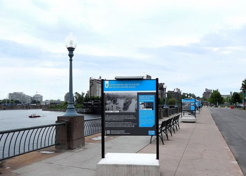
1. Luttes contre l'eau et la glace/Battle with Waters and Ice Marker (north side)

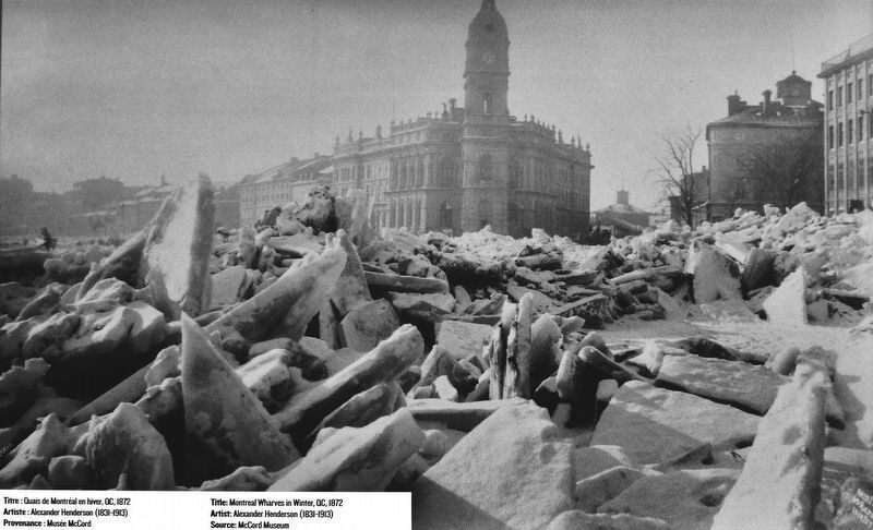
L'hiver, l'amoncellement de glaces est important dans le port, les terres basses, subissant régulièrement des embâcles.
Gardez l'œil ouvert !
Nous retrouvons sur le mur du siège social de la Société du Vieux-Port de Montréal (333 de la Commune Ouest), une marque qui témoigne de la hauteur atteinte par les eaux de la grande inondation de 1886.
Le mur de crue est encore visible à certains endroits du Vieux-Port (Entrée Quai de l'Horloge et secteur des écluses).
In winter, ice accumulation was a challenge for the port. Low-lying lands regularly became
this page online
Keep an eye out!
The wall of the Old Port of Montreal Corporation's headquarters (333 de la Commune West) features a mark that shows the high point of the Great Flood that submerged parts of the City in 1886.
The flood wall is still visible in certain parts of the Old Port (Clock Tower Pier entrance and locks sector).
Topics. This historical marker is listed in these topic lists: Disasters • Waterways & Vessels. A significant historical year for this entry is 1886.
Location. 45° 30.081′ N, 73° 33.161′ W. Marker is in Montréal, Québec. It is in Old Port of Montreal. It can be reached from Rue Quai Alexandra just east of Rue de la Commune Ouest, on the right when traveling east. The marker is located on the Promenade du Vieux-Port, on the south side of the Grand Quay of the Port of Montréal. Touch for map. Marker is at or near this postal address: 200 Rue de la Commune Ouest, Montréal QC H2Y 4B2, Canada. Touch for directions.

Regionally, this marker is in Central Canada. Globally, it is in North America, the Western Hemisphere, and the Western World. Historically, it finds itself in what was once a British

Photographed by Cosmos Mariner, May 21, 2024
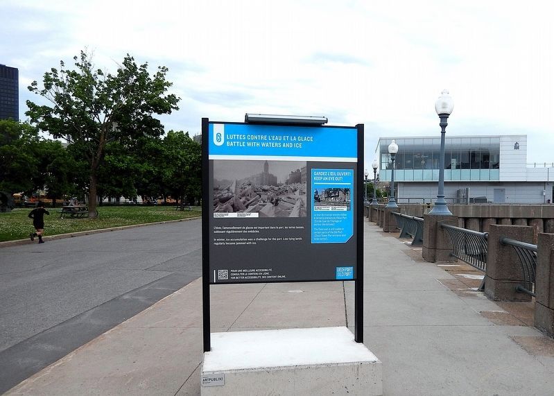
2. Luttes contre l'eau et la glace/Battle with Waters and Ice Marker (south side)
Other nearby markers. At least 8 other markers are within walking distance of this marker: De la Berge Aux Quais / From Riverbanks to Piers (here, next to this marker); Porte d'entrée d'une autre époque / Gateway to a Different Time (a few steps from this marker); Lieu de passage et d'échange / A Place Transit & Trade (a few steps from this marker); Naissance du port moderne / Birth of a Modern Port (a few steps from this marker); Lieu Phare de l'histoire du Canada / A Landmark in Canada's History (within shouting distance of this marker); a different marker also named Naissance du port moderne / Birth of a Modern Port (within shouting distance of this marker); Le plus grand port céréalier du monde / The World's Largest Grain Port (within shouting distance of this marker); Transformation Vieux-Port en site récréotouristique / Old Port Transformed into Recreational Tourism (within shouting distance of this marker). Touch for a list and map of all markers in Montréal.
Related markers. Click here for a list of markers that are

Courtesy Musée McCord Museum
3. Marker detail: Flood, Bonaventure Depot, Montréal, QC, 1886
Inondation, gare Bonaventure, Montréal, QC, 1886
Artiste : George Charles Arless senior (1841-1903)
Artiste : George Charles Arless senior (1841-1903)
Also see . . .
1. 1886 flood had Montreal at its Mercy (Montreal Gazette).
(by John Kalbfleisch) Excerpt: The St. Lawrence was on the rampage. Unimaginably huge masses of spring ice had drifted inexorably downstream and jammed in the narrow, shallow waters of St. Mary’s Current, where the Jacques Cartier Bridge now crosses to the South Shore. The river had nowhere to go. With astonishing speed, it backed up and swelled over its banks, even over the revetment wall protecting the Old Port. The city seemed at its mercy.(Submitted on March 28, 2025, by Cosmos Mariner of Cape Canaveral, Florida.)
Montreal had suffered floods from its very beginnings. In December 1642, Paul de Maisonneuve’s fragile, infant settlement was almost destroyed by one, the waters receding at the last possible moment in what de Maisonneuve was convinced was a miracle. But no flood over the years could match what befell the city in April 1886.
2. Great Montreal Flood of 1886 (Wikipedia Commons photos). (Submitted on March 28, 2025, by Cosmos Mariner of Cape Canaveral, Florida.)

Courtesy Old Port of Montréal Corporation
4. Marker detail: Height of the water during the great flood of 1886
Hauteur de l'eau lors de la grande inondation de 1886.
Provenance : Société du Vieux-Port de Montréal
Provenance : Société du Vieux-Port de Montréal
Courtesy Musée McCord Museum
5. Marker detail: Montreal Wharves in Winter, 1872
Quais de Montréal en hiver, 1872
Artiste : Alexander Henderson (1831-1913)
Artiste : Alexander Henderson (1831-1913)

Courtesy Old Port of Montréal Corporation
6. Marker detail: Vestiges of the flood wall, Clock Tower Pier entrance, 2023
Vestiges du mur de crues situé à l'entrée du Quai de l'Horloge, 2023
Provenance : Société du Vieux-Port de Montréal
Provenance : Société du Vieux-Port de Montréal
Photographed by Cosmos Mariner, May 21, 2024
7. Luttes contre l'eau et la glace/Battle with Waters and Ice Marker (north side)
Looking south along the Promenade du Vieux-Port.
Photographed by Cosmos Mariner, May 21, 2024
8. Luttes contre l'eau et la glace/Battle with Waters and Ice Marker (south side)
Looking north along the Promenade du Vieux-Port.
Credits. This page was last revised on April 5, 2025. It was originally submitted on March 27, 2025, by Cosmos Mariner of Cape Canaveral, Florida. This page has been viewed 142 times since then and 28 times this year. Photos: 1, 2, 3, 4, 5, 6, 7, 8. submitted on March 28, 2025, by Cosmos Mariner of Cape Canaveral, Florida.
