East Florence in Lauderdale County, Alabama — The American South (East South Central)
Wilson Dam
Photographed by Sandra Hughes Tidwell, March 26, 2025
1. Wilson Dam Marker
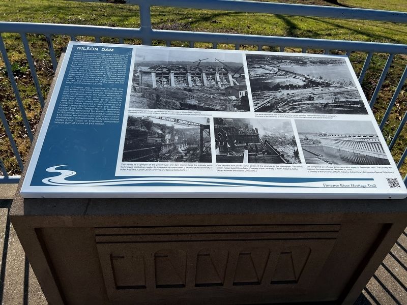
On Armistice Day, November 11, 1918, the war ended. The nitrate plants fell into disuse, and operations were formally suspended in 1922. Construction on the future Wilson Dam continued until 1921, when funding finally dried up. Opinion on what to do with the dam and nitrate plants remained divided in Congress. Some favored private interests and hoped corporations could take over. Others, including Senator George Norris
this page online
Captions:
(Photo #1) An early photograph shows construction on the rear side of Wilson Dam's spillway. (Courtesy of the University of North Alabama, Collier Library Archives and Special Collections)
(Photo #2) This aerial view of the dam reveals the many cranes and other heavy machinery used to complete it. (Courtesy of the University of North Alabama, Collier Library Archives and Special Collections)
(Photo #3) This image is a glimpse of the powerhouse and dam interior. Note the intricate wood framing and scaffolding needed for this phase of construction. (Courtesy of the University of North Alabama, Collier Library Archives and Special Collections)
(Photo #4) Dam laborers work on the apron portion of the structure in this photograph. (Courtesy of the University of North Alabama, Collier Library Archives and Special Collections)
(Photo #5) The completed powerhouse began generating power in September 1925. This photograph captures the powerhouse on December 31, 1925. (Courtesy of the University of North Alabama, Collier Library Archives and Special Collections)
Erected by Florence
Photographed by Sandra Hughes Tidwell, March 26, 2025
2. Wilson Dam Marker
Topics. This historical marker is listed in these topic lists: Bridges & Viaducts • Parks & Recreational Areas • War, World I. A significant historical date for this entry is December 31, 1925.
Location. 34° 48.339′ N, 87° 37.892′ W. Marker is in Florence, Alabama, in Lauderdale County. It is in East Florence. It is on Hightower Place. Touch for map. Marker is at or near this postal address: 15 Hightower Pl, Florence AL 35630, United States of America. Touch for directions.

Regionally, this marker is in North Alabama and in the Shoals. It is also in the American South, specifically in the Deep South, in Appalachia, and specifically in Southern Appalachia. Globally, it is in North America, a Gulf of Mexico state, the Western Hemisphere, the Western World, and the Anglosphere. Historically, it finds itself in what was once the territory of the Mississippian Culture, one of the Confederate States of America, and the Antebellum South.
Other nearby markers. At least 8 other markers are within walking distance of this marker: Tennessee Valley Authority (here, next to this marker); Charles Caine Anderson (within
Photographed by Sandra Hughes Tidwell, March 26, 2025
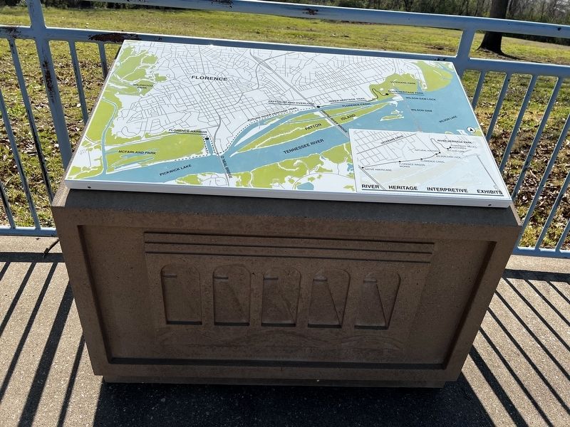
3. River/Heritage/Interpretive/Exhibits
Florence
*McFarland Park,
*Florence Harbor,
*Future River Heritage Trail,
*River Heritage Trail,
*River Heritage Park
*Patton Island Overlook
*Veterans Park
The waterway
.Pickwick "Lake
O'Neal Bridge "
Tennessee River
"Singing River Bridge",
Florence Canal
Wilson Dam Lock
Wilson Dam
Wilson Lake
Markers along the River Heritage Trail
*Native Americans
*Florence Wagon Works
*Florence Canal
*Wilson Dam Lock
Along River Heritage Park
* Keysot
*Wilson Dam
*Tennessee Valley Authority
River/Heritage/Interpretive/Exhibits
One at the beginning and end of the trail.
Credits. This page was last revised on April 1, 2025. It was originally submitted on March 27, 2025, by Sandra Hughes Tidwell of Killen, Alabama, USA. This page has been viewed 238 times since then and 32 times this year. Photos: 1, 2, 3. submitted on March 27, 2025, by Sandra Hughes Tidwell of Killen, Alabama, USA. • James Hulse was the editor who published this page.
