Norwichtown in Southeastern Region, Connecticut — The American Northeast (New England)
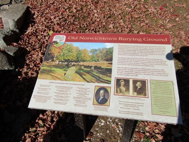
Old Norwichtown Burying Ground
Walk Norwich Benedict Arnold Trail
Photographed by Conrad Ward, October 20, 2024
1. Old Norwichtown Burying Ground Marker
This burying ground was established in 1700 on land owned by Rev. James Fitch, Norwich's first minister, and Lt. Samuel Huntington. The land was chosen for the burying ground because it was hilly and unsuitable for farming. As Norwich grew, more land was added for burials. Through the gate is the original colonial section with headstones from the 1700s. Several thousand burials have been recorded; about 1,300 headstones remain today. Many African Americans were buried in unmarked graves in the back of the burying ground.
The earliest gravesites in Norwich are found in the Post and Gager Burying Ground. Their "post and rail" wooden markers no longer exist. By the mid-1600s, stone markers were used. Tombstones were purchased in pairs and marked the head (headstone) and foot (footstone) of the grave. Bodies were buried with their feet to the East so they faced the rising sun on judgment day.
Notice the different carving styles and evolving imagery on the stones. Early images of skulls, crossbones and winged hourglasses symbolized death. By the mid-1700s, winged cherubs suggested ascension of the spirit. Weeping willows
this page online
Notable Norwich Citizens in the Colonial Burying Ground
Oliver Arnold (1721-1781)
Benedict Arnold's Uncle
Hannah Waterman King Arnold (1708-1759)
Mother of Benedict Arnold
Thomas Harland (1735-1807)
First American Clockmaker
Governor Samuel Huntington (1731-1796)
Signer of the Declaration of Independence, President of United States under the Articles of Confederation in Perpetuity, State Supreme Court Judge, Governor of Connecticut
Deacon Simon Huntington (1629-1706)
Founder of Norwich and oldest tombstone in the Colonial Burying Ground
Simon Huntington (1686-1707)
Bitten by rattlesnake
Christopher Huntington (1660-1735)
First-born male in Norwich
Jedediah Huntington (1743-1818)
General in Revolutionary War
Ebenezer Huntington (1754-1834)
General in Revolutionary War
Jerusha Lathrop (1717-1805)
Wife of Dr. Daniel Lathrop
Joshua Lathrop (1723-1807)
Prominent Druggist
Dr. Daniel Lathrop (1712-1782)
Prominent Druggist
Col. Christopher Leffingwell (1734-1810)
Prominent
Photographed by Conrad Ward, October 20, 2024
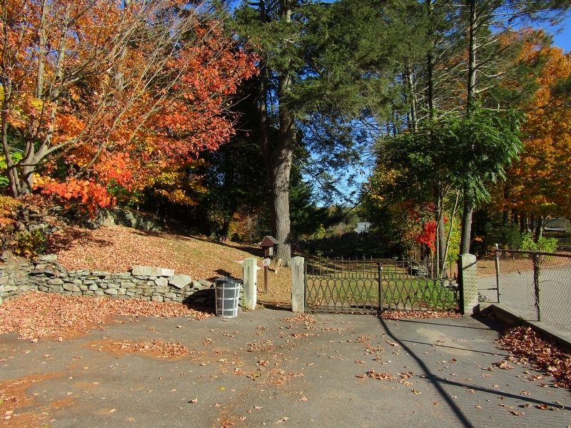
2. Old Norwichtown Burying Ground Marker
(Marker is behind the entrance)
Reverend Benjamin Lord (1694-1784)
Pastor at the First Congregational Church
Diah Manning (1760-1815)
Drum Major during the Revolutionary War
Boston Trowtrow (?-1772)
Black Governor of Norwich
Other Norwich 18th Century Burying Grounds:
Post and Gager Burying Ground - Lee Avenue (Founders Burying Ground)
Oak Street Cemetery - 37 Oak Street Please be respectful of the burying grounds.
Enjoy your look back into the 18th Century.
(Portrait captions)
Samuel Huntington, President of the United States under the Articles of Confederation in Perpetuity (Portrait by Charles Wilson Peale)
Dr. Joshua and Mrs. Mercy (Eels) Lathrop
(Mary Perkins, Old House of the Ancient Town of Norwich)
Acknowledgments
This panel was produced by the Norwich Historical Society in cooperation with the Norwich Community Development Corporation, the Norwich Heritage Groups, City of Norwich and Norwich Public Works Department. Research and writing by Regan Miner; panel design and oversight of fabrication by Geoff Steadman and Pam Ballard.
The Norwich Historical Society received support for this project from: State Historic Preservation Office of the Department of Economic and Community Development with funds from: The Community Investment Act of the State of Connecticut; the Sachem Fund; Eastern Connecticut Association of Realtors; the R.S. Gernon Trust; and the Elsie A. Brown Fund.
wałknorwich.org
2015
Erected 2015 by Walk Norwich Trails.
Topics. This historical marker is listed in this topic list: Cemeteries & Burial Sites.
Location. 41° 32.906′ N, 72° 5.6′ W. Marker is in Norwich in Southeastern Region, Connecticut. It is in Norwichtown. It is on Old Cemetery Lane when traveling east. Touch for map. Marker is in this post office area: Norwich CT 06360, United States of America. Touch for directions.

Regionally, this marker is on the Connecticut Shoreline, in Greater New London and in the Thames River Valley. It is also in the American Northeast, in New England, and on the Eastern Seaboard. Globally, it is in the North Atlantic Region, North America, the Western Hemisphere, the Western World, and the Anglosphere. Historically, it finds itself in what was once New London County and also one of the original Thirteen Colonies.
Other nearby markers. At least 8 other markers are within walking distance of this marker: En Memoire de Vingt Compagnons de Lafayette (a few steps from this marker); Twenty French Soldiers Memorial (a few steps from this marker); Once upon a time in Norwich... (within shouting distance of this marker); Samuel Huntington (about 300 feet away, measured in a direct line); Tomb of Samuel Huntington (about 300 feet away); The Old Burying Ground (about 300 feet away); Gravesite of Boston Trowtrow, Norwich's "Black Governor" (about 400 feet away); John Mason (about 500 feet away). Touch for a list and map of all markers in Norwich.
Also see . . .
1. Hannah Arnold (Wikipedia). (Submitted on March 27, 2025.)
2. Samuel Huntington (Wikipedia). (Submitted on March 27, 2025.)
3. Jedediah Huntington (Wikipedia). (Submitted on March 27, 2025.)
4. Ebenezer Huntington (Wikipedia). (Submitted on March 27, 2025.)
5. Walk Norwich Trails. (Submitted on March 27, 2025.)
Credits. This page was last revised on May 19, 2026. It was originally submitted on March 27, 2025, by Conrad Ward of Guilford, Connecticut. This page has been viewed 279 times since then and 54 times this year. Photos: 1, 2. submitted on March 27, 2025, by Conrad Ward of Guilford, Connecticut. • Andrew Ruppenstein was the editor who published this page.
