
Near New Summerfield in Rusk County, Texas — The American South (West South Central)
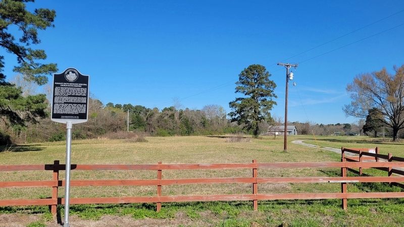
Pleasant Grove Methodist Episcopal Church South Cemetery

Photographed by James Hulse, March 17, 2025
1. Pleasant Grove Methodist Episcopal Church South Cemetery Marker
The Methodist Cemetery was established here in 1873, with the burial of James Bradford Morris (b. 1856). He was the son of Stephen and Mary Morris. Others buried here include Dr. Richard H.C. Shelton, an eminent southwestern surgeon; other friends and relatives of Stephen and Mary Morris; and pioneer settlers.
Church trustees Seaton Moore, Simpson Moore, and G.D. Boatwright purchased this land for the church and cemetery in 1877. The Pleasant Grove Church eventually disbanded, with the remaining members joining St. Paul's Methodist Church in Henderson (11 mi. NE). By 1929, the year of the last burial in this graveyard, most Methodist families were using the City Cemetery in Henderson. The Pleasant Grove Cemetery
this page online
Erected 1986 by Texas Historical Commission. (Marker Number 11028.)
Topics. This historical marker is listed in these topic lists: Cemeteries & Burial Sites • Religion & Religious Structures. A significant historical year for this entry is 1853.
Location. 32° 0.896′ N, 94° 58.025′ W. Marker is near New Summerfield, Texas, in Rusk County. It is on U.S. 79 ¼ mile west of County Road 4193D, on the right when traveling west. The marker is located along the highway. Touch for map. Marker is at or near this postal address: 14380 US-79, Henderson TX 75654, United States of America. Touch for directions.

Regionally, this marker is in the American South, specifically in the Deep South, and in the Piney Woods. Globally, it is in North America, a Gulf of Mexico state, the Western Hemisphere, the Western World, and the Anglosphere. Historically, it finds itself in what was once New Spain, the Republic of Texas, one of the Confederate States of America, and the Antebellum South.
Other nearby markers. At
Photographed by James Hulse, March 17, 2025
2. Pleasant Grove Methodist Episcopal Church South Cemetery Marker

Photographed by Jeff Leichsenring, December 1, 2025
3. Pleasant Grove Methodist Episcopal Church South Cemetery Marker
Credits. This page was last revised on December 2, 2025. It was originally submitted on March 27, 2025, by James Hulse of Medina, Texas. This page has been viewed 311 times since then and 73 times this year. Photos: 1, 2. submitted on March 28, 2025, by James Hulse of Medina, Texas. 3. submitted on December 2, 2025, by Jeff Leichsenring of Garland, Texas.
