San Martín de las Pirámides in Teotihuacán, Mexico State, Mexico — The Central Highlands (North America)
El Quincunce
⎯⎯⎯
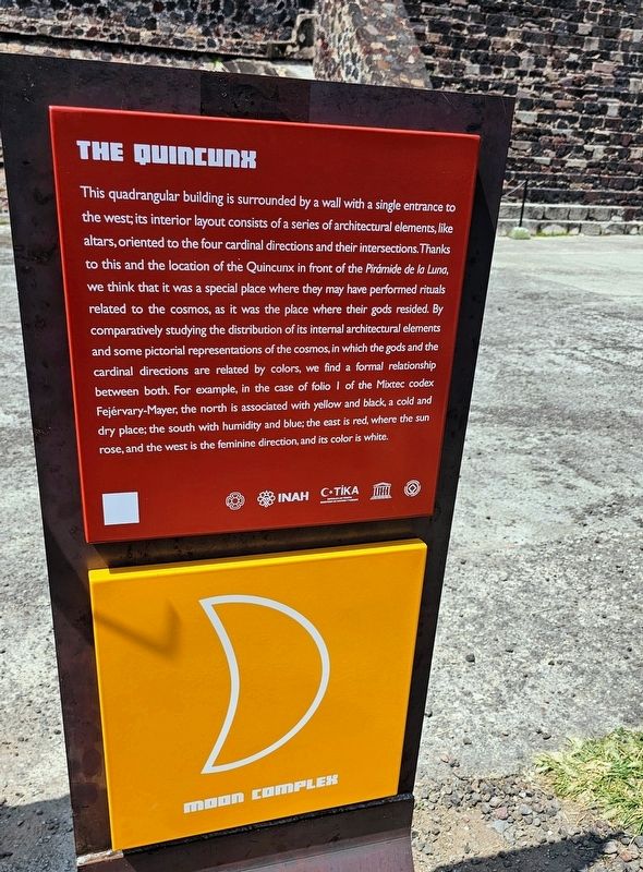
The Quincunx
Photographed by Ian Lefkowitz, October 14, 2024
1. The Quincunx Marker

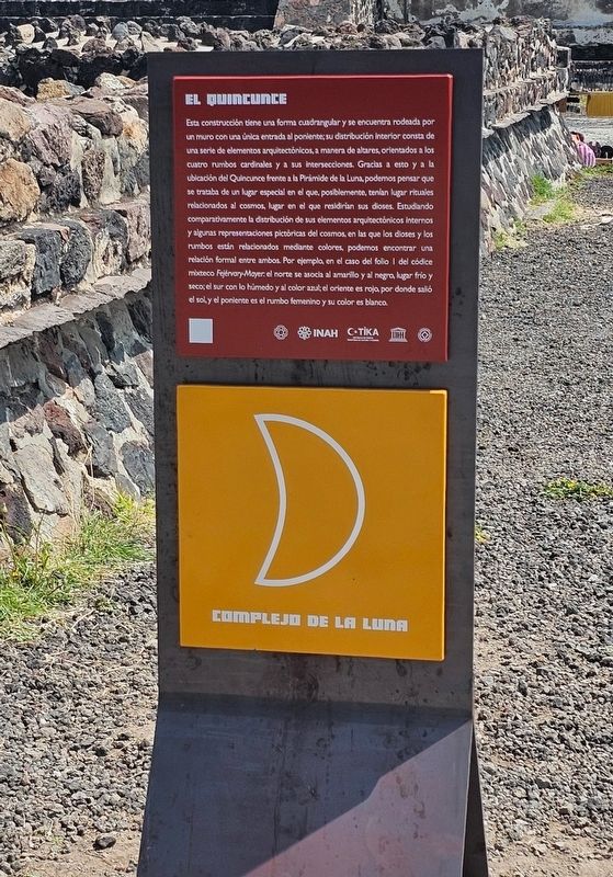
Esta construcción tiene una forma cuadrangular y se encuentra rodeada por un muro con una única entrada al poniente; su distribución Interior consta de una serie de elementos arquitectónicos, a manera de altares, orientados a los cuatro rumbos cardinales y a sus intersecciones. Gracias a esto y ala ubicación del Quincunce frente a la Pirámide de la Luna, podemos pensar que se trataba de un lugar especial en el que, posiblemente, tenían lugar rituales relacionados al cosmos, lugar en el que residirían sus dioses. Estudiando comparativamente la distribución de sus elementos arquitectónicos internos y algunas representaciones pictóricas del cosmos, en las que los dioses y los rumbos están relacionados mediante colores, podemos encontrar una relación formal entre ambos. Por ejemplo, en el caso del folio I del códice mixteco Fejérvary-Mayer: el norte se asocia al amarillo y al negro, lugar frio y seco; el sur con lo húmedo y al color azul, el oriente es rojo, por donde saló el sol y el poniente es el rumbo femenino y su color es blanco.
This quadrangular building is surrounded by a
this page online
Erected by Instituto Nacional de Antropología e Historia (INAH).
Topics. This historical marker is listed in these topic lists: Architecture • Indigenous Peoples and Communities • Religion & Religious Structures.
Location. 19° 41.915′ N,
Photographed by Ian Lefkowitz, October 14, 2024
2. El Quincunce
The Spanish language historical marker is adjacent to the English language historical marker.

Regionally, this marker is in Central Mexico and specifically in Mexico City Metropolitan Area. Globally, it is in North America, specifically in Mesoamerica, on the Ring of Fire, and in the Western Hemisphere. Historically, it finds itself in what was once New Spain, a Spanish colony, and the Aztec Empire.
Other nearby markers. At least 8 other markers are within walking distance of this marker: The Pyramid of the Moon (within shouting distance of this marker); Palacio de Quetzalpapalotl (about 150 meters away, measured in a direct line); Miccoatli (about 150 meters away); The Quetzalpapálotl Architectural Complex (about 150 meters away); The Temple of Agriculture (about 210 meters away); Late Occupation of Teotihuacan and the Mexica Presence (about 240 meters away); Mural del Puma / The Puma Mural (approx. 0.3 kilometers away); The History of Teotihuacán

Photographed by Ian Lefkowitz, October 14, 2024
3. The Quincunx
The Quincunx is located near the Pyramid of the Moon, to the right of this other nearby structure.
Credits. This page was last revised on October 18, 2025. It was originally submitted on March 29, 2025, by Ian Lefkowitz of New York, New York. This page has been viewed 229 times since then and 94 times this year. Photos: 1, 2, 3. submitted on March 29, 2025, by Ian Lefkowitz of New York, New York. • J. Makali Bruton was the editor who published this page.
