La Rue in Henderson County, Texas — The American South (West South Central)
Morrison Chapel/La Rue Cemetery
Photographed by James Hulse, March 17, 2025
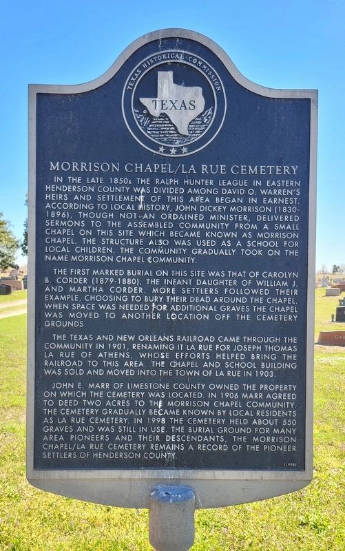
1. Morrison Chapel/La Rue Cemetery Marker
The first marked burial on this site was that of Carolyn B. Corder (1879-1880), the infant daughter of William J. and Martha Corder. More settlers followed their example, choosing to bury their dead around the chapel. When space was needed for additional graves the chapel was moved to another location off the cemetery grounds.
The Texas and New Orleans Railroad came through the community in 1901, renaming it La Rue for Joseph Thomas La Rue of Athens, whose efforts helped bring the railroad to this area. The chapel and school building was sold and moved into the town of La Rue in 1903.
John E. Marr of Limestone County owned the property on which the cemetery was located. In 1906 Marr agreed to deed two acres to the Morrison Chapel community. The cemetery gradually became known by local residents as La Rue Cemetery. In 1998 the cemetery held about 550 graves and was still in use. The burial ground for many area pioneers and their descendants, the Morrison Chapel/La Rue Cemetery remains a record of the pioneer settlers of Henderson County
Erected 1998 by Texas Historical Commission. (Marker Number 14587.)
Topics. This historical marker is listed in these topic lists: Cemeteries & Burial Sites • Settlements & Settlers. A significant historical year for this entry is 1901.
Location. 32° 7.451′ N, 95° 40.222′ W.
this page online

Regionally, this marker is in the American South and in the Piney Woods. Globally, it is in North America, a Gulf of Mexico state, the Western Hemisphere, the Western World, and the Anglosphere. Historically, it finds itself in what was once New Spain, the Republic of Texas, one of the Confederate States of America, and the Antebellum South.
Other nearby markers. At least 8 other markers are within 7 miles of this marker, measured as the crow flies: The Rev. Thomas Hunt Hall, M.D. (approx. 2.9 miles away); New York Cemetery (approx. 2.9 miles away); Davis Reynolds (approx. 3.1 miles away); Poynor Cemetery (approx. 5.1 miles away); First Baptist Church of Poynor (approx. 5.4 miles away); Baxter School (approx. 5½ miles away); Fincastle Cemetery and Church (approx. 6.1 miles away); Pilgrim’s Rest Primitive Baptist Church
Photographed by James Hulse, March 17, 2025
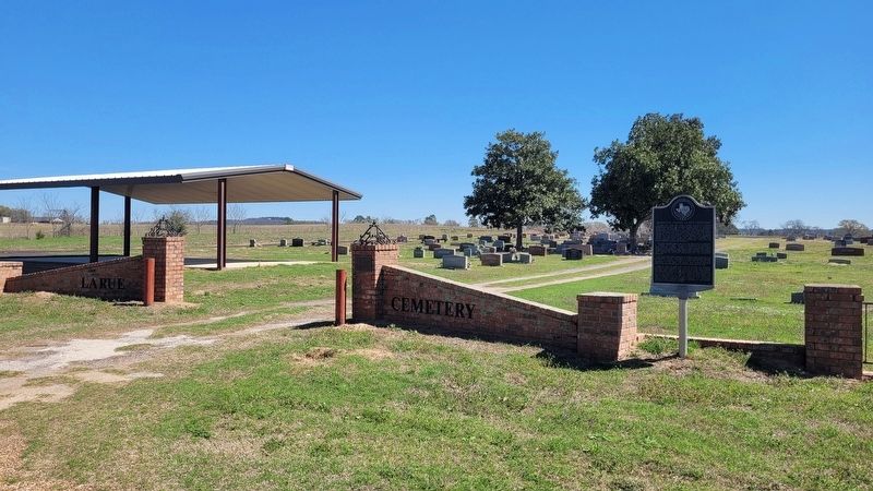
2. Morrison Chapel/La Rue Cemetery and Marker
Credits. This page was last revised on March 30, 2025. It was originally submitted on March 29, 2025, by James Hulse of Medina, Texas. This page has been viewed 218 times since then and 77 times this year. Photos: 1, 2. submitted on March 30, 2025, by James Hulse of Medina, Texas.
