Redding in Western Region, Connecticut — The American Northeast (New England)
Lake McDougall
| — | Putnam Memorial State Park | — |
Photographed by Michael Herrick, January 20, 2010
1. Lake McDougall Marker
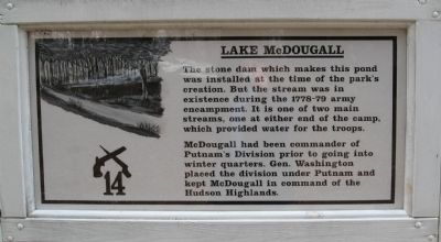
The stone dam which makes this pond was installed at the time of the park’s creation. But the stream was in existence during the 1778-79 army encampment. It is one of two main streams, one at either end of the camp, which provided water for the troops.
McDougall had been commander of Putnam’s Division prior to going into winter quarters. Gen. Washington placed the division under Putnam and kept McDougall in command of the Hudson Highlands.
Erected 2009 by Friends & Neighbors of Putnam Park. (Marker Number 14.)
Topics and series. This historical marker is listed in these topic lists: War, US Revolutionary • Waterways & Vessels. In addition, it is included in the Former U.S. Presidents: #01 George Washington series list.
Location. 41° 20.306′ N, 73° 22.972′ W. Marker is in Redding in Western Region, Connecticut. It can be reached from the intersection of Putnam Park Road (Connecticut Route 58) and Route 107, on the right when traveling south. Located in Putnam Memorial State Park. Touch for map. Marker is in this post office area: Redding CT 06896, United
this page online

Regionally, this marker is on the Connecticut Shoreline and in Greater Bridgeport. It is also in the American Northeast and in New England. Globally, it is in North America, the Western Hemisphere, the Western World, and the Anglosphere. Historically, it finds itself in what was once Fairfield County and also one of the original Thirteen Colonies.
Other nearby markers. At least 8 other markers are within walking distance of this marker: Memorial Monument (within shouting distance of this marker); Company Street (Fireback Row) (about 300 feet away, measured in a direct line); Putnam Memorial State Park (about 300 feet away); Cemetery/Command Officer’s Quarters (about 300 feet away); Camp Guardhouse (about 400 feet away); “Putnam’s Escape from Horseneck” (about 400 feet away); Visitor Center (1893 Pavilion) (about 400 feet away); Israel Putnam (about 400 feet away). Touch for a list and map of all markers in Redding.
Photographed by Michael Herrick, January 20, 2010
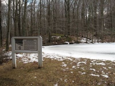
2. Lake McDougall and Marker
The dam is behind the marker
Photographed by Michael Herrick, January 20, 2010
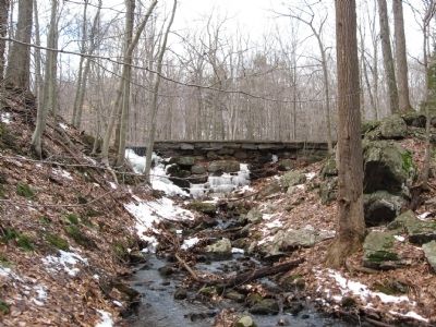
3. Downstream View of the Dam That Forms Lake McDougall
The stream flows into Lake Putnam, across Putnam Park Road, in the recreation side of the park.
Credits. This page was last revised on May 19, 2026. It was originally submitted on January 26, 2010, by Michael Herrick of Southbury, Connecticut. This page has been viewed 1,338 times since then and 28 times this year. Photos: 1, 2, 3. submitted on January 26, 2010, by Michael Herrick of Southbury, Connecticut. • Bill Pfingsten was the editor who published this page.
