Pilot Point in Denton County, Texas — The American South (West South Central)
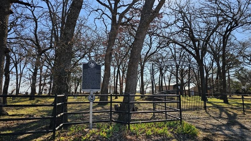
Skinner Cemetery

Photographed by Joe Lotz, March 2, 2025
1. Skinner Cemetery Marker
Predominantly of Anglo-Saxon Protestant descent, most of those buried here came from Kentucky, Virginia, Missouri, Arkansas, and Tennessee. Many were farmers or ranchers. Significant graves include that of J.D. Merchant, Sr., a local businessman who built the first brick building in the area. Also here are several victims of yellow fever, including Prissie and Sarah Wilson, sisters who died within 2 months of one another during the epidemic of 1872 and 1873. Two people named James Graham, born on the same date two years apart, died on the same September day in 1867.
Lucinda Skinner, the last charter member of the Pilot Point First Baptist Church, died in 1890. By 1900, there were probably 200 graves in the cemetery. The land was sold by John Skinner to the Skinner Cemetery Association in 1905; the last recorded burial was that of Joe Mylo Phipps, an infant who died in 1928. The Skinner Cemetery remains a vital link to the early settlers of the Pilot Point community.
Erected 1997 by Texas Historical Commission. (Marker Number 11847.)
Topics. This historical marker is listed in these topic lists: Cemeteries & Burial Sites • Settlements & Settlers. A significant historical month for this entry is March 1858.
Location. 33° 23.224′ N, 96° 56.982′ W. Marker is in Pilot Point, Texas, in Denton County. It is on Debbie Lane 0.1 miles south of U.S. 377, on the left when traveling south. Touch for map. Marker is at or near this postal address: 957 Debbie Ln, Pilot Point TX 76258, United States of America. Touch for directions.

Regionally, this marker
this page online
Other nearby markers. At least 8 other markers are within 6 miles of this marker, measured as the crow flies: Pilot Point Church of Christ (approx. ¾ mile away); County Line Baptist Church (approx. 0.8 miles away); Pilot Point Post-Signal (approx. 0.9 miles away); City of Pilot Point (approx. 0.9 miles away); St. Thomas Aquinas Catholic Church (approx. 1.3 miles away); Belew Cemetery (approx. 3.4 miles away); Wilson Cemetery (approx. 5.3 miles away); Primitive Baptist Church of Tioga (approx. 5.8 miles away). Touch for a list and map of all markers in Pilot Point.

Photographed by Joe Lotz, March 2, 2025
2. Image of marker subject
Photographed by Joe Lotz, March 2, 2025
3. Skinner Cemetery Marker
Credits. This page was last revised on March 30, 2025. It was originally submitted on March 29, 2025, by Joe Lotz of Flower Mound, Texas. This page has been viewed 186 times since then and 50 times this year. Photos: 1, 2, 3. submitted on March 29, 2025, by Joe Lotz of Flower Mound, Texas. • James Hulse was the editor who published this page.
