Near Sharpsburg in Washington County, Maryland — The American Northeast (Mid-Atlantic)
Grove Farm
A Visit from Abe Lincoln
| — | Antietam Campaign 1862 | — |
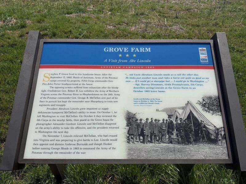
Stephen P. Grove lived in this handsome house. After the September 17, 1862, Battle of Antietam, Army of the Potomac camps covered this property. Fifth Corps commander Gen. Fitz-John Porter headquartered at the house.
The opposing armies suffered from exhaustion after the bloody fight. Confederate Gen. Robert E. Lee withdrew the Army of Northern Virginia across the Potomac River to Shepherdstown on the 18th. Arm of the Potomac commander Gen. George B. McClellan sent part of his force in pursuit but kept the remainder near Sharpsburg to train new regiments and resupply.
President Abraham Lincoln grew impatient as supply deficiencies hampered McClellan's ability to move. On October 1, he left Washington to visit McClellan. On October 3 they reviewed the 5th Corps in the nearby fields, then posed at the Grove house for photographer Alexander Gardner. Lincoln and McClellan disagreed on the army's ability to take the offensive, and the president returned to Washington the next day.
On November 7, Lincoln relieved McClellan, who had crossed into Virginia and was preparing to give battle to Lee. Lincoln would then appoint
this page online
"… old Uncle Abraham Lincoln made us a call the other day. He looks just another man and rides a horse not quite as good as my own .... If I could get a stovepipe hat … I could go to Washington ...."
— Sgt. Harvey Dinsmore, 134th Pennsylvania, 5th Corps, describes seeing Lincoln at the Grove Farm in October 1862 letter home.
Topics and series. This historical marker is listed in this topic list: War, US Civil. In addition, it is included in the Maryland Civil War Trails series list. A significant historical date for this entry is September 17, 1862.
Location. 39° 26.933′ N, 77° 46.281′ W. Marker is near Sharpsburg, Maryland, in Washington County. It is on Shepherdstown Pike (Maryland Route 34) 0.6 miles south of Ranch Lane, on the right when traveling north. Touch for map. Marker is at or near this postal address: 17173 Shepherdstown Pike, Sharpsburg MD 21782, United States of America. Touch for directions.

Regionally, this marker is in Western Maryland. It is also in the American Mid-Atlantic,
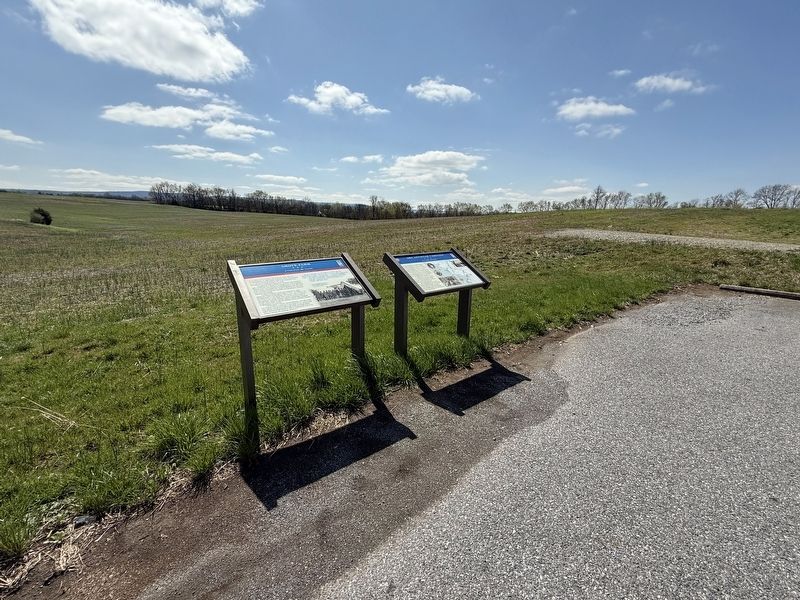
Other nearby markers. At least 8 other markers are within 2 miles of this marker, measured as the crow flies: 1862 Antietam Campaign (here, next to this marker); Battle of Antietam (approx. 0.2 miles away); a different marker also named Antietam Station (approx. ¼ mile away); The Civil War Veterans Walkway To Glory At Antietam (approx. 0.3 miles away); Headquarters Site Gen. R.E. Lee (approx. ¾ mile away); Jacob Highbarger House (approx. 1.2 miles away); First Methodist Cemetery (approx. 1.2 miles away); Packhorse Ford (approx. 1.3 miles away). Touch for a list and map of all markers in Sharpsburg.
Other markers no longer nearby. Grove Farm (was within shouting distance of this marker but has been replaced with another marker now near it); Antietam Station (was approx. ¼ mile away but has been replaced with another marker now near it).
Related marker. Click here for another marker that is related to this marker. this marker has replaced the linked marker.
Credits. This page was last revised on April 1, 2025. It was originally submitted on April 1, 2025, by Devry Becker Jones of Washington, District of Columbia. This page has been viewed 212 times since then and 46 times this year. Photos: 1, 2. submitted on April 1, 2025, by Devry Becker Jones of Washington, District of Columbia.
