St. George on Staten Island in Richmond County, New York — The American Northeast (Mid-Atlantic)
U.S. Lighthouse Service General Depot

Photographed by Larry Gertner, September 30, 2024
1. U.S. Lighthouse Service General Depot wayside
OIL VAULTS
Constructed in 1864
National Register of Historic Places
Six masonry vaults were constructed to hold the lard, sperm, and mineral oils that were used to illuminate lighthouses before electrification. Experimental studies on fuels conducted here at the Depot benefitted lighthouse operations throughout the country. The small brick building between the Vaults and the Barracks was once a laboratory (shown on the map as Building 5). Its separate location suggests safety considerations.
Five of the six vaults are 51 feet long, 21 feet wide and over 13 feet tall. The sixth vault is about half that size. Brick arches for the ceilings of the vaults, and the massive brownstone wall containing the iron vault doors is more than two feet thick. Earth fill and vegetation cover the roof of the vaults, which, at the turn of the last century, was covered with grass and was one of the first tennis courts in the United States.
BARRACKS
Built 1864 – or earlier
National Register of Historic Places
Constructed as a warehouse, this building is not only the oldest on the site but may even predate the depot. It has a gabled roof
this page online
Erected by National Lighthouse Museum.
Topics and series. This historical marker is listed in this topic list: Waterways & Vessels. In addition, it is included in the Lighthouses series list. A significant historical year for this entry is 1864.
Location. 40° 38.496′ N, 74° 4.444′ W. Marker is on Staten Island, New York, in Richmond County. It is in St. George. It is on an unnamed street east of Bay Street, on the right when traveling south. Touch for map. Marker is at or near
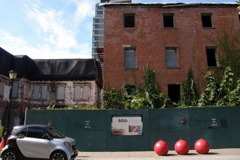
Photographed by Larry Gertner, September 30, 2024
2. U.S. Lighthouse Service General Depot wayside site
Building 6 to the right

Regionally, this marker is in New York City. It is also in the American Northeast, in the Mid-Atlantic, and on the Eastern Seaboard. Globally, it is in the North Atlantic Region, North America, the Western Hemisphere, the Western World, and the Anglosphere. Historically, it finds itself in what was once New Netherland and also one of the original Thirteen Colonies.
Other nearby markers. At least 8 other markers are within walking distance of this marker: A different marker also named U.S. Lighthouse Service General Depot (a few steps from this marker); a different marker also named U.S. Lighthouse Service General Depot (a few steps from this marker); a different marker also named U.S. Lighthouse Service General Depot (within shouting distance of this marker); a different marker also named U.S. Lighthouse Service General Depot (within shouting distance of this marker); HRH The Princess Royal Visit (about 300 feet away); United States Merchant Memorial (about 500 feet away); Memorial to Clarence T. Barrett
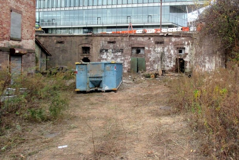
Photographed by Larry Gertner, November 15, 2024
3. The oil vaults
Recently made visible
Other markers no longer nearby. The Barracks (was a few steps from this marker but has been permanently removed); The Administration Building (was within shouting distance of this marker but has been permanently removed); National Lighthouse Museum (was within shouting distance of this marker but has been permanently removed); The 1907 Lamp Shop (was about 300 feet away, measured in a direct line but has been permanently removed); Maritime New York (was about 300 feet away but has been permanently removed).
Also see . . . National Lighthouse Museum (New York City). Wikipedia entry (Submitted on April 3, 2025, by Larry Gertner of New York, New York.)
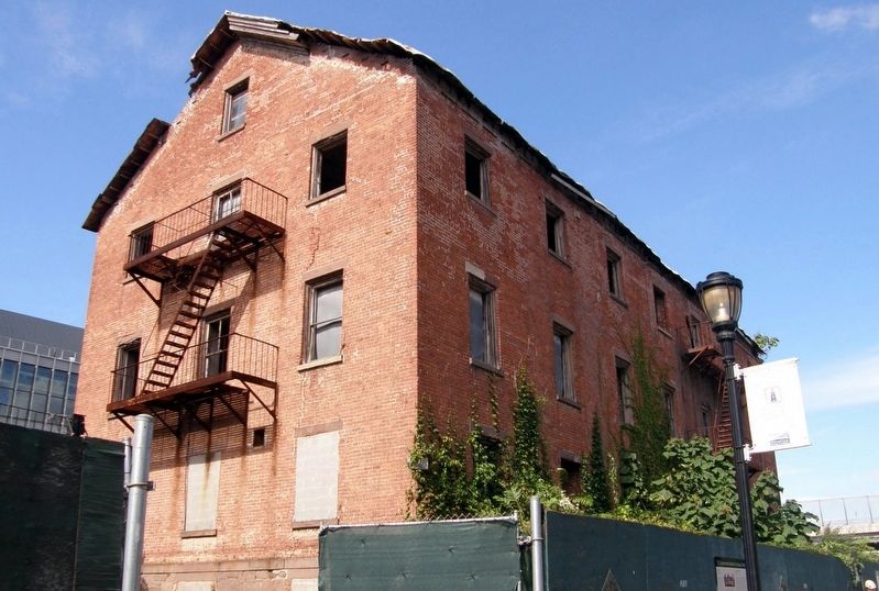
Photographed by Larry Gertner, September 30, 2024
4. Building 6 - Barracks
Credits. This page was last revised on April 3, 2025. It was originally submitted on April 3, 2025, by Larry Gertner of New York, New York. This page has been viewed 152 times since then and 26 times this year. Photos: 1, 2, 3, 4. submitted on April 3, 2025, by Larry Gertner of New York, New York.
