Panmure Head Lighthouse
Heritage Lighthouse
⎯⎯⎯
phare de Panmure Head
Phare Patrimonial
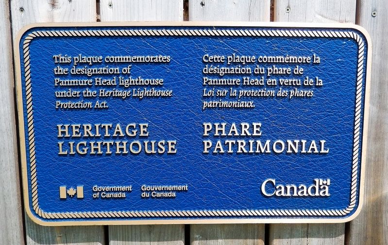

Erected by Government of Canada / Gouvernement du Canada.
Topics and series. This historical marker is listed in these topic lists: Architecture • Notable Buildings • Waterways & Vessels. In addition, it is included in the Canada, Historic Sites and Monuments Board, and the Lighthouses series lists.
Location. 46° 8.66′ N, 62° 27.993′ W. Marker is in Montague, Prince Edward Island, in Kings County. It can be reached from Lighthouse Road 0.2 kilometers north of Chemin Panmure Island (Prince Edward Island Route 347), on the right when traveling north. The marker is mounted on the railing on the west side of the lighthouse. Touch for map. Marker is at or near this postal address: 67 Lighthouse Road, Montague PE C0A 1R0, Canada. Touch for directions.

Regionally, this marker is in Points East Coastal P. E.
this page online
Other nearby markers. At least 8 other markers are within 16 kilometers of this marker, measured as the crow flies: Georgetown War Memorial (approx. 6.7 kilometers away); The Honorable Andrew Archibald (A.A.) Macdonald (approx. 6.7 kilometers away); Georgetown’s New Railway Station / Nouvelle gare ferroviaire de Georgetown (approx. 6.9 kilometers away); Three Rivers (approx. 6.9 kilometers away); Cape Bear (approx. 15.7 kilometers away); The “Harbour” / Le « Harbour » (approx. 16.1 kilometers away); Cape Bear Lighthouse / Phare de Cape Bear (approx. 16.2 kilometers away); The Fishery at Murray Harbour / La Pêche À Murray Harbour (approx. 16.2 kilometers away).
Regarding Panmure Head Lighthouse / phare de Panmure Head. Designated under the Canadian Heritage Lighthouse Protection Act (2015-02-12). From the Federal Designation:
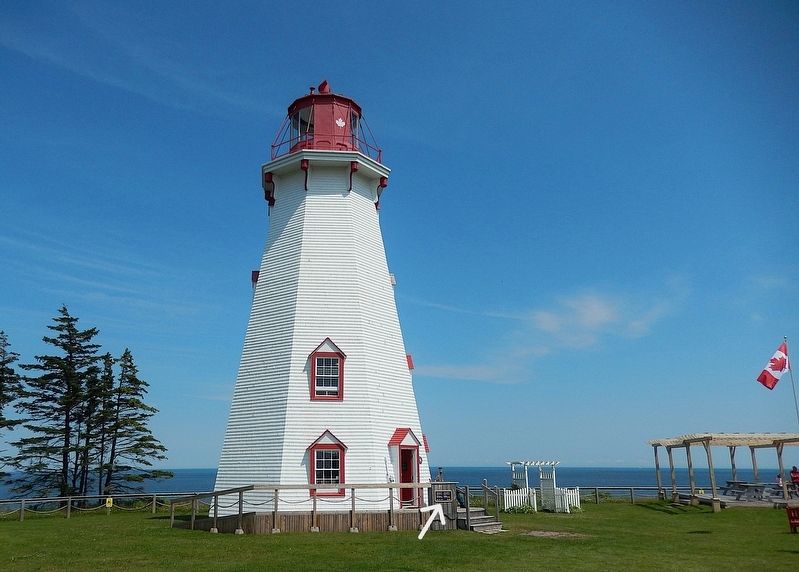
The PanmureHead Lighthouse is exceptionally well built and over the years has required no major repairs, a tribute to its good craftsmanship and materials. The excellent functional design of its structure is reflected in its heavy timber-frame construction on a stone foundation. The Panmure Head Lighthouse establishes the picturesque maritime character of the region, fitting comfortably in its surrounding marine and agricultural environment. As the tallest built structure visible from the water, it exhibits a certain domestic charm. The lighthouse is well known to local residents and visitors, as it still serves its original purpose as a navigational aid for recreational, fishing, and commercial traffic.Photographed by Cosmos Mariner, July 16, 20192. Panmure Head LighthouseThe marker is near the lighthouse entrance.The following character-defining elements of the Panmure Head Lighthouse should be respected: its location at the north end of a sandy beach on Panmure Island; its intact, as-built structural form, height, profile, and balanced proportions based on the standard design of octagonal, tapered, wooden towers; its octagonal cast-iron lantern; its platform supported by scrolled brackets and surrounded by a metal railing; its tall octagonal wood-frame
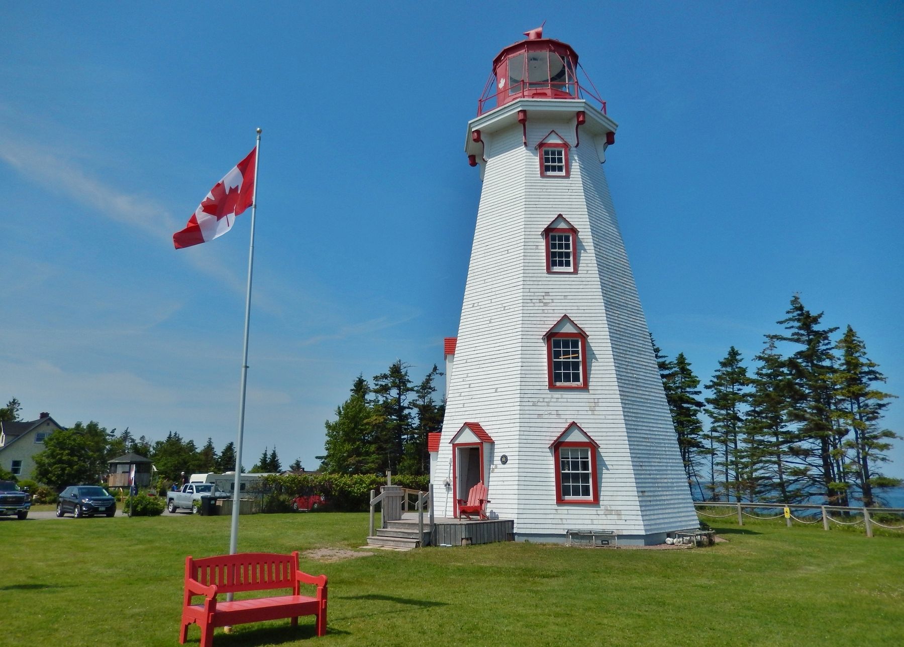
tower with tapered sides and a corbelled cornice; its six-over-six multi-paned windows; its sole entry doorway with red asphalt shingles pediment; its exterior walls covered with shingles; its simple interior layout with wooden ladder-type stairs; its traditional red and white exterior colour scheme, consisting of a white tower and gallery, with red features such as the trim of the door and windows, the railing of the gallery, the lantern, and the roof; and, its visual prominence in relation to the water and landscape.Photographed by Cosmos Mariner, July 16, 20193. Panmure Head Lighthouse (southeast elevation)
Also see . . .
1. Panmure Head Lighthouse (Parks Canada).
Excerpt: The Panmure Head Lighthouse is a 58 foot octagonal, tapered, wooden tower surmounted by a twelve-sided, cast-iron lantern. It is located at the north end of a sandy beach on Panmure Island and marks the entrance to Georgetown Harbour on the east coast of Prince Edward Island.(Submitted on April 4, 2025, by Cosmos Mariner of Cape Canaveral, Florida.)The Panmure Head Lighthouse is an excellent example of the development of marine aids to navigation along Canada’s coastal and inland waterways. Constructed in 1853, it was the second lighthouse built in Prince Edward Island. The lighthouse guides ships into Georgetown
Harbour and keeps them clear of the dangerous Bear Reef to the south.The Panmure Head Lighthouse is an excellent example of the socio-economic development of the nearby coastal communities of Georgetown and Montague, which were shipbuilding and commercial centres. The lighthouse supported fishing boats, steamers, and schooners serving these communities and the surrounding region. It also serves cruise ships heading towards the St. Lawrence, oil tankers servicing P.E.I. ports like Charlottetown, lobster and other fishing boats, as well as recreational traffic in the local area known as Three Rivers.
2. Panmure Head Lighthouse (Lighthousefriends.com).
Excerpt: A petition by several inhabitants of King’s County was presented to the House of Assembly of Prince Edward Island in 1849 noting the large number of vessels that frequented Georgetown Harbour and the great risk and loss to such shipping caused by the absence of a lighthouse near Georgetown. After a similar petition was presented to the House of Assembly the following two years, a special committee recommended that the Lieutenant Governor procure the requisite plans and estimates in 1851. The Lieutenant Governor requested that Captain Henry W. Bayfield, who was surveying the Gulf of St. Lawrence, give his opinion on the best location for a lighthouse near Georgetown. Captain Bayfield’s response included the following: “A light properly placed on Panmure Point, the north east extremity of Panmure Island, would answer the double purpose of leading into the Harbour of Georgetown, and of guiding vessels clear of the dangerous Bear Reef; whilst its disappearance behind Boughton Island would, in like manner, be a guide to vessels all along the coast, far up towards the East Point; it would thus be far more useful as a Coast Light than it would be if placed on Boughton Island.”(Submitted on April 4, 2025, by Cosmos Mariner of Cape Canaveral, Florida.)
Credits. This page was last revised on September 21, 2026. It was originally submitted on April 3, 2025, by Cosmos Mariner of Cape Canaveral, Florida. This page has been viewed 144 times since then and 33 times this year. Photos: 1, 2, 3. submitted on April 4, 2025, by Cosmos Mariner of Cape Canaveral, Florida.
