Dorion in Vaudreuil-Dorion in Montérégie, Québec — Central Canada (French-Canadian)
Place Dumont, mon histoire...
⎯⎯⎯
Dumont Plaza, my history...
Photographed by Cosmos Mariner, August 9, 2019
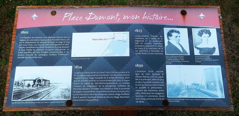
1. Place Dumont, mon histoire... Marker

1800
L’occupation du territoire s'est effectuée d'abord dans la logique de colonisation typique de la Nouvelle-France, soit par le déploiement du système de côtes et rangs le long des cours d'eau. Les avenues Saint-Jean-Baptiste et Saint-Charles constituent les tracés fondateurs le long desquels se sont établis les premiers occupants permanents. La trame parallèle des lots d'origine, perpendiculaire à ces anciens chemins de campagne, explique l'orientation actuelle des lots et des rues.
1823
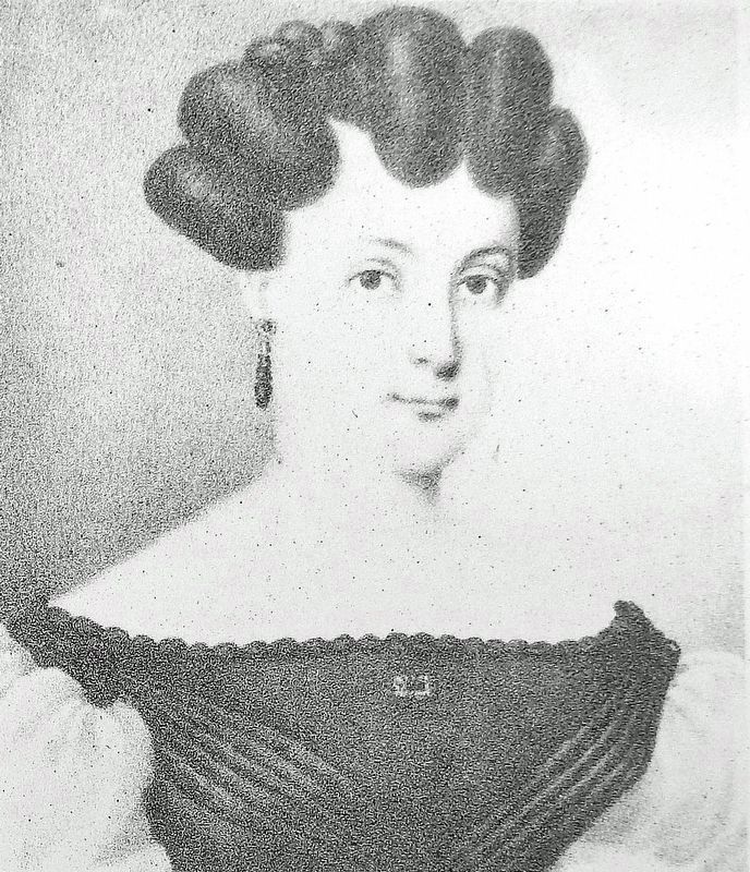
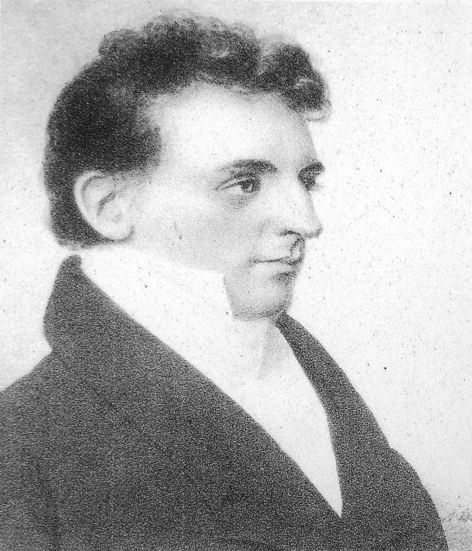
Louise-Josephte Chartier de Lotbinière, qui a hérité de la seigneurie un an auparavant (elle en prendra cependant possession seulement en 1829), se marie à un marchand de la rue Saint-Paul à Montréal, un certain Robert Unwin Harwood.
1854
La ligne du chemin de fer du Grand Tronc (CN) est ouverte et la fin du-régime seigneurial est proclamée. Ces deux événements transforment le visage tranquille de la petite péninsule. Alors que les activités urbaines se concentraient jadis dans le noyau autour de l'église de Saint-Michel-de-Vaudreuil, un nombre croissant de villégiateurs de la bourgeoisie d'affaires de Montréal décident
this page online
1890
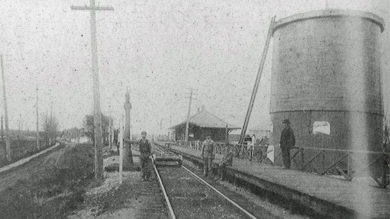
L'ouverture d'une seconde ligne de train, Montréal & Ottawa Railway (CP) Co., parallèle à la première, attire de plus en plus d’activités urbaines vers le sud de l’avenue Saint-Charles et amplifie le phénomène : maisons des cheminots, entrepôts, hôtels pour les voyageurs, tavernes et commerces divers sont chose commune à la fin du 19e siècle.
[légendes d'images]
• Occupation du terriroire en 1800.
• Gare du Grand Tronc, démolie dans les années 1970.
1800
The occupation of the territory was initially carried out in the logic of colonization typical of New France, that is, by the deployment of the system of hills and ranges along the waterways. Saint-Jean-Baptiste and Saint-Charles avenues constitute the founding routes along which the first permanent occupants settled. The parallel grid of the original lots, perpendicular to these old country roads,
Centre d'archives de Vaudreuil-Soulanges
2. Marker detail: Louise-Josephte Chartier de Lotbinière (1803-1869)
1823
Louise-Josephte Chartier de Lotbinière, who had inherited the seigneury a year earlier (she would, however, only take possession of it in 1829), married a merchant from Saint-Paul Street in Montreal, a certain Robert Unwin Harwood.
1854
The Grand Trunk Railway (CN) line is opened and the end of the seigneurial regime is proclaimed. These two events transform the peaceful face of the small peninsula. While urban activities were once concentrated in the core around the church of Saint-Michel-de-Vaudreuil, a growing number of vacationers from Montreal's business bourgeoisie decided to establish their summer residences near the train station. The first buildings were located nearby, on the banks of the Ottawa River, in Sheffield Village, in the Vaudreuil Station district, and in Mannheim Village (today's Old Dorion).
1890
The opening of a second train line, the Montreal & Ottawa Railway (CP) Co., parallel to the first, attracted more and more urban activity south of Saint-Charles Avenue and amplified the phenomenon: railway workers' houses, warehouses, hotels for travelers, taverns
Centre d'archives de Vaudreuil-Soulanges
3. Marker detail: Robert Unwin Harwood
Né en Angleterre, en 1798, et décédé au château Vaudreuil, en 1863. • • • Born in England in 1798, and died at Château Vaudreuil in 1863.
[image captions]
• Extent of the territory in 1800.
• Grand Trunk Station, demolished in the 1970s.
Topics. This historical marker is listed in these topic lists: Colonial Era • Industry & Commerce • Railroads & Streetcars • Settlements & Settlers. A significant historical year for this entry is 1800.
Location. 45° 23.052′ N, 74° 0.613′ W. Marker is in Vaudreuil-Dorion, Québec, in Montérégie. It is in Dorion. It is at the intersection of Avenue Saint-Charles and Harwood Boulevard (Autoroute 20), on the right when traveling south on Avenue Saint-Charles. The marker is located in Dumont Plaza, at the northwest corner of the intersection. Touch for map. Marker is in this post office area: Vaudreuil-Dorion QC J7V 1W9, Canada. Touch for directions.

Regionally, this marker is in Greater Montréal. It is also in Central Canada. Globally, it is in North America, the Western Hemisphere, and the Western World. Historically, it finds itself in what was once a British colony, the Viceroyalty of New France, the Haudenosaunee (Iroquois) Confederacy,
Centre d'archives de Vaudreuil-Soulanges
4. Marker detail: Gare du CP, aujourd’hui AMT-Dorion
CP station, today AMT-Dorion
CP station, today AMT-Dorion
Other nearby markers. At least 8 other markers are within 16 kilometers of this marker, measured as the crow flies: A different marker also named Place Dumont, mon histoire... / Dumont Plaza, my history... (here, next to this marker); a different marker also named Place Dumont, mon histoire... / Dumont Plaza, my history... (a few steps from this marker); a different marker also named Place Dumont, mon histoire... / Dumont Plaza, my history... (a few steps from this marker); a different marker also named Place Dumont, mon histoire... / Dumont Plaza, my history... (a few steps from this marker); 75e anniversaire / 75th Anniversary (about 90 meters away, measured in a direct line); Pierre de Rigaud, 1698-1778 (approx. 2 kilometers away); Round Stone Windmill and House (approx. 12.5 kilometers away); Thomas Bassett Macaulay (approx. 15.1 kilometers away). Touch for a list and map of all markers in Vaudreuil-Dorion.
Related markers. Click here for a list of markers that are related to this marker.
Also see . . .
1. Louisa (de Lotbinière) Harwood (1803-1869).
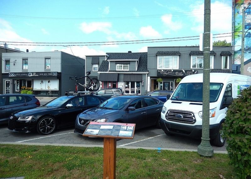
Excerpt: In 1829, she and her husband chose(Submitted on April 6, 2025, by Cosmos Mariner of Cape Canaveral, Florida.)to inherit the Seigneury of Vaudreuil (48,821-acres), which although the smallest of her father's seigneuries, it was also the most valuable. 25,052-acres of Vaudreuil's land was cultivated for arable crops and farmed by censitaires. The seigneury also included her family's manor house, a domaine near the church (built by her grandfather and still closely associated with the de Lotbiniere-Harwood family today), a mill, and several hay-producing islands on the river. When the old Seigneurial system of New France was abolished in 1854, the 48,821-acre Manor of Vaudreuil was subdivided and sold for over $1 million which was divided between the Harwood's 10-children.Photographed by Cosmos Mariner, August 9, 20195. Place Dumont, mon histoire... MarkerLooking north; Rue Dumont is in the background.
2. Robert Unwin Harwood (1798-1863).
Excerpt: He came to Montreal in 1821 representing William Harwood & Sons, his family's wholesale silver and hardware business in Sheffield that exported to Jamaica, Bermuda, Baltimore and Lower Canada. In 1823, he married Louise-Josephte de Lotbiniere, Seigneuresse de Vaudreuil, and thereby became the Seigneur of Vaudreuil. He was an effective and entrepreneurial seigneur and was well-liked by his censitaires.(Submitted on April 6, 2025, by Cosmos Mariner of Cape Canaveral, Florida.)
Credits. This page was last revised on June 14, 2025. It was originally submitted on April 3, 2025, by Cosmos Mariner of Cape Canaveral, Florida. This page has been viewed 103 times since then and 16 times this year. Photos: 1. submitted on April 5, 2025, by Cosmos Mariner of Cape Canaveral, Florida. 2, 3, 4, 5. submitted on April 6, 2025, by Cosmos Mariner of Cape Canaveral, Florida.
