Mid-City Industrial in Minneapolis in Hennepin County, Minnesota — The American Midwest (Upper Plains)
About Mid-City Industrial Area
| — | Minneapolis Diagonal Trail | — |
Photographed by McGhiever, June 7, 2024
1. About Mid-City Industrial Area Marker
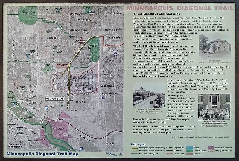
Stinson Boulevard was the first parkway created in Minneapolis. In 1885 James Stinson donated land, from Division Street (now East Hennepin Avenue) to East Broadway Street, for the parkway. At the time, Stinson Boulevard marked the east edge of Minneapolis and sat in undeveloped countryside. Areas on the bluff to the east, near Lauderdale, were platted for residential development. In 1907 Columbus School was built at Hoover and Winter Streets NE to serve the potential residential population there and in the east Como neighborhood.
The Mid-City Industrial Area (north of you) that extends from East Hennepin Avenue to New Brighton Boulevard, and from three blocks west of Stinson Boulevard to the city limits at 33rd Avenue, was designated as the Minneapolis Industrial Area in 1913, when Minneapolis began to limit land uses to restricted residential or industrial areas. Prior to 1913 this had been open land used for farming. The consortium of railroads called the Minnesota Transfer Railway laid track along Traffic St. NE, parallel to East Hennepin Ave., with spurs to future industrial plants and warehouses.
It was only
this page online
Nicollet-Stinson streetcars turned up Stinson from East Heppenin Ave. taking workers from all over the city to and from their jobs.
1922. Photo courtesy of Minneapolis Public Schools
Northwestern Terminal Building
Normal & Peel, 1935. Photo courtesy of the Minnesota Historical Society
Employees on the steps of the General Mills Research Laboratories
Norman & Peel, 1938. Photo courtesy of the Minnesota Historical Society
[reverse]
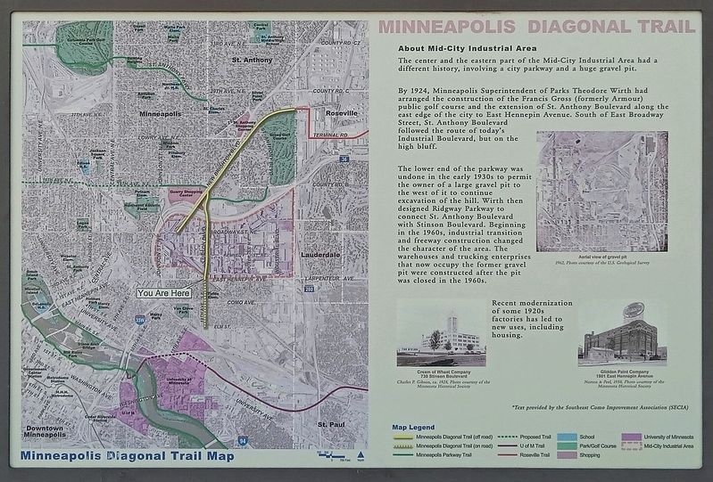
The center and the eastern part of the Mid-City Industrial Area had a different history, involving a city parkway and a huge gravel pit.
By 1924, Minneapolis Superintendent of Parks Theodore Wirth had arranged the construction of Francis Gross
Photographed by McGhiever, June 7, 2024
2. About Mid-City Industrial Area Marker Reverse
The lower end of the parkway was undone in the early 1930s to permit the owner of a large gravel pit to the west of it to continue excavation of the hill. Wirth then designed Ridgway Parkway to connect St. Anthony Boulevard with Stinson Boulevard. Beginning in the 1960s, industrial transition and freeway construction changed the character of the area. The warehouses and trucking enterprises that now occupy the former gravel pit were constructed after the pit was closed in the 1960s.
Recent modernization of some 1920s factories has led to new uses, including housing.
1962. Photo courtesy of the U.S. Geological Survey
Cream of Wheat Company
730 Stinson Boulevard
Charles P. Gibson, ca. 1928. Photo courtesy of the Minnesota Historical Society
Glidden Paint Company
1901 East Hennepin Avenue
Norton & Peel, 1958. Photo courtesy of the Minnesota Historical Society
*Text provided by the Southeast Como Improvement Association (SECIA)
Topics.
Photographed by McGhiever
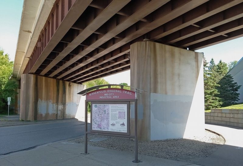
3. About Mid-City Industrial Area Marker at the northeast corner of Stinson and Hennepin
Location. 44° 59.495′ N, 93° 13.621′ W. Marker is in Minneapolis, Minnesota, in Hennepin County. It is in Mid-City Industrial. It is at the intersection of Stinson Boulevard NE and E. Hennepin Avenue, on the right when traveling north on Stinson Boulevard NE. Touch for map. Marker is at or near this postal address: 301 Stinson Boulevard NE, Minneapolis MN 55413, United States of America. Touch for directions.

Regionally, this marker is in the Twin Cities Metropolitan Area. It is also in the American Midwest, in the Corn Belt, and in the Great River Road Region. Globally, it is in North America, the Western Hemisphere, the Western World, and the Anglosphere. Historically, it finds itself in what was once Rupert’s Land, the territory of the Mississippian Culture, and the Louisiana Purchase.
Other nearby markers. At least 8 other markers are within one mile of this marker, measured as the crow flies: About Como Neighborhood (within shouting distance of this marker); Minneapolis Diagonal Trail (approx. 0.6 miles away); Northeast Park Neighborhood (approx. 0.9 miles away); Beltrami Park (approx. 0.9 miles away); Maple Hill Cemetery (approx. 0.9 miles away); The Quarry (approx. one mile away); Home of Alpha Phi (approx. one mile away); University of Minnesota Spanish-American War Memorial (approx. one mile away). Touch for a list and map of all markers in Minneapolis.
Credits. This page was last revised on April 4, 2025. It was originally submitted on April 4, 2025, by McGhiever of Minneapolis, Minnesota. This page has been viewed 472 times since then and 129 times this year. Photos: 1, 2, 3. submitted on April 4, 2025, by McGhiever of Minneapolis, Minnesota.
