Vieux-Québec-Cap-Blanc-colline Parlementaire in Capitale-Nationale, — Central Canada (French-Canadian)
Cove Fields
Photographed by Cosmos Mariner, August 3, 2019
1. Cove Fields Marker

Laboratoire de l’arsenal
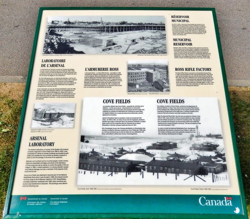
Le laboratoire de l'Arsenal, annexe de l'Arsenal de Québec, occupe une part importante des Cove Fields de 1884 à 1939. Il s'agit en fait d'une série de bâtiments en bois, entourés d'une palissade et isolés les uns des autres par des remparts de terre, afin de limiter les dégâts en cas d'explosion.
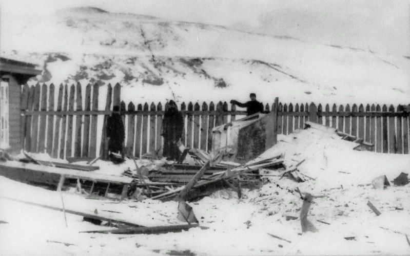
De 100 à 200 personnes, en majorité des femmes, y font le remplissage et l'assemblage de cartouches et d'obus. Pour s'assurer de la qualité des cartouches, un champ de tir est aménagé à proximité. En 1899, une violente explosion dans une chambre de séchage ne cause que des pertes matérielles mais rappelle la dangerosité du travail et du site.
Avec la formation du parc des Champs-de-Bataille à partir de 1908, les Cove Fields sont destinés à devenir une composante de ce parc. En 1912, l'Arsenal déménage son champ de tir dans la paroisse de Saint-Sauveur. La fabrication de cartouches se poursuit malgré tout jusqu'en 1938 alors que la production de munitions est transférée à Valcartier. L'année suivante les bâtiments sont démolis.
L'Armurerie Ross
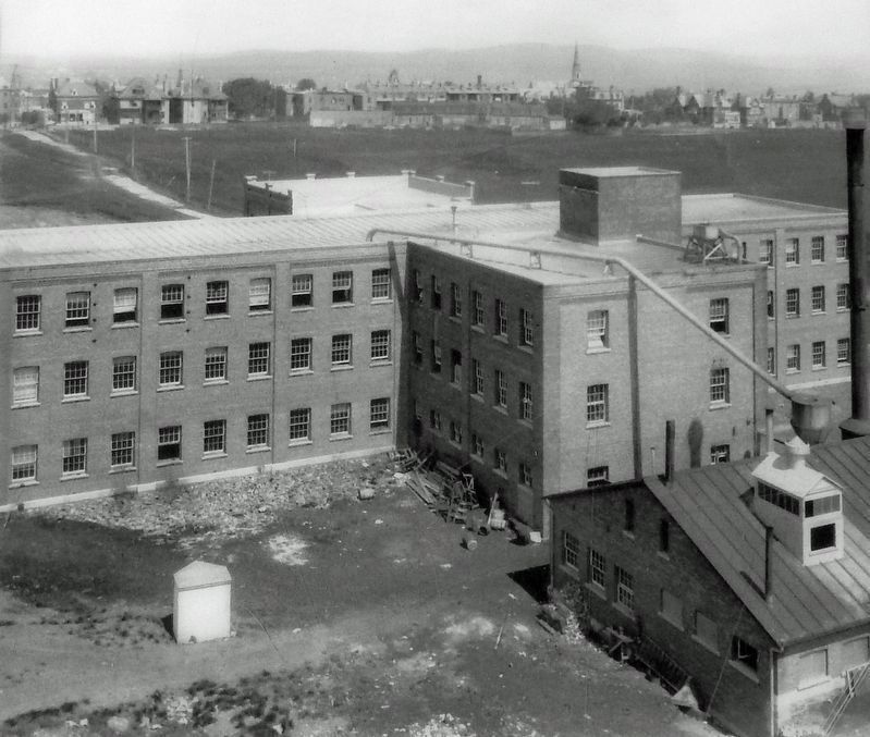
L'Armurerie Ross — ou Ross Rifle Factory —
this page online
Réservoir municipal
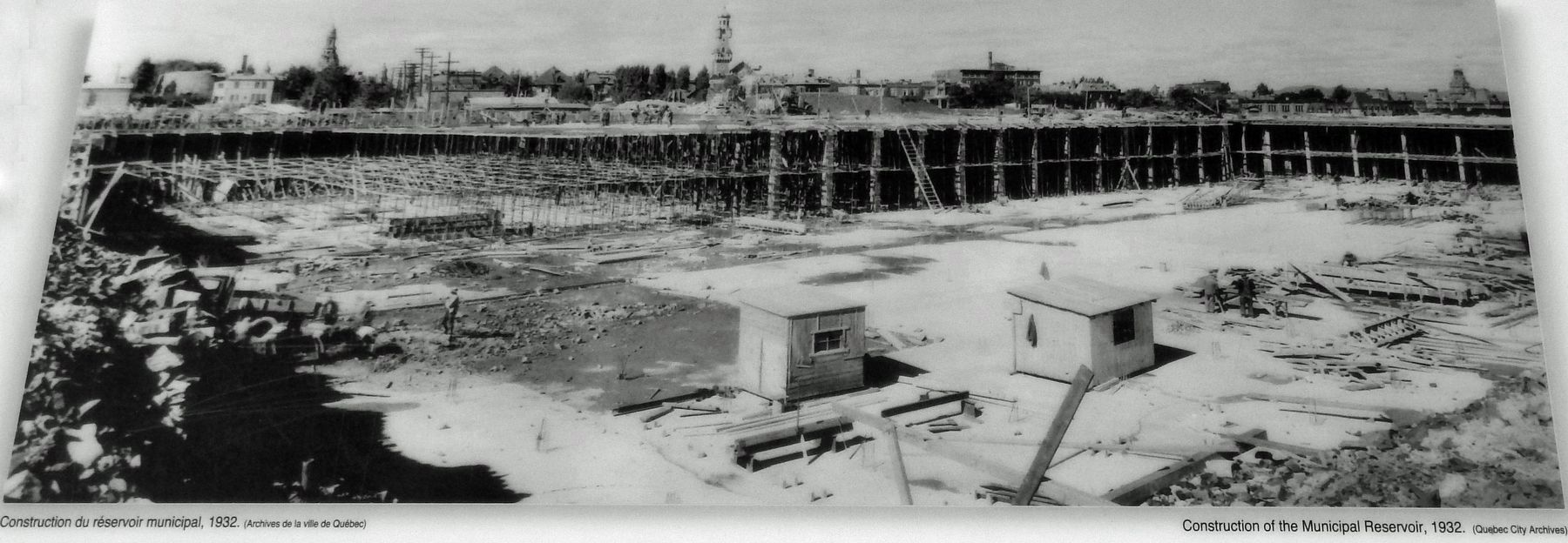
De 1931 à 1933, un réservoir d'eau potable est construit à l'extrémité ouest des Cove Fields. En plus d'améliorer le système d'aqueduc et la protection des incendies, le projet s'inscrit dans le cadre de vastes chantiers entrepris par les gouvernements pour fournir du travail aux nombreux chômeurs frappés par la crise économique des années 1930. Situé sur un des points les plus élevés de Québec, le réservoir souterrain contient 130 000 mètres cubes d'eau. Il approvisionne, encore aujourd'hui, un secteur de la Basse-Ville.
Cove Fields
La vocation militaire
Bibliothèque et Archives Canada
2. Marker detail: Explosion in 1899
Après la Deuxième Guerre mondiale, le site est occupé par des civils : de 1945 à 1951, en raison d'une crise du logement, plusieurs familles sans logis s'entassent dans les baraques militaires. La population croit et la vie s'organise dans le Faubourg de la misère. Relocalisé, le dernier occupant quitte les lieux en 1951.
Afin d'aménager le parc des Champs-de-Bataille. la Commission des champs de bataille nationaux acquiert les Cove Fields dès 1928 mais ce n'est que lentement que le site est libéré de tous bâtiments militaires, permettant le début des travaux d'aménagement.
Arsenal Laboratory
The Arsenal Laboratory, an annex of the Quebec City Arsenal, covered a large part of Cove Fields from 1884 to 1939. It was composed of a series of wooden buildings surrounded by palisades and isolated
Bibliothèque et Archives Canada
3. Marker detail: Armurerie Ross / Ross Rifle Factory
Between one hundred and two hundred people, mostly women, filled and assembled cartridges and shells at the laboratory. A firing range was set up nearby to control the quality of the cartridges. In 1899, a violent explosion in a drying chamber caused only material damage, but was a reminder of the hazards of the work and the site.
Since Cove Fields was destined to become part of the National Battlefields Park when it was formed in 1908, the Arsenal moved its firing range to the St Sauveur district in 1912. Nevertheless, cartridge production continued until 1938, when munitions production was transferred to Valcartier. The buildings were demolished the following year.
Ross Rifle Factory
The Ross Rifle Factory was built by industrialist Charles Ross in 1902, and thousands of rifles were produced there. They were used by the Canadian army up until the start of the First World War, when they were withdrawn from service because they were unreliable. In 1917, the government expropriated the factory and rented the buildings to another manufacturer,
Archives de la ville de Québec
4. Marker detail: Construction du réservoir municipal, 1932
Construction of the Municipal Reservoir, 1932
Municipal Reservoir
Between 1931 and 1933, a drinking water reservoir was built at the far western end of Cove Fields. In addition to improving the waterworks system and firefighting operations, the project was one of the many infrastructure projects undertaken by governments to make work for the scores of unemployed affected by the Depression in the 1930s. Situated on one of the highest points in Quebec City, the underground reservoir contains 130,000 cubic metres of water and still supplies part of the Lower Town today.
Cove Fields
The military vocation of Cove Fields, owned by the Department of National Defence, is clear: they were home to the Ross Rifle Factory (in the background), military barracks (in the centre) and the Arsenal Laboratory (foreground) at the same time. A military hospital and a camp for German prisoners were also located on the site.
After the Second World War, the site was occupied by civilians: from 1945 to 1951, many families without
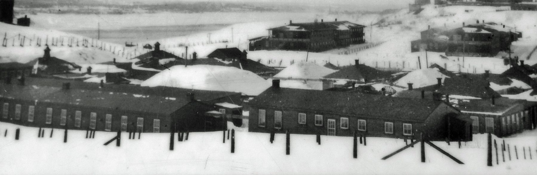
Archives de la Commission des champs de bataille nationaux, circa 1929
5. Marker detail: Cove Fields, hiver/winter 1929-1930
In order to build the National Battlefields Park, the National Battlefields Commission acquired Cove Fields in 1928, but the military buildings were only gradually cleared from the site, allowing redevelopment to begin.
Erected by Commission des champs de bataille nationaux / National Battlefield Commission.
Topics. This historical marker is listed in these topic lists: Charity & Public Work • Industry & Commerce • Parks & Recreational Areas • War, World II.
Location. 46° 48.415′ N, 71° 12.65′ W. Marker is in Québec, in Capitale-Nationale. It is in Vieux-Québec-Cap-Blanc-colline Parlementaire. It is on Avenue du Cap-Diamont just south of George VI Avenue, on the left when traveling south. The marker is located at the north end of Battlefields Park. Touch for map. Marker is at or near this postal address:
Photographed by Cosmos Mariner, August 3, 2019
6. Cove Fields Marker
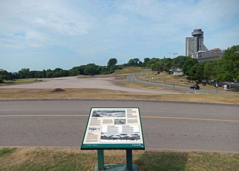
Looking southwest across Avenue du Cap-Diamont and Battlefields Park.

Regionally, this marker is in Central Canada. Globally, it is in North America, the Western Hemisphere, and the Western World. Historically, it finds itself in what was once a British colony, the Viceroyalty of New France, the Haudenosaunee (Iroquois) Confederacy, and Rupert’s Land.
Other nearby markers. At least 8 other markers are within walking distance of this marker: De la mer à la terre / From Sea to Land (about 150 meters away, measured in a direct line); Calibre: 10 cm Kanone 17 (about 210 meters away); Calibre: 10.5 cm Feldhaubitze 98/09 (about 210 meters away); In Memory of Our Fallen Soldiers (about 210 meters away); Calibre: 7.7 cm Feldkanone 16 (about 240 meters away); Souvenirs de Guerre / Memories of War (about 240 meters away); General Montgomery’s Army (about 240 meters away); Le Canada au Front / Canada at the Front (about 240 meters away). Touch for a list and map of all markers in Québec.
Credits. This page was last revised on April 8, 2025. It was originally submitted on April 5, 2025, by Cosmos Mariner of Cape Canaveral, Florida. This page has been viewed 278 times since then and 130 times this year. Photos: 1, 2, 3, 4, 5, 6. submitted on April 7, 2025, by Cosmos Mariner of Cape Canaveral, Florida.
