Stoneybatter in Dublin in County Dublin, Leinster, Ireland — Mid-East (and Dublin)
Congo
Niemba/Jadotville

Photographed by William Fischer, Jr., April 3, 2025
1. Congo Marker
UN Operations in the Congo/ July 1960 - June 1964
Number of Tours Served: 6191 / Casualties: 26
Why the Irish were there?
• The Congo achieved independence from Belgium in June 1960. Yet Belgium troops were ordered to intervene in the wake of a mutiny of the Force Publique, a paramilitary security force under Belgian command, as well as other civil disorder.
• The Congolese army mutinied and took over the province of Katanga and declared its independence.
• This caused a civil war in Katanga between the secessionists, under leader Moise Tshombe, and supporters of President Lumumba, mainly Baluba tribesmen.
• As a result, the Congo appealed to the UN to restore order in the country and maintain territorial integrity.
• In July 1960, Ireland activated the 32 Infantry Battalion - the first complete Irish unit to travel overseas - with 685 troops under Lt Col MJ Buckley. They were joined by the 33 Infantry Battalion in August, bringing the total number of Irish troops in the region to over 1000.
• The troops' priorities were the restoration of essential services, the reassurance of the local population, the supervision of local trade and the operation of [illegible] airstrips. Reorganising local military units, however, was the most dangerous task with which the troops were faced.
• In December 1961, members of the 36 Infantry Battalion were involved in the Battle of the Tunnel, in Elizabethville, during which three members of the unit were killed. As a result of their performance, 14 Distinguished Service Medals were awarded to A Company personnel.
• One Military Medal for Gallantry and 65 Distinguished Service [M]edals were awarded to Irish troops over the four years. The mission earned Irish troops respect in the UN as a result of their fairness and high level of
this page online
Niemba
Why the Irish were there?
• In October of 1960, the village of Niemba was occupied by local tribesmen and train movements through the town became extremely difficult. After negotiations with Baluba tribesmen, a patrol determined that there was evidence of violence and looting in the area.
• The decision was made to garrison the town. Patrols were conducted between Manono and Niemba with the intent that patrols would start at both locations and rendezvous at a predetermined point.
• On November 8, 1960, one of these patrols, led by Lt Kevin Gleeson, became surrounded by Baluba tribesmen.
• The UN mandate dictated that the troops could not fire unless fired upon; the tribesmen attacked and the patrol returned fire, but they were surrounded. Ultimately, after inflicting heavy casualties on the tribesmen, the patrol scattered. Nine of the 11-man patrol were killed. The Niemba garrison was evacuated on 11 November.
• In September 1961, A Company of the 35th Infantry Battalion, consisting of about 150 men, was relocated to the Jadotville area of the Katanga province, about 90
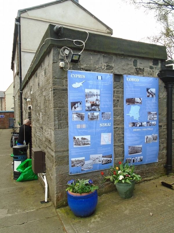
Photographed by William Fischer, Jr., April 3, 2025
2. Congo Marker
• The forces at Jadotville were attacked first on September 13, 1961 by gendarmerie while the soldiers attended Mass. In the following days, the forces at Jadotville received mortar and small arms fire, in addition to bombs and machine gun fire from a Fouga jet flown by a Belgian mercenary. Opposition forces numbered between 2,000 and 3,000.
• After several days of fighting, along with a number of false or reneged agreements, the gendarmerie demanded that the Irish troops surrender. The Irish were forced to accept this cease-fire; further fighting would have resulted in the complete annihilation of the company.
• The troops went into captivity for five and a half weeks and were released on October 25, 1961. The troops had planned to breakout had this release not occurred.
Erected by Irish United Nations Veterans Association.
Topics. This memorial is listed in these topic lists: Patriots & Patriotism • Peace • Wars, Non-US. A significant historical month for this entry is July 1960.
Location. 53° 21.062′ N, 6° 17.192′ W. Memorial is in Dublin, Leinster, in County Dublin. It is in Stoneybatter. It can be reached from Mount Temple Road. Marker is on the Irish United Nations Veterans Association Headquarters grounds. Touch for map. Memorial is at or near this postal address: 6 Mount Temple Road, Dublin, Leinster D07 A3Y4, Ireland. Touch for directions.

Regionally, this memorial is in the Ancient East. Globally, it is on the Atlantic Ocean, in the North Atlantic Region, in Europe, on the Island of Ireland, on the Celtic Fringe, in the European Union, in Atlantic Europe, on one of the British Isles, in the Western World, and in the Anglosphere.
Other nearby markers. At least 8 other markers are within walking distance of this marker: Cyprus - Sinai (here, next to this marker); Irish Defence Forces Headquarters Flag Pole Remnant (here, next to this marker); IUNVA House and memorial / Teach agus Cuimneachan CÉINA (here, next to this marker); The 25 Pounder Gun (a few steps from this marker); United Nations Irish Peacekeepers Memorial (a few steps from this marker); Lebanon (a few steps from this marker); Somalia (a few steps from this marker); Deceased United Nations Veterans Memorial Cross (a few steps from this marker). Touch for a list and map of all markers in Dublin.
Credits. This page was last revised on April 5, 2025. It was originally submitted on April 5, 2025, by William Fischer, Jr. of Reynoldsburg, Ohio. This page has been viewed 115 times since then and 37 times this year. Photos: 1, 2. submitted on April 5, 2025, by William Fischer, Jr. of Reynoldsburg, Ohio.
