Peterboro in Madison County, New York — The American Northeast (Mid-Atlantic)
Gerrit Smith Estate
| — | Underground Rairoad Heritage Trail | — |
Photographed by Susan A. Dalaba, April 25, 2022
1. Gerrit Smith Estate Marker
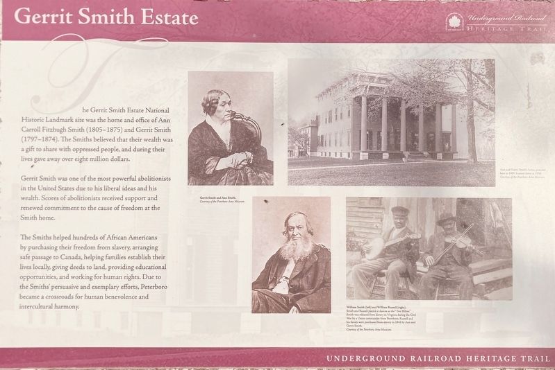
Gerrit Smith was one of the most powerful abolitionist in the United States due to his liberal ideas and his wealth. Scores of abolitionists received support and renewed commitment to the cause of freedom at the Smith home.
The Smith’s helped hundreds of African Americans by purchasing their freedom from slavery, arranging safe passage to Canada, helping families establish their lives locally, giving deeds to land, providing educational opportunities, and working for human rights. Due to the Smith’s persuasive and exemplary efforts, Peterboro became a crossroads for human benevolence and intercultural harmony.
Topics. This historical marker is listed in these topic lists: Abolition & Underground RR • African Americans.
Location. 42° 58.049′ N, 75° 41.21′ W. Marker is in Peterboro,
this page online

Regionally, this marker is in Upstate New York, specifically in Central New York, and in the Syracuse Metropolitan Area. It is also in the American Northeast and in the Mid-Atlantic. Globally, it is in North America, the Western Hemisphere, the Western World, and the Anglosphere. Historically, it finds itself in what was once the Haudenosaunee (Iroquois) Confederacy, New Netherland, and one of the original Thirteen Colonies.
Other nearby markers. At least 8 other markers are within walking distance of this marker: A different marker also named Gerrit Smith Estate (a few steps from this marker); Gerrit Smith: Humanitarian (a few steps from this marker); The Land Office (a few steps from this marker); Gerrit Smith: Abolitionist (a few steps from this marker); Peterboro Land Office (a few steps from this marker); The Mansion (a

Photographed by Susan A. Dalaba, April 25, 2022
2. Gerrit Smith Estate Marker
Photographed by Susan A. Dalaba, April 25, 2022
3. Gerrit Smith Estate Marker
Credits. This page was last revised on April 26, 2025. It was originally submitted on April 5, 2025, by Susan A. Dalaba of Cortland, New York. This page has been viewed 82 times since then and 14 times this year. Photos: 1, 2, 3. submitted on April 5, 2025, by Susan A. Dalaba of Cortland, New York. • Andrew Ruppenstein was the editor who published this page.
Editor’s want-list for this marker. photo of the marker within its surroundings • Can you help?
