Hampden Township near Mechanicsburg in Cumberland County, Pennsylvania — The American Northeast (Mid-Atlantic)
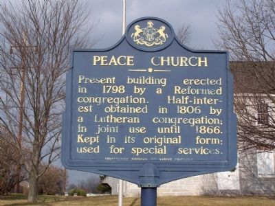
Peace Church
Photographed by Bill Pfingsten, January 24, 2010
1. Peace Church Marker
Erected by Pennsylvania Historical and Museum Commission.
Topics and series. This historical marker is listed in these topic lists: Cemeteries & Burial Sites • Religion & Religious Structures. In addition, it is included in the Pennsylvania Historical and Museum Commission (PHMC) series list. A significant historical year for this entry is 1798.
Location. 40° 13.894′ N, 76° 57.293′ W. Marker is near Mechanicsburg, Pennsylvania, in Cumberland County. It is in Hampden Township. It is at the intersection of East Trindle Road and St. John's Road, on the right when traveling east on East Trindle Road. Touch for map. Marker is at or near this postal address: 4501 E Trindle Rd, Camp Hill PA 17011, United States of America. Touch for directions.

Regionally, this marker is in South-Central Pennsylvania and in Greater Harrisburg. It is also in the American Northeast, in the Mid-Atlantic, in Appalachia, and specifically in Northern
this page online
Other nearby markers. At least 8 other markers are within walking distance of this marker: Veterans Memorial (approx. half a mile away); Shiremanstown Sesquicentennial Time Capsule (approx. half a mile away); a different marker also named Peace Church (approx. half a mile away); Atticks Tailor Shop - Built Mid 1800s (approx. 0.6 miles away); Rupp General Store - Built Before 1862 (approx. 0.6 miles away); Rupp Carriage Factory - Built Around 1875 (approx. 0.6 miles away); The Starr Tin Shop (approx. 0.6 miles away); Jacob Miller - 1874 (approx. 0.6 miles away).
Also see . . . Peace Church - Behind the Marker. ExplorePAHistory.com (Submitted on July 14, 2011, by Mike Wintermantel of Pittsburgh, Pennsylvania.)
Photographed by Bill Pfingsten, January 24, 2010
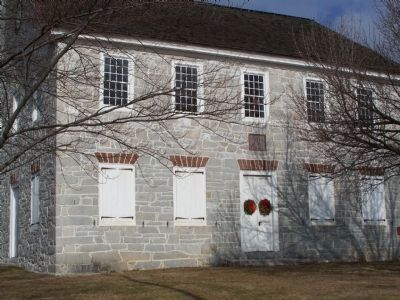
2. Peace Church
Photographed by Bill Pfingsten, January 24, 2010
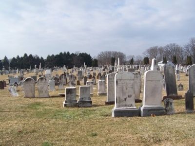
3. Peace Church Cemetery
Photographed by Bill Pfingsten, January 24, 2010
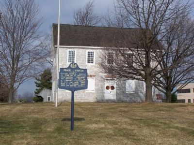
4. Peace Church Marker
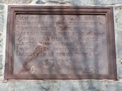
Photographed by Bill Pfingsten, January 24, 2010
5. Name plate above door. Text is in German.
Credits. This page was last revised on February 7, 2023. It was originally submitted on January 28, 2010, by Bill Pfingsten of Bel Air, Maryland. This page has been viewed 1,563 times since then and 64 times this year. Photos: 1, 2, 3, 4, 5. submitted on January 28, 2010, by Bill Pfingsten of Bel Air, Maryland.
