Trillium Industrial Park in Kitchener in Waterloo Region, Ontario — Central Canada (North America)
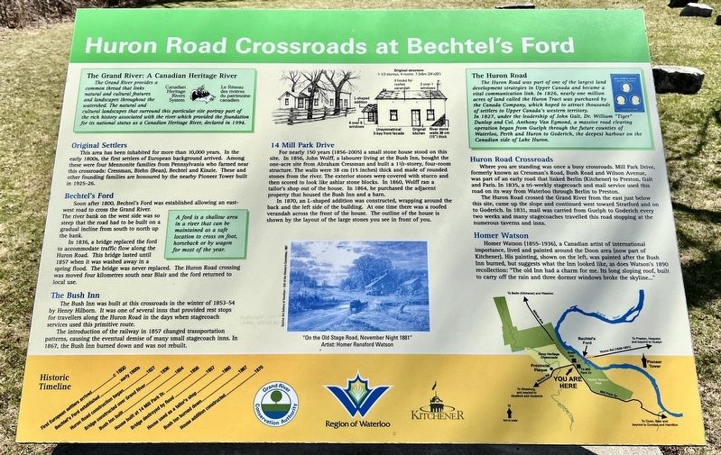
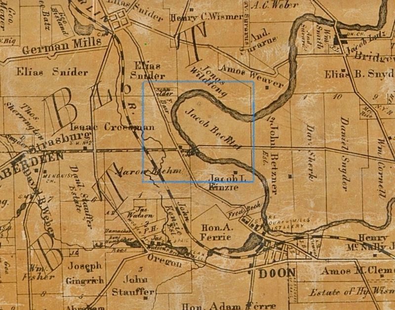
Huron Road Crossroads at Bechtel’s Ford
Photographed by Tim Boyd, April 4, 2025
1. Huron Road Crossroads at Bechtel’s Ford Marker
Original Settlers
This area has been inhabited for more than 10,000 years. In the early 1800s, the first settlers of European background arrived. Among these were four Mennonite families from Pennsylvania who farmed near this crossroads: Cressman, Biehn (Bean), Bechtel and Kinzie. These and other founding families are honoured by the nearby Pioneer Tower built in 1925-26.
Bechtel's Ford
Soon after 1800, Bechtel's Ford was established allowing an east-west road to cross the Grand River.
The river bank on the west side was so steep that the road had to be built on a gradual incline from south to north up the bank. In 1836, a bridge replaced the ford to accommodate traffic flow along the Huron Road.
This bridge lasted until 1857 when it was washed away in a spring flood. The bridge was never replaced. The Huron Road crossing was moved four kilometres south near Blair and the ford returned to local use.
The Bush Inn
The Bush Inn was built at this crossroads in the winter of 1853-54 by Henry Hilborn. It was one of several inns that provided rest stops for travellers along the Huron Road in the days when stagecoach
this page online
14 Mill Park Drive
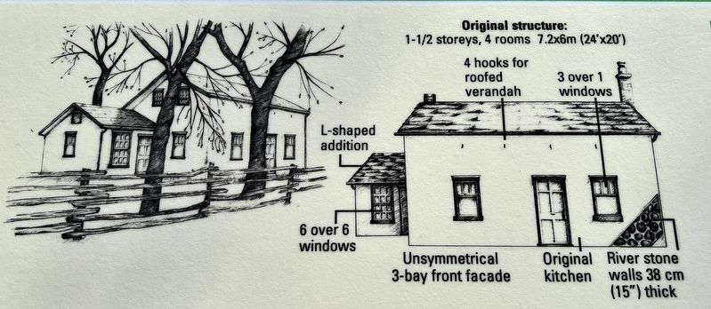
For nearly 150 years (1856-2005) a small stone house stood on this site. In 1856, John Wolff, a labourer living at the Bush Inn, bought the one-acre site from Abraham Cressman and built a 1½-storey, four-room structure. The walls were 38 cm (15 inches) thick and made of rounded stones from the river. The exterior stones were covered with stucco and then scored to look like ashlar stone blocks. In 1860, Wolff ran a tailor's shop out of the house. In 1864, he purchased the adjacent property that housed the Bush Inn and a barn.
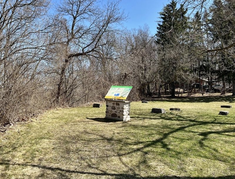
In 1870, an L-shaped addition was constructed, wrapping around the back and the left side of the building. At one time there was a roofed verandah across the front of the house. The outline of the house is shown by the layout of the large stones you see in front of you.
Huron Road Crossroads
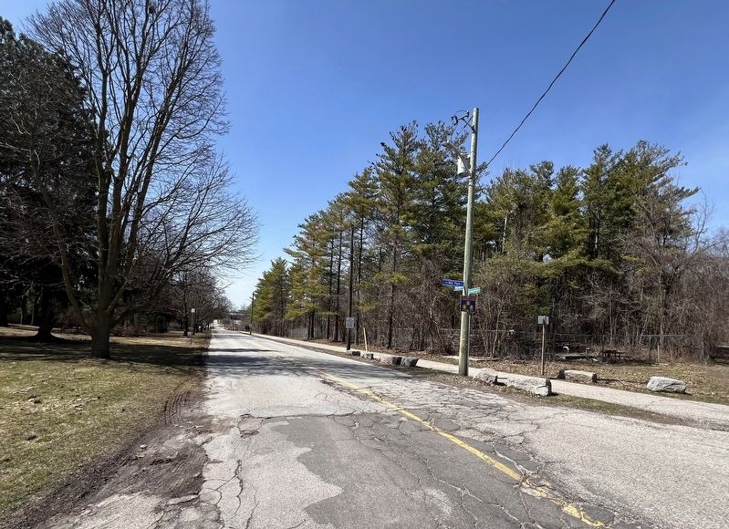
Where you are standing was once a busy crossroads. Mill Park Drive, formerly
Photographed by Tim Boyd, April 4, 2025
2. Huron Road Crossroads at Bechtel’s Ford Marker
Homer Watson
Homer Watson (1855-1936), a Canadian artist of international importance, lived and painted around the Doon area (now part of Kitchener). His painting, shown on the left, was painted after the Bush Inn burned, but suggests what the Inn looked like, as does Watson's 1890 recollection: "The old Inn had a charm for me. Its long sloping roof, built to carry off the rain and three dormer windows broke the skyline..."
Erected by Region of Waterloo.
Topics. This historical marker is listed in these topic lists: Roads & Vehicles • Settlements & Settlers. A significant historical year for this entry is 1800.
Location. 43° 24.081′ N,
Photographed by Tim Boyd, April 4, 2025
3. Huron Road Crossroads at Bechtel’s Ford marker photo detail
14 Mill Park Drive

Regionally, this marker is in the Huron-Perth-Waterloo-Wellington Area and in Southwestern Ontario. It is also in Central Canada. Globally, it is in North America, the Western Hemisphere, the Western World, and the Anglosphere. Historically, it finds itself in what was once a British colony, the Viceroyalty of New France, the Haudenosaunee (Iroquois) Confederacy, and Rupert’s Land.
Other nearby markers. At least 8 other markers are within walking distance of this marker: Huron Road Bridge (approx. 0.2 kilometers away); The Huron Road (approx. 0.4 kilometers away); Waterloo Historical Society (approx. 0.4 kilometers away); Waterloo Pioneer Memorial Tower (approx. 1.3 kilometers away); Homer Ransford Watson (approx. 1.4 kilometers away); Pioneer Tower West

Photographed by Homer Watson
4. Huron Road Crossroads at Bechtel’s Ford marker illustration detail and caption
Photographed by Tim Boyd, April 4, 2025
5. The Huron Road from the site of Bechtel’s Ford, 2025
6. Area of the Huron Road and Bechtel’s Ford, 1861
Credits. This page was last revised on April 19, 2025. It was originally submitted on April 5, 2025, by Tim Boyd of Hamilton, Ontario. This page has been viewed 192 times since then and 43 times this year. Photos: 1, 2, 3, 4, 5, 6. submitted on April 5, 2025, by Tim Boyd of Hamilton, Ontario. • Andrew Ruppenstein was the editor who published this page.
