Marker Logo
THE HISTORICAL
MARKER DATABASE
“Bite-Size Bits of Local, National, and Global History”
Downtown in Ennis in Ellis County, Texas — The American South (West South Central)
 

Ennis Bluebonnet Trails
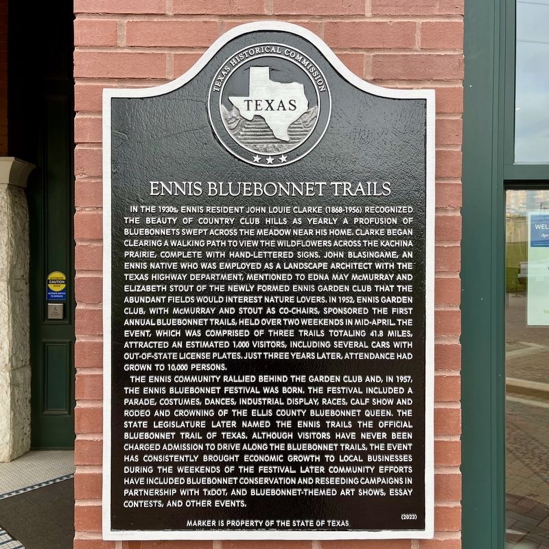
 
 
Ennis Bluebonnet Trails Marker image. Click for full size.
Photographed by QuesterMark, April 5, 2025
1. Ennis Bluebonnet Trails Marker
Inscription. In the 1930s, Ennis resident John Louie Clarke (1868–1956) recognized the beauty of Country Club Hills as yearly a profusion of bluebonnets swept across the meadow near his home. Clarke began clearing a walking path to view the wildflowers across the Kachina Prairie, complete with hand-lettered signs. John Blasingame, an Ennis native who was employed as a landscape architect with the Texas Highway Department, mentioned to Edna May McMurray and Elizabeth Stout of the newly formed Ennis Garden Club that the abundant fields would interest nature lovers. In 1952, Ennis Garden Club, with McMurray and Stout as co-chairs, sponsored the first annual Bluebonnet Trails, held over two weekends in mid-April. The event, which was comprised of three trails totaling 41.8 miles, attracted an estimated 1,000 visitors, including several cars with out-of-state license plates. Just three years later, attendance had grown to 10,000 persons.

The Ennis community rallied behind the Garden Club and, in 1957, the Ennis Bluebonnet Festival was born. The festival included a parade, costumes, dances, industrial display, races, calf show and rodeo,
Paid Advertisement
Click or scan to see
this page online
and crowning of the Ellis County Bluebonnet Queen. The state legislature later named the Ennis Trails the official Bluebonnet Trail of Texas. Although visitors have never been charged admission to drive along the Bluebonnet Trails, the event has consistently brought economic growth to local businesses during the weekends of the festival. Later community efforts have included bluebonnet conservation and reseeding campaigns in partnership with TxDOT, and bluebonnet-themed art shows, essay contests, and other events. (2023) Marker is Property of the State of Texas
 
Erected 2025 by Texas Historical Commission. (Marker Number 23855.)
 
Topics. This historical marker is listed in this topic list: Natural Features. A significant historical month for this entry is April 1952.
 
Location. 32° 19.723′ N, 96° 37.677′ W. Marker is in Ennis, Texas, in Ellis County. It is in Downtown. It is at the intersection of Northwest Main and W Knox St, on the left when traveling north on Northwest Main. Touch for map. Marker is at or near this postal address: 201 NW Main St, Ennis TX 75119, United States of America. Touch for directions.

Regionally, this marker
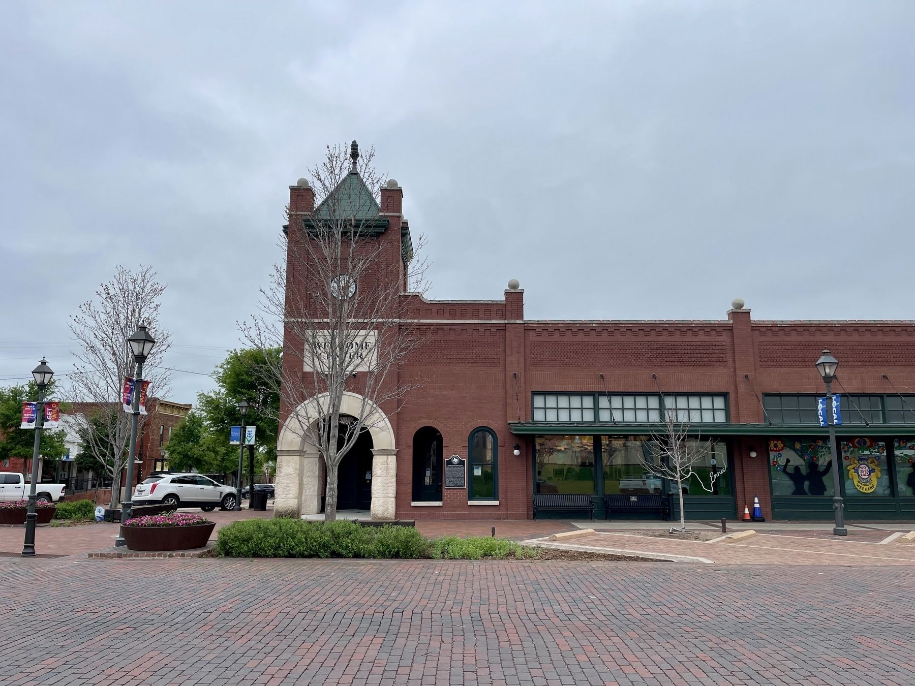
Ennis Bluebonnet Trails Marker at the Welcome Center image. Click for full size.
Photographed by QuesterMark, April 5, 2025
2. Ennis Bluebonnet Trails Marker at the Welcome Center
is in the Prairies & Lakes Region and in the Dallas-Fort Worth Metropolitan Area. Globally, it is in North America, a Gulf of Mexico state, the Western Hemisphere, the Western World, and the Anglosphere. Historically, it finds itself in what was once New Spain, the Republic of Texas, and one of the Confederate States of America.

Other nearby markers. At least 8 other markers are within walking distance of this marker: Pierce Park (within shouting distance of this marker); Katie Daffan (within shouting distance of this marker); Railroads in Ennis (within shouting distance of this marker); Town of Ennis (about 300 feet away, measured in a direct line); The Southern Pacific Railroad in Ennis (about 300 feet away); Ennis National Bank Building (about 400 feet away); Minnie McDowal (about 400 feet away); LaJuan Schlegel (about 400 feet away). Touch for a list and map of all markers in Ennis.
 
More about this marker. This subject marker is mounted between two windows on the Ennis Welcome Center, facing Main Street and Pierce Park in Ennis.

The marker dedication ceremony for this marker was held on Thursday, April 3, 2025,
Paid Advertisement
from 10:00AM to 11:00AM at the Ennis Welcome Center.
 
 
Credits. This page was last revised on April 8, 2025. It was originally submitted on April 5, 2025, by QuesterMark of Fort Worth, Texas. This page has been viewed 296 times since then and 47 times this year. Photos:   1, 2. submitted on April 5, 2025, by QuesterMark of Fort Worth, Texas. • James Hulse was the editor who published this page.

m=269579

CeraNet Cloud Computing sponsors the Historical Marker Database.
This website earns income from purchases you make after using our links to Amazon.com. We appreciate your support.
Paid Advertisement
Jul. 26, 2026