Holbrook in Navajo County, Arizona — The American Mountains (Southwest)
Triassic Landscape
Photographed by Denise Boose, September 2, 2013
1. Triassic Landscape Marker
Photo Caption:
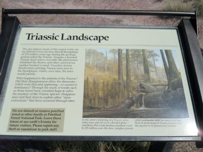
In this artist’s rendering of a Triassic scene, fallen trees and silt cover a flooded plain – conditions that could produce petrified wood. In 225 million years the slow, complex process called continental drift has moved the land from its most tropical Triassic location near the equator to its present-day location.
In this artist’s rendering of a Triassic scene, fallen trees and silt cover a flooded plain – conditions that could produce petrified wood. In 225 million years the slow, complex process called continental drift has moved the land from its most tropical Triassic location near the equator to its present-day location.
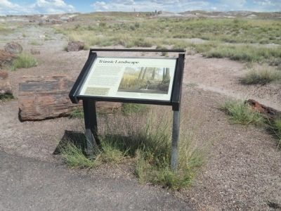
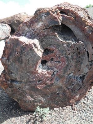
The dry plateau lands of this region today are far different from the tree-littered floodplains of 225 million years ago during the geologic period called the Triassic. Imagine a forested Triassic land where crocodile-like phytosaurs inhabited the shores, and other carnivorous reptiles hunted on land. Visualize stormy floodwaters carrying Triassic trees here to the floodplains, where, over time, the trees would petrify.
What happened to the animals of the Triassic? Did their disappearance allow the dinosaurs – which were then just appearing – to ascend to dominance? Through the study of fossils such as those found here, scientists hope to solve the mystery of the Triassic species’ disappearance and find clues to explain other “mass extinctions” that have occurred through time.
Do not disturb or remove petrified wood or other fossils in Petrified Forest National Park. Leave these traces of our earth’s history for future visitors. Please report any theft or vandalism to park staff.
Erected by National Park Service, U.S. Department of the Interior.
Topics. This historical marker is listed in these topic
this page online
Location. This marker has been replaced by another marker nearby. It was located near 34° 51.834′ N, 109° 47.477′ W. Marker was in Holbrook, Arizona, in Navajo County. It could be reached from Petrified Forest Road, on the right when traveling north. Touch for map. Marker was in this post office area: Holbrook AZ 86025, United States of America. Touch for directions.

Regionally, this marker was in Hopi. It was also in the American Southwest, in the Mountain West, on the Colorado Plateau, and at the Four Corners. Globally, it was in North America, the Western Hemisphere, the Western World, and the Anglosphere. Historically, it found itself in what was once New Spain, the territory of the Ancestral Puebloans, and Mexico’s Alta California.
Other nearby markers. At least 8 other markers are within 6 miles of this location, measured as the crow flies: When Crystal Forest Was a Forest (within shouting distance of this marker); From Wood to Stone (within shouting distance of this marker); First Impressions
Photographed by Denise Boose, September 2, 2013
2. Triassic Landscape Marker
Another marker is no longer nearby. Jasper Forest (was approx. 2 miles away but has been permanently removed).
Related marker. Click here for another marker that is related to this marker. This marker has been replaced with the linked marker.
Photographed by Denise Boose, September 2, 2013
3. Triassic Landscape Marker
Photographed by Denise Boose, September 2, 2013
4. Petrified Wood
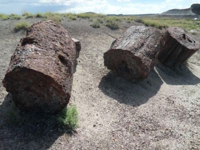
Photographed by Denise Boose, September 2, 2013
5. Petrified Wood
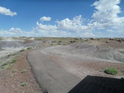
Photographed by Denise Boose, September 2, 2013
6. View of the Flood Plains
Photographed by Denise Boose, September 2, 2013
7. Petrified Wood
Photographed by Denise Boose, September 2, 2013
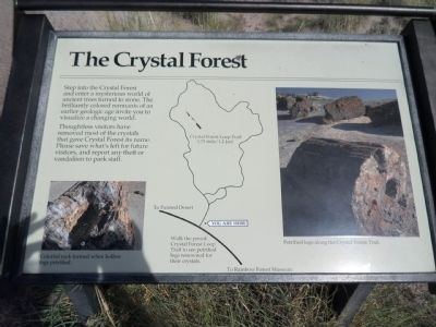
8. The Crystal Forest
Step into the Crystal Forest and enter a mysterious world of ancient trees turned to stone. The brillantly colored remants of an earlier geologic age invite you to visualize a changing world.
Thoughtless visitors have removed most of the crystals that gave Crystal Forest its name. Please save what's left for future visitors, and report any theft or vandalism to park staff.
Crystal Forest Loop Trail (.75 mile/1.2 km)
Walk the paved Crystal Forest Loop Trail to see petrified logs renowned for their crystals.
Credits. This page was last revised on April 8, 2025. It was originally submitted on September 28, 2013, by Denise Boose of Tehachapi, California. This page has been viewed 1,146 times since then and 20 times this year. Last updated on April 6, 2025, by Ian Lefkowitz of New York, New York. Photos: 1, 2, 3, 4, 5, 6, 7, 8. submitted on September 28, 2013, by Denise Boose of Tehachapi, California. • Devry Becker Jones was the editor who published this page.
