Dublin's Docklands in County Dublin, Leinster, Ireland — Mid-East (and Dublin)
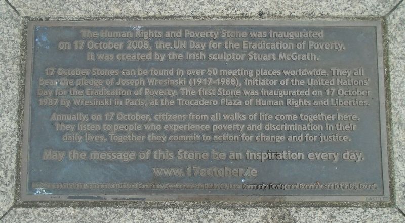
Human Rights and Poverty Stone
17 October - United Nations International Day for the Eradication of Poverty
Photographed by William Fischer, Jr., April 3, 2025
1. Human Rights and Poverty Stone Marker

17 October Stones can be found in over 50 meeting places worldwide. They all bear the pledge of Joseph Wresinski (1917-1988), initiator of the United Nations Day for the Eradication of Poverty. The first Stone was inaugurated on 17 October 1987 by Wresinski in Paris, at the Trocadero Plaza of Human Rights and Liberties.
Annually, on 17 October, citizens from all walks of life come together here. They listen to people who experience poverty and discrimination in their daily lives. Together they commit to action for change and for justice.
May the message of this Stone be an inspiration every day.
——————————————————————
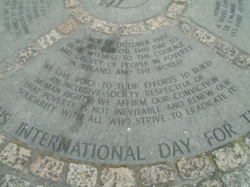
Since 17 October 1987, we gather on this day to bear witness to the courage and dignity of people in poverty in Ireland and the world.
We give voice to their efforts to build an inclusive society respectful of human rights. We affirm our conviction that poverty is not inevitable and renew our solidarity with all who strive to eradicate
this page online
——————————————————————
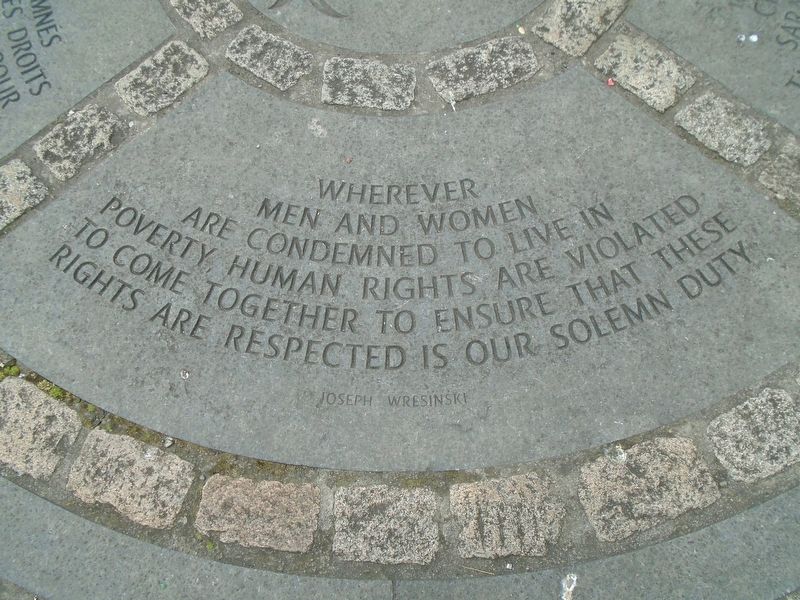
Wherever men and women are condemned to live in poverty, human rights are violated. To come together to ensure that these rights are respected is our solemn duty.
Joseph Wreninski
——————————————————————
Joseph Wreninski
——————————————————————
Joseph Wreninski
——————————————————————
www.17october.ie
Erected 2008 by the Department of Rural and Community Development, the Dublin City Local Community Development Commitee and Dublin City Council.
Topics. This historical marker is listed in these topic lists: Charity & Public Work • Civil Rights • Education • Peace. A significant historical date for this entry is October 17, 1987.
Location. 53° 20.88′ N, 6° 14.961′ W. Marker is in Dublin, Leinster, in County Dublin. It is in Dublin's Docklands. It is at the intersection
Photographed by William Fischer, Jr., April 3, 2025
2. Human Rights and Poverty Stone Dedication Marker

Regionally, this marker is in the Ancient East. Globally, it is on the Atlantic Ocean, in the North Atlantic Region, in Europe, on the Island of Ireland, on the Celtic Fringe, in the European Union, in Atlantic Europe, on one of the British Isles, in the Western World, and in the Anglosphere.
Other nearby markers. At least 8 other markers are within walking distance of this marker: A different marker also named Human Rights and Poverty Stone (here, next to this marker); National Famine Way (within shouting distance of this marker); Great Irish Famine Victims and Their Canadian Descendants (within shouting distance of this marker); "Famine" (within shouting distance of this marker); Dublin Docklands Landmarks (within shouting distance of this marker); Irish Seaman's National Memorial (about 150 meters away, measured in a direct line); Pairc Elizabeth O'Farrell Park (about 180
Photographed by William Fischer, Jr., April 3, 2025
3. Human Rights and Poverty Stone Quote (English) Marker
Related marker. Click here for another marker that is related to this marker.
Photographed by William Fischer, Jr., April 3, 2025
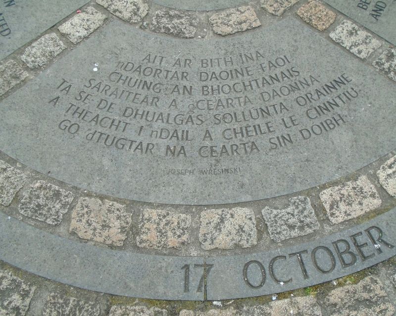
4. Human Rights and Poverty Stone Quote (Gaelic) Marker
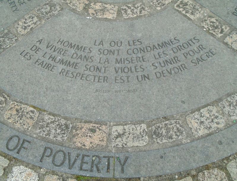
Photographed by William Fischer, Jr., April 3, 2025
5. Human Rights and Poverty Stone Quote (French) Marker
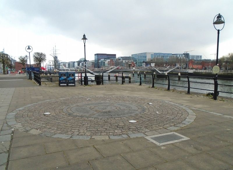
Photographed by William Fischer, Jr., April 3, 2025
6. Human Rights and Poverty Stone Memorial
Credits. This page was last revised on April 6, 2025. It was originally submitted on April 6, 2025, by William Fischer, Jr. of Reynoldsburg, Ohio. This page has been viewed 170 times since then and 26 times this year. Photos: 1, 2, 3, 4, 5, 6. submitted on April 6, 2025, by William Fischer, Jr. of Reynoldsburg, Ohio.
