
Las Cruces in Doña Ana County, New Mexico — The American Mountains (Southwest)
The History of the New Mexico State Flag
Photographed by Ian Lefkowitz, September 3, 2022
1. The History of the New Mexico State Flag Marker
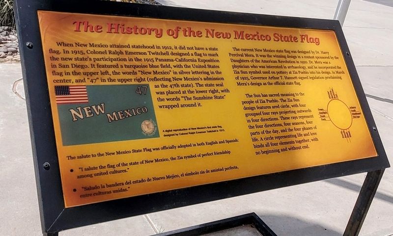
When New Mexico attained statehood in 1912, it did not have a state flag. In 1915, Colonel Ralph Emerson Twitchell designed a flag to mark the new state's participation in the 1915 Panama-California Exposition in San Diego. It featured a turquoise blue field, with the United States flag in the upper left, the words “New Mexico” in silver lettering in the center, and “47” in the upper right (reflecting New Mexico's admission as the 47th state). The state seal was placed at the lower right, with the words “The Sunshine State” wrapped around it.
The current New Mexico state flag was designed by Dr. Harry Percival Mera. It was the winning design in a contest sponsored by the Daughters of the American Revolution in 1920. Dr. Mera was a physician who was interested in archaeology, and he incorporated the Zia Sun symbol used on pottery at Zia Pueblo into his design. In March of 1925, Governor Arthur T. Hannett signed legislation proclaiming Mera's design as the official state flag.
The Sun has sacred meaning to the people of Zia Pueblo. The Zia Sun design features a red circle, with four groups of four rays projecting
this page online
Salute to the State Flag
The salute to the New Mexico State Flag was officially adopted in both English and Spanish:
• “I salute the flag of the state of New Mexico, the Zia symbol of perfect friendship among united cultures.”
• “Saludo la bandera del estado de Nuevo Mejico, el símbolo Zia de amistad perfecta, entre culturas unidas.”
Zia Illustration
Winter • Spring • Summer • Fall
Dawn • Daylight • Dusk • Dark
North • South • East • West
Infancy • Youth • Adulthood • Old Age
Topics and series. This historical marker is listed in these topic lists: Government & Politics • Indigenous Peoples and Communities. In addition, it is included in the Vexillology series list. A significant historical month for this entry is March 1925.
Location. 32° 17.97′ N, 106° 43.266′ W. Marker is in Las Cruces, New Mexico, in Doña Ana County. It is on Dripping Springs Road. Touch for map. Marker is at or
Photographed by Ian Lefkowitz, September 3, 2022
2. New Mexico Farm and Ranch Heritage Museum
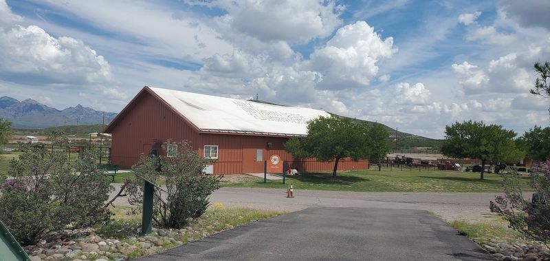
This historical marker is on the grounds of the sprawling New Mexico Farm and Ranch Heritage Museum.

Regionally, this marker is in the Rio Grande Valley. It is also in the American Southwest. Globally, it is in North America, the Western Hemisphere, the Western World, and the Anglosphere. Historically, it finds itself in what was once New Spain, the Gadsden Purchase, and the Republic of Texas.
Other nearby markers. At least 8 other markers are within 4 miles of this marker, measured as the crow flies: The Historic Green Bridge (about 300 feet away, measured in a direct line); María Gutiérrez Spencer (approx. 2.4 miles away); Miller Field Gates (approx. 2.4 miles away); America's First Battle of World War II: The Philippines (approx. 2.9 miles away); Heroes of Bataan (approx. 2.9 miles away); Doña Ana County Courthouse (approx. 3.4 miles away); Rio Grande Theatre (approx. 3½ miles away); The Branigan Building (approx. 3.6 miles away). Touch for a list and map of all markers in Las Cruces.
Credits. This page was last revised on April 8, 2025. It was originally submitted on March 31, 2025, by Ian Lefkowitz of New York, New York. This page has been viewed 351 times since then and 78 times this year. Last updated on April 7, 2025, by Ian Lefkowitz of New York, New York. Photos: 1, 2. submitted on March 31, 2025, by Ian Lefkowitz of New York, New York. • Devry Becker Jones was the editor who published this page.
