Hespeler in Cambridge in Waterloo Region, Ontario — Central Canada (North America)
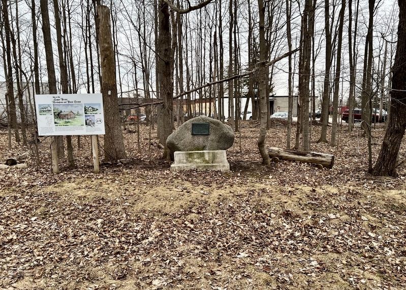
Waterloo Township Community Meeting House School and Burial Ground
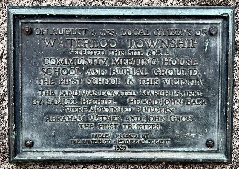
Photographed by Tim Boyd, April 4, 2025
1. Waterloo Township Community Meeting House School and Burial Ground Marker
Erected 1929 by Waterloo Historical Society.
Topics. This historical marker is listed in these topic lists: Cemeteries & Burial Sites • Education • Religion & Religious Structures • Settlements & Settlers. A significant historical date for this entry is August 8, 1829.
Location. 43° 25.041′ N, 80° 19.805′ W. Marker is in Cambridge, Ontario, in Waterloo Region. It is in Hespeler. It is on Stager Place 0.2 kilometers north of Beaverdale Road, on the right when traveling north. Touch for map. Marker is at or near this postal address: 40 Stager Place, Cambridge ON N3C 2W4, Canada. Touch for directions.

Regionally, this marker is in the Huron-Perth-Waterloo-Wellington Area and in Southwestern Ontario. It is also in Central Canada. Globally, it is in North America, the Western Hemisphere,
this page online
Other nearby markers. At least 8 other markers are within 3 kilometers of this marker, measured as the crow flies: Site of the Samuel Bechtel Meeting House and Burial Ground (here, next to this marker); First Mennonite Sunday School (approx. 1.7 kilometers away); History of the Riverbank (approx. 2.2 kilometers away); Hespeler Cenotaph (approx. 2.3 kilometers away); Tannery Street/ Forbes Park Area (approx. 2.3 kilometers away); Jacob’s Landing and Hespeler Mill Pond (approx. 2.3 kilometers away); Otto Julius Klotz (approx. 3.3 kilometers away); Preston Cenotaph (approx. 3.3 kilometers away). Touch for a list and map of all markers in Cambridge.
Also see . . . Ken Seiling Waterloo Region Museum. Region of Waterloo Museums website entry:
Waterloo Township was originally an area of land known as Block Two of the Grand River land grant donated by the British to the Six Nations First Peoples during the late eighteenth century(Submitted on April 9, 2025, by Tim Boyd of Hamilton, Ontario.)for their loyalty to the Crown in the American Revolutionary wars. When Block Two was incorporated in the District of Gore in 1816, it became Waterloo Township, named in honour of the battle that ended the Napoleonic Wars in Europe. The township was the first of Waterloo County's five townships to be settled. In many regards, its settlement laid the foundation for the later settlement of other townships in Waterloo County, with a pool of pioneering experience and a source of supplies. The first immigrants to settle in Waterloo Township were almost exclusively German Mennonites from Pennsylvania.Photographed by Tim Boyd, April 4, 20252. Waterloo Township Community Meeting House School and Burial Ground Marker
Credits. This page was last revised on July 5, 2026. It was originally submitted on April 9, 2025, by Tim Boyd of Hamilton, Ontario. This page has been viewed 114 times since then and 35 times this year. Photos: 1, 2. submitted on April 9, 2025, by Tim Boyd of Hamilton, Ontario. • Andrew Ruppenstein was the editor who published this page.
